Category:Mayyil
Grama Panchayat In Kannur District Of Kerala | |||||
| Upload media | |||||
| Instance of |
| ||||
|---|---|---|---|---|---|
| Part of |
| ||||
| Location | Kannur district, Kerala, India | ||||
| Has part(s) |
| ||||
| Population |
| ||||
| Area |
| ||||
| Elevation above sea level |
| ||||
| official website | |||||
 | |||||
Subcategories
This category has the following 4 subcategories, out of 4 total.
Media in category "Mayyil"
The following 4 files are in this category, out of 4 total.
-
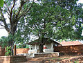 Arimbra Subrahmanya Temple, Mayyil Kannur.jpg 2,553 × 1,944; 2.62 MB
-
 Paddy field in Kannur (2).jpg 4,608 × 2,592; 5.38 MB
-
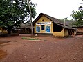 Perumacheri AUP School.JPG 4,000 × 3,000; 3.64 MB
-
 Velamvayanasala.jpg 3,200 × 2,400; 1.41 MB

.jpg)

