Category:McClellan–Kerr Arkansas River Navigation System
part of the inland waterway system originating at the Tulsa Port of Catoosa and running southeast through Oklahoma and Arkansas to the Mississippi River | |||||
| Upload media | |||||
| Location |
| ||||
|---|---|---|---|---|---|
| |||||
Subcategories
This category has the following 2 subcategories, out of 2 total.
L
- Lake Dardanelle (9 F)
R
Media in category "McClellan–Kerr Arkansas River Navigation System"
The following 14 files are in this category, out of 14 total.
-
 Aerial photo of the Tulsa Port of Catoosa taken May 5, 2008.jpg 3,000 × 2,397; 5.78 MB
-
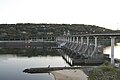 Big Dam Bridge.jpg 2,144 × 1,424; 848 KB
-
 CAC CC 001 18 34 0000 3322a.jpg 788 × 522; 44 KB
-
 CAC CC 001 18 34 0000 3322b.jpg 788 × 522; 48 KB
-
 CAC CC 001 18 34 0000 3322c.jpg 788 × 522; 47 KB
-
 Joe Hardin Lock and Dam, Arkansas River.jpg 4,928 × 3,264; 9.15 MB
-
 Kerr-McClellan map.png 500 × 541; 250 KB
-
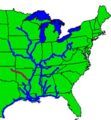
 Map of McClellan–Kerr Arkansas River Navigation System.jpg 1,064 × 656; 234 KB
-
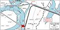 McClellan–Kerr Arkansas River Navigation System, Pool 2, Navigation Chart.jpg 1,491 × 760; 428 KB
-
 Murray Lock.jpg 2,144 × 1,424; 707 KB
-
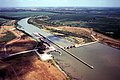
 Norrell Lock and Dam, Arkansas.jpg 4,928 × 2,693; 8.01 MB
-
 USACE Newt Graham Lock and Dam.jpg 1,500 × 999; 537 KB
-
 USACE Webbers Falls Lock and Dam.jpg 1,001 × 1,500; 580 KB
-
 Wilbur D. Mills Dam.jpg 4,928 × 2,637; 8.85 MB


