Category:Meall Ghaordaidh
1039m high mountain in Scotland  | |||||
| Upload media | |||||
| Instance of | |||||
|---|---|---|---|---|---|
| Location |
| ||||
| Mountain range | |||||
| Topographic prominence |
| ||||
| Elevation above sea level |
| ||||
 | |||||
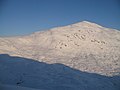
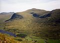
Meall Ghaordaidh is a mountain in the southern Highlands of Scotland. It lies to the north Loch Tay, to the west of Ben Lawers and to the north of the village of Killin. It is 1039 m high, and listed as a Munro and a Marilyn.
Media in category "Meall Ghaordaidh"
The following 22 files are in this category, out of 22 total.
-
 Coire Ghaordaidh - geograph.org.uk - 1064715.jpg 640 × 480; 47 KB
-
 Coire Ghaordaidh - geograph.org.uk - 1069203.jpg 640 × 480; 52 KB
-

-
 Fence, Meall Taurnaigh - geograph.org.uk - 1067162.jpg 640 × 480; 55 KB
-
 Glen Lyon from Meall Ghaordhaidh - geograph.org.uk - 1203060.jpg 640 × 480; 69 KB
-
 Loch Lyon from Meall Ghaordaidh - geograph.org.uk - 1017851.jpg 640 × 480; 57 KB
-
 Lochan nan Geadas - geograph.org.uk - 1557379.jpg 640 × 480; 92 KB
-
 Meall Ghaordaidh - geograph.org.uk - 1064722.jpg 640 × 480; 59 KB
-
 Meall Ghaordaidh behind bars - geograph.org.uk - 1063702.jpg 480 × 640; 55 KB
-
 Meall Ghaordaidh.jpg 640 × 452; 60 KB
-
 Meall Taurnaigh - geograph.org.uk - 1067150.jpg 640 × 454; 62 KB
-

-

-

-
 Stone on ridge near Meall Ghaordaidh - geograph.org.uk - 570774.jpg 627 × 470; 83 KB
-

-

-
 The trig point on Meall Ghaordaidh - geograph.org.uk - 94403.jpg 640 × 463; 85 KB
-

-
 Below Meall Ghaordaidh - geograph.org.uk - 636832.jpg 638 × 440; 63 KB
-
 River Lyon at Pubil - geograph.org.uk - 8286.jpg 640 × 447; 77 KB
-


