Category:Media contributed by the Folger Shakespeare Library
English: See Commons:Folger Shakespeare Library for background information about the upload and Commons talk:Folger Shakespeare Library for discussion.
Media in category "Media contributed by the Folger Shakespeare Library"
The following 165 files are in this category, out of 165 total.
-
 Image of Daphne by Abraham Ortelius.jpeg 3,031 × 2,352; 2.43 MB
-
 Image of Tempe in Thessaly by Abraham Ortelius.jpeg 3,023 × 2,344; 2.29 MB
-
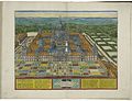 Image of the Monasterio de el Escorial by Abraham Ortelius.jpeg 3,057 × 2,354; 2.3 MB
-
 Inset map of Carthage by Abraham Ortelius (cropped).jpeg 391 × 416; 76 KB
-
 Map and images of the peregrination of Abraham the Patriarch by Abraham Ortelius.jpeg 3,029 × 2,348; 2.33 MB
-
 Map and images of the peregrination of Saint Paul by Abraham Ortelius.jpeg 3,035 × 2,338; 2.28 MB
-
 Map of Abruzzo by Abraham Ortelius.jpeg 1,055 × 837; 405 KB
-
 Map of Africa by Abraham Ortelius.jpeg 3,051 × 2,337; 2.62 MB
-
 Map of ancient Egypt and inset map of the area around Alexandria by Abraham Ortelius.jpeg 3,070 × 2,370; 2.36 MB
-
 Map of ancient geography by Abraham Ortelius.jpeg 3,060 × 2,363; 1.98 MB
-
 Map of ancient Italy by Abraham Ortelius (Liguria).jpg 636 × 349; 161 KB
-
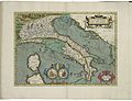 Map of ancient Italy by Abraham Ortelius.jpeg 3,068 × 2,354; 2.36 MB
-

-
 Map of ancient Thrace by Abraham Ortelius.jpeg 3,058 × 2,359; 2.33 MB
-
 Map of ancient Tuscia by Abraham Ortelius.jpeg 3,058 × 2,370; 2.18 MB
-
 Map of Anjou by Abraham Ortelius.jpeg 3,032 × 2,346; 2.2 MB
-
 Map of Artois by Abraham Ortelius.jpeg 1,587 × 1,176; 622 KB
-
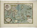
 Map of Asia by Abraham Ortelius.jpeg 3,021 × 2,333; 2.46 MB
-
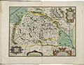
 Map of Austria by Abraham Ortelius.jpeg 3,033 × 2,353; 2.34 MB
-
 Map of Barbary by Abraham Ortelius.jpeg 1,557 × 1,179; 546 KB
-
 Map of Bavaria by Abraham Ortelius.jpeg 1,578 × 1,185; 654 KB
-
 Map of Bohemia by Abraham Ortelius.jpeg 3,045 × 2,348; 2.2 MB
-
 Map of Brabant by Abraham Ortelius.jpeg 3,048 × 2,379; 2.33 MB
-
 Map of Brandenburg by Abraham Ortelius.jpeg 3,066 × 2,360; 2.31 MB
-
 Map of China by Abraham Ortelius.jpeg 1,579 × 1,189; 632 KB
-
 Map of Cyprus and inset map of Lemnos by Abraham Ortelius.jpeg 1,595 × 1,181; 619 KB
-
 Map of Dacia and Moesia by Abraham Ortelius.jpeg 1,540 × 1,182; 543 KB
-
 Map of East Friesland and inset map of part of Reiderland by Abraham Ortelius.jpeg 1,539 × 1,174; 622 KB
-
 Map of England and Ireland, and the Progeny of the kings of England by Abraham Ortelius.jpeg 3,027 × 2,343; 3.29 MB
-
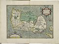
 Map of England by Abraham Ortelius.jpeg 3,061 × 2,351; 2.59 MB
-
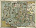
 Map of England, Scotland, and Ireland by Abraham Ortelius.jpeg 3,042 × 2,352; 2.63 MB
-
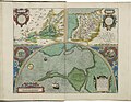
 Map of Europe 1 by Abraham Ortelius.jpeg 1,567 × 1,187; 569 KB
-
 Map of Europe 2 by Abraham Ortelius.jpeg 1,536 × 1,178; 595 KB
-
 Map of Flanders and inset map of part of Zeeland by Abraham Ortelius.jpeg 1,585 × 1,176; 650 KB
-
 Map of Florence by Abraham Ortelius.jpeg 1,582 × 1,179; 549 KB
-
 Map of Forum Julii by Abraham Ortelius.jpeg 1,579 × 1,187; 569 KB
-
 Map of France 1 by Abraham Ortelius.jpeg 3,062 × 2,348; 2.42 MB
-
 Map of France 2 by Abraham Ortelius.jpeg 3,060 × 2,332; 2.8 MB
-
 Map of Friesland by Abraham Ortelius.jpeg 1,584 × 1,188; 560 KB
-
 Map of Galicia by Abraham Ortelius.jpeg 1,536 × 1,190; 619 KB
-
 Map of Gallia Belgica by Abraham Ortelius.jpeg 3,045 × 2,343; 2.39 MB
-

-
-
 Map of Gallic Italy by Abraham Ortelius.jpeg 3,058 × 2,364; 2.23 MB
-
 Map of Gelderland by Abraham Ortelius.jpeg 3,039 × 2,355; 2.43 MB
-
 Map of Germania by Abraham Ortelius.jpeg 3,051 × 2,350; 2.41 MB
-
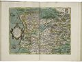
 Map of Germany by Abraham Ortelius.jpeg 3,057 × 2,361; 2.76 MB
-
 Map of Greece 1 by Abraham Ortelius.jpeg 1,583 × 1,182; 635 KB
-
 Map of Greece 2 by Abraham Ortelius.jpeg 3,052 × 2,343; 2.34 MB
-
 Map of Holland by Abraham Ortelius.jpeg 1,584 × 1,178; 636 KB
-
 Map of Hungary (2nd) by Abraham Ortelius.jpeg 1,590 × 1,171; 635 KB
-
 Map of Hungary by Abraham Ortelius.jpeg 1,583 × 1,180; 643 KB
-
 Map of Iceland by Abraham Ortelius.jpeg 1,595 × 1,184; 577 KB
-
 Map of Illyricum by Abraham Ortelius.jpeg 1,581 × 1,178; 610 KB
-
 Map of India and the Maluku Islands by Abraham Ortelius.jpeg 1,562 × 1,186; 596 KB
-
 Map of Ireland 1 by Abraham Ortelius.jpeg 3,063 × 2,334; 2.32 MB
-
 Map of Ireland 2 by Abraham Ortelius.jpeg 1,546 × 1,172; 824 KB
-
 Map of Ischia by Abraham Ortelius.jpeg 1,611 × 1,176; 610 KB
-
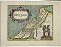 Map of Israel by Abraham Ortelius.jpeg 3,054 × 2,348; 2.24 MB
-
 Map of Italy by Abraham Ortelius.jpeg 1,564 × 1,184; 587 KB
-
 Map of Japan by Abraham Ortelius.jpeg 3,068 × 2,362; 2.3 MB
-
 Map of Latium and inset map of Mount Circe by Abraham Ortelius.jpeg 3,035 × 2,356; 2.16 MB
-
 Map of Liége by Abraham Ortelius.jpeg 3,054 × 2,367; 2.48 MB
-
 Map of Lorainne by Abraham Ortelius.jpeg 3,029 × 2,357; 2.31 MB
-
 Map of Luxembourg by Abraham Ortelius.jpeg 3,030 × 2,369; 2.3 MB
-

-
 Map of Mansfield by Abraham Ortelius.jpeg 3,021 × 2,360; 2.27 MB
-
 Map of Moravia by Abraham Ortelius.jpeg 3,006 × 2,357; 2.18 MB
-
 Map of New Spain by Abraham Ortelius.jpeg 3,066 × 2,337; 2.42 MB
-
 Map of Palestine by Abraham Ortelius.jpeg 3,057 × 2,352; 2.25 MB
-
 Map of Pannonia and Illyria by Abraham Ortelius.jpeg 3,034 × 2,339; 2.18 MB
-
 Map of Picardy by Abraham Ortelius.jpeg 3,020 × 2,347; 2.16 MB
-
 Map of Poitou (province in France) by Abraham Ortelius.jpeg 3,035 × 2,338; 2.38 MB
-
 Map of Poland and Lithuania by Abraham Ortelius.jpeg 1,580 × 1,176; 593 KB
-
 Map of Portugal by Abraham Ortelius.jpeg 1,538 × 1,171; 616 KB
-
 Map of Prester John (Ethiopia) by Abraham Ortelius.jpeg 6,095 × 4,674; 6.5 MB
-
 Map of Provence by Abraham Ortelius.jpeg 3,059 × 2,373; 2.42 MB
-
 Map of Prussia by Abraham Ortelius.jpeg 1,580 × 1,188; 622 KB
-
 Map of Roman Africa and inset map of Carthage by Abraham Ortelius.jpeg 3,049 × 2,347; 2.31 MB
-
 Map of Romania by Abraham Ortelius.jpeg 1,598 × 1,183; 576 KB
-
 Map of Russia, or the Empire of the Grand Duke of Moscovia, by Abraham Ortelius.jpeg 1,580 × 1,174; 500 KB
-
 Map of sacred geography by Abraham Ortelius.jpeg 3,041 × 2,340; 2.17 MB
-
 Map of Salzburg by Abraham Ortelius.jpeg 3,024 × 2,333; 2.28 MB
-
 Map of Scandinavia by Abraham Ortelius.jpeg 1,590 × 1,183; 588 KB
-
 Map of Scotland by Abraham Ortelius.jpeg 2,895 × 2,336; 2.4 MB
-
 Map of Silesia by Abraham Ortelius.jpeg 3,042 × 2,352; 2.06 MB
-
 Map of Slavonia, Croatia, Carnia, Istria, and Bosnia by Abraham Ortelius.jpeg 1,597 × 1,188; 540 KB
-
 Map of Spain and inset map of Cadiz by Abraham Ortelius.jpeg 3,055 × 2,345; 2.63 MB
-
 Map of Spain by Abraham Ortelius.jpeg 3,054 × 2,336; 2.73 MB
-
 Map of Switzerland by Abraham Ortelius.jpeg 1,584 × 1,181; 565 KB
-
 Map of Tartaria by Abraham Ortelius.jpeg 1,574 × 1,179; 546 KB
-
 Map of the Americas by Abraham Ortelius.jpeg 3,070 × 2,365; 2.54 MB
-
 Map of the Azore Islands by Abraham Ortelius.jpeg 3,018 × 2,361; 2.38 MB
-
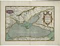 Map of the Black Sea by Abraham Ortelius.jpeg 3,053 × 2,351; 2.34 MB
-
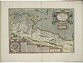
 Map of the British Isles by Abraham Ortelius.jpeg 1,538 × 1,185; 625 KB
-
 Map of the County of Burgundy by Abraham Ortelius.jpeg 3,035 × 2,345; 2.16 MB
-
 Map of the County of Hainaut by Abraham Ortelius.jpeg 1,596 × 1,186; 624 KB
-
 Map of the diocese of Seville in Andalusia by Abraham Ortelius.jpeg 1,541 × 1,203; 594 KB
-
 Map of the Duchy of Burgundy by Abraham Ortelius.jpeg 3,033 × 2,360; 2.17 MB
-
 Map of the Duchy of Limburg by Abraham Ortelius.jpeg 3,059 × 2,348; 2.23 MB
-
 Map of the Duchy of Milan by Abraham Ortelius.jpeg 1,574 × 1,189; 629 KB
-
 Map of the Duchy of Piedmont by Abraham Ortelius.jpeg 1,582 × 1,181; 640 KB
-
 Map of the Duchy of Württemberg by Abraham Ortelius.jpeg 6,317 × 4,738; 7.19 MB
-
 Map of the Earldom of Namur by Abraham Ortelius.jpeg 3,057 × 2,369; 2.37 MB
-
 Map of the Holy Land by Abraham Ortelius.jpeg 3,063 × 2,360; 2.3 MB
-
 Map of the Ile de France by Abraham Ortelius.jpeg 3,050 × 2,349; 2.09 MB
-
 Map of the Kingdom of Naples by Abraham Ortelius.jpeg 1,610 × 1,184; 679 KB
-
 Map of the Kingdom of Persia by Abraham Ortelius.jpeg 1,564 × 1,186; 566 KB
-

-
 Map of the liberties of Brest by Abraham Ortelius.jpeg 1,580 × 1,173; 539 KB
-

-
 Map of the liberties of Perugia by Abraham Ortelius.jpeg 1,584 × 1,187; 565 KB
-
 Map of the liberties of Verona by Abraham Ortelius.jpeg 1,574 × 1,178; 536 KB
-
 Map of the Netherlands by Abraham Ortelius.jpeg 3,066 × 2,367; 2.36 MB
-
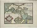
 Map of the Ottoman Empire by Abraham Ortelius.jpeg 3,046 × 2,353; 2.43 MB
-
 Map of the Pacific Ocean by Abraham Ortelius.jpeg 2,510 × 1,747; 1.97 MB
-
-
 Map of the Touraine by Abraham Ortelius.jpeg 1,538 × 1,173; 554 KB
-
 Map of the voyage of Aeneas by Abraham Ortelius.jpeg 1,536 × 1,180; 554 KB
-

-
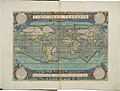 Map of the world by Abraham Ortelius.jpeg 1,538 × 1,166; 582 KB
-
 Map of Transylvania by Abraham Ortelius.jpeg 1,574 × 1,180; 533 KB
-
 Map of Tuscia by Abraham Ortelius.jpeg 1,596 × 1,181; 588 KB
-
 Map of Upper Saxony by Abraham Ortelius.jpeg 3,036 × 2,344; 2.29 MB
-
 Map of Valencia by Abraham Ortelius (cropped).jpeg 2,466 × 1,742; 1.81 MB
-
 Map of Valencia by Abraham Ortelius.jpeg 3,013 × 2,346; 2.25 MB
-
 Map of Wales by Abraham Ortelius.jpeg 3,030 × 2,358; 2.43 MB
-

-
 Map of Westphalia by Abraham Ortelius.jpeg 3,030 × 2,404; 2.24 MB
-
 Map of Zeeland by Abraham Ortelius.jpeg 1,589 × 1,189; 542 KB
-
 Maps of Anatolia, of Egypt, and of Carthage by Abraham Ortelius.jpeg 1,553 × 1,184; 538 KB
-
 Maps of Apulia and of Calabria by Abraham Ortelius.jpeg 1,606 × 1,194; 531 KB
-
 Maps of Berry and of Limagne by Abraham Ortelius.jpeg 1,536 × 1,175; 504 KB
-
 Maps of Braunschweig and Lüneberg and of the territory of Nuremberg by Abraham Ortelius.jpeg 3,006 × 2,377; 1.99 MB
-
 Maps of Buchonia and of the County of Waldeck by Abraham Ortelius.jpeg 3,027 × 2,351; 2.08 MB
-
 Maps of Calais and Boulogne and of Vermandois by Abraham Ortelius.jpeg 2,394 × 1,767; 1.7 MB
-
 Maps of Carpetania, of Gipuzkoa, and of Cadiz by Abraham Ortelius.jpeg 3,047 × 2,360; 2.22 MB
-

-

-
 Maps of Culiacán and of Hispaniola and Cuba by Abraham Ortelius.jpeg 3,033 × 2,338; 2.37 MB
-
 Maps of Denmark and of the Cimbrian (Jutland) Peninsula by Abraham Ortelius.jpeg 3,071 × 2,343; 2.28 MB
-
 Maps of Dietmarsh and of Oldenburg by Abraham Ortelius.jpeg 3,059 × 2,360; 2.13 MB
-
 Maps of Franconia and of the Bishopric of Münster by Abraham Ortelius.jpeg 3,063 × 2,354; 2.33 MB
-
 Maps of Hennenberg and of Hesse by Abraham Ortelius.jpeg 1,540 × 1,174; 512 KB
-

-

-
-

-
 Maps of Narbonne, of Savoie, and of the Comtat Venaissin by Abraham Ortelius.jpeg 3,029 × 2,367; 2.29 MB
-

-

-

-
 Maps of the Argonautica by Abraham Ortelius.jpeg 3,043 × 2,352; 2.27 MB
-
 Maps of the Blois region and of Limousin by Abraham Ortelius.jpeg 3,065 × 2,368; 2.15 MB
-

-

-

-
 Maps of the liberties of Padua and of the liberties of Treviso by Abraham Ortelius.jpeg 1,577 × 1,174; 557 KB
-
 Maps of the peregrination of Ulysses by Abraham Ortelius.jpeg 3,012 × 2,363; 2.28 MB
-

-
 Maps of the territory of Basel and of the Swabian Circle by Abraham Ortelius.jpeg 1,589 × 1,189; 599 KB
-
 Maps of Thuringia and of the province of Meissen by Abraham Ortelius.jpeg 3,066 × 2,355; 1.87 MB
-
 The Order of the German Empire in the West 1 by Abraham Ortelius.jpeg 1,555 × 1,176; 557 KB
-
 The Order of the German Empire in the West 2 by Abraham Ortelius.jpeg 1,540 × 1,178; 541 KB
-
 Urola Kosta by Abraham Ortelius (cropped).jpeg 241 × 357; 43 KB


.jpeg)


.jpg)


_by_Abraham_Ortelius.jpeg)


_by_Abraham_Ortelius.jpeg)


_by_Abraham_Ortelius.jpeg)


_by_Abraham_Ortelius.jpeg)


.jpeg)


_Peninsula_by_Abraham_Ortelius.jpeg)


_by_Abraham_Ortelius.jpeg)

_and_of_Brittany_and_Normandy_by_Abraham_Ortelius.jpeg)


_by_Abraham_Ortelius.jpeg)


.jpeg)