Category:Meishan Township, Chiayi County
English: Meishan Township.
日本語: 梅山郷。
中文(臺灣):梅山鄉。
rural township in Chiayi County, Taiwan   | |||||
| Upload media | |||||
| Instance of | |||||
|---|---|---|---|---|---|
| Location | Chiayi County, Taiwan Province, ROC | ||||
| Population |
| ||||
| Area |
| ||||
| Elevation above sea level |
| ||||
 | |||||
Subcategories
This category has the following 15 subcategories, out of 15 total.
*
A
L
- Liyuanliao Station (6 F)
- Longgong Waterfall (5 F)
M
- Meishan Park (33 F)
- Meishan Yuxu Temple (3 F)
R
- Ruifeng Yongxing Temple (2 F)
T
Y
- Yuntan Waterfall (3 F)
Media in category "Meishan Township, Chiayi County"
The following 19 files are in this category, out of 19 total.
-
 Caoling landslide scarp with mountain view.jpg 2,048 × 1,536; 2.11 MB
-
 Children of the Taiping Primary School in Chiayi County 2021.jpg 1,920 × 1,280; 498 KB
-
 Longyanlin.JPG 640 × 480; 38 KB
-
 V01-20131026-013 (11230012105).jpg 1,430 × 960; 789 KB
-
 Yizhishan level crossing.jpg 7,360 × 4,912; 14.84 MB
-
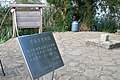
 Yuan Tan Esological Park sign 20160208.jpg 3,456 × 5,184; 4.36 MB
-
 吳鳳廟 Wufeng Temple - panoramio.jpg 4,320 × 3,239; 2.8 MB
-
 嘉義縣梅山鄉 - panoramio.jpg 2,736 × 3,648; 1.7 MB
-
 嘉義縣梅山鄉 中山路 - panoramio (1).jpg 4,000 × 3,000; 1.72 MB
-
 嘉義縣梅山鄉 中山路 - panoramio.jpg 4,000 × 3,000; 1.88 MB
-
 嘉義縣梅山鄉 太平 Taiping(Meishan,Chiayi) - panoramio.jpg 3,648 × 2,432; 1.05 MB
-
 嘉義縣梅山鄉 環南路 - panoramio.jpg 3,648 × 2,432; 1.29 MB
-
 嘉義縣竹崎鄉 奮起湖步道 - panoramio (1).jpg 1,552 × 2,592; 1.37 MB
-
 嘉義縣竹崎鄉 奮起湖步道 - panoramio (2).jpg 2,592 × 1,552; 1.21 MB
-
 大尖山 一等衛星控制點 20101205.jpg 3,648 × 2,432; 2.04 MB
-
 新葉 New leaves - panoramio.jpg 3,264 × 2,448; 2.93 MB
-
 燕子崖 - panoramio.jpg 2,432 × 3,648; 1.69 MB
-
 碧湖山薄霧晨曦.jpg 4,032 × 3,024; 2.75 MB
-
 茶花 Camellia - panoramio (1).jpg 2,948 × 2,211; 883 KB


.jpg)


.jpg)
_-_panoramio.jpg)

.jpg)
.jpg)


.jpg)