Category:Melmerby, Richmondshire
village and civil parish in Richmondshire, North Yorkshire, UK  | |||||
| Upload media | |||||
| Instance of | |||||
|---|---|---|---|---|---|
| Location | Richmondshire, North Yorkshire, Yorkshire and the Humber, England | ||||
 | |||||
English: Melmerby is a village and civil parish in the Richmondshire district of North Yorkshire, England. It lies in the Yorkshire Dales about south west of Leyburn. Its neighbours are two other villages Carlton and Agglethorpe.
Media in category "Melmerby, Richmondshire"
The following 35 files are in this category, out of 35 total.
-
 Benchmark on wall near Wraykeld Well - geograph.org.uk - 2634807.jpg 683 × 1,024; 309 KB
-
 Coverdale lambs - geograph.org.uk - 1801192.jpg 1,280 × 960; 344 KB
-
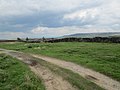
 Coverdale near Melmerby - geograph.org.uk - 1801185.jpg 640 × 480; 108 KB
-
 East Scrafton Moor - geograph.org.uk - 2840681.jpg 1,600 × 1,200; 859 KB
-
 Fields near Melmerby - geograph.org.uk - 127159.jpg 640 × 480; 129 KB
-
 Footpath heading for Scar Wood - geograph.org.uk - 4136695.jpg 4,000 × 3,000; 3.43 MB
-
 Grouse grit tray, Melmerby Moor - geograph.org.uk - 4390091.jpg 3,776 × 2,520; 4.07 MB
-
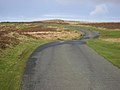
 Lane descending towards Melmerby - geograph.org.uk - 4375392.jpg 5,184 × 3,456; 7.34 MB
-
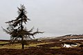 Lonely Tree on Melmerby Moor - geograph.org.uk - 4375338.jpg 5,184 × 3,456; 7.36 MB
-
 Melmerby Methodist Church - geograph.org.uk - 1801171.jpg 640 × 480; 93 KB
-
 Melmerby Moor - geograph.org.uk - 125067.jpg 640 × 298; 40 KB
-
 Melmerby Moor - geograph.org.uk - 3490721.jpg 1,600 × 1,200; 515 KB
-
 Melmerby Moor - geograph.org.uk - 4375311.jpg 5,184 × 3,456; 7.68 MB
-
 Melmerby Moor Road - geograph.org.uk - 3490712.jpg 1,600 × 1,200; 441 KB
-
 Melmerby.jpg 640 × 480; 117 KB
-
 Minor road near Wraykeld Well - geograph.org.uk - 1927191.jpg 2,048 × 1,536; 1.13 MB
-
 Penhill track - geograph.org.uk - 3490764.jpg 1,600 × 1,200; 556 KB
-
 Ramsgill Head - geograph.org.uk - 3490769.jpg 1,600 × 1,200; 697 KB
-
 Road crossing Melmerby Moor - geograph.org.uk - 5818736.jpg 4,000 × 3,000; 3.26 MB
-
 Road crossing Melmerby Moor - geograph.org.uk - 5818737.jpg 4,000 × 3,000; 3.17 MB
-
 Road junction on the road from Carlton to Coverham - geograph.org.uk - 4136684.jpg 4,000 × 3,000; 3.57 MB
-
 Sheep Grazing below Penhill - geograph.org.uk - 2262448.jpg 1,280 × 853; 385 KB
-
 Shooting Track on Melmerby Moor (1) - geograph.org.uk - 4375324.jpg 5,184 × 3,456; 6.89 MB
-
 Shooting Track on Melmerby Moor (2) - geograph.org.uk - 4375350.jpg 5,184 × 3,456; 7.44 MB
-
 St Simon's Bridge - geograph.org.uk - 4136701.jpg 4,000 × 3,000; 4.13 MB
-
 Track below Penhill - geograph.org.uk - 3965366.jpg 640 × 480; 87 KB
-
 Track down from Penhill leading to Coverdale - geograph.org.uk - 4390085.jpg 3,776 × 2,520; 4.02 MB
-
 View north at start of footpath to Carlton - geograph.org.uk - 2634832.jpg 1,024 × 683; 233 KB
-
 Winter sunlight on the flanks of Penhill - geograph.org.uk - 6355571.jpg 5,184 × 2,863; 2.86 MB
-
 A Grassy Track - geograph.org.uk - 288271.jpg 640 × 480; 104 KB
-
 Carlton Village Hall - geograph.org.uk - 439767.jpg 640 × 480; 70 KB
-
 Griff Head - geograph.org.uk - 347823.jpg 600 × 450; 75 KB
-
 Looking Over Melmerby Moor - geograph.org.uk - 288266.jpg 640 × 480; 90 KB
-
 Melmerby Moor - geograph.org.uk - 283611.jpg 640 × 480; 91 KB
-
 Shooting butt on Melmerby Moor - geograph.org.uk - 542086.jpg 600 × 450; 66 KB


_-_geograph.org.uk_-_4375324.jpg)
_-_geograph.org.uk_-_4375350.jpg)


