Category:Melvich
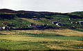
English: Melvich is a village in the county of Sutherland on the North Coast of Scotland, situated on the A836 road, near the mouth of the River Halladale.
human settlement in Highland, Scotland, UK  | |||||
| Upload media | |||||
| Instance of | |||||
|---|---|---|---|---|---|
| Location |
| ||||
 | |||||
Media in category "Melvich"
The following 51 files are in this category, out of 51 total.
-
 Bighouse house overlooking Melvich Bay - geograph.org.uk - 2020057.jpg 3,648 × 2,736; 2.1 MB
-
 Bighouse, Melvich - geograph.org.uk - 577799.jpg 640 × 480; 86 KB
-
 Following the Halladale River towards Melvich Bay - geograph.org.uk - 6157762.jpg 3,776 × 2,520; 4.06 MB
-
 Golval, Strath Halladale - geograph.org.uk - 281900.jpg 640 × 480; 44 KB
-
 Halladale Estuary - geograph.org.uk - 166000.jpg 640 × 480; 70 KB
-
 Halladale River - geograph.org.uk - 257075.jpg 640 × 480; 47 KB
-
 Loch Mor - geograph.org.uk - 240327.jpg 640 × 480; 91 KB
-
 Looking towards Portskerra Harbour - geograph.org.uk - 5234520.jpg 4,395 × 3,296; 4.09 MB
-
 Melvich from across the River Halladale.jpg 640 × 401; 94 KB
-
 Melvich Hotel - geograph.org.uk - 31389.jpg 640 × 479; 101 KB
-
 Ordnance Survey Sheet NC 86 96 Melvich, Published 1968.jpg 15,252 × 8,871; 35.19 MB
-

-
 Track to the Beach at Melvich - geograph.org.uk - 931618.jpg 640 × 480; 69 KB
-
 A bleak December day - geograph.org.uk - 579519.jpg 640 × 417; 76 KB
-
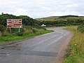
 A836 - geograph.org.uk - 368827.jpg 640 × 474; 55 KB
-
 A897 southbound - geograph.org.uk - 827025.jpg 640 × 480; 73 KB
-
 Akran burn - geograph.org.uk - 793805.jpg 640 × 480; 137 KB
-
 Approaching the A836 - geograph.org.uk - 595793.jpg 640 × 411; 59 KB
-
 Clach Sgoilte (the Split Stone) - geograph.org.uk - 494012.jpg 640 × 427; 97 KB
-
 Cnoc Elpceil - geograph.org.uk - 702074.jpg 640 × 427; 35 KB
-
 Craggy knoll south of Melvich - geograph.org.uk - 702070.jpg 640 × 427; 37 KB
-
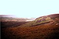
 Empty moorland south of Melvich - geograph.org.uk - 702056.jpg 640 × 427; 45 KB
-
 Geodh' Eisgiadh - geograph.org.uk - 496285.jpg 640 × 427; 119 KB
-
 Halladale Bridge - geograph.org.uk - 257074.jpg 640 × 480; 76 KB
-
 Halladale Estuary - geograph.org.uk - 166002.jpg 640 × 480; 73 KB
-
 Halladale estuary - geograph.org.uk - 620132.jpg 640 × 617; 118 KB
-
 Halladale River - geograph.org.uk - 257077.jpg 640 × 480; 62 KB
-
 Headstone in Kirkton Cemetery - geograph.org.uk - 595806.jpg 460 × 640; 130 KB
-
 Hilltops catching the evening sun - geograph.org.uk - 594182.jpg 640 × 367; 69 KB
-
 Kirton Gravel Pit - geograph.org.uk - 257081.jpg 640 × 480; 85 KB
-
 Late November Glow - geograph.org.uk - 594183.jpg 640 × 382; 77 KB
-
 Loch Earacha covered with snow - geograph.org.uk - 579530.jpg 640 × 422; 76 KB
-
 Loch Hollistan - geograph.org.uk - 496295.jpg 640 × 427; 72 KB
-
 Loch na Caorach - geograph.org.uk - 169073.jpg 640 × 480; 52 KB
-
 Looking south across peatbog - geograph.org.uk - 702081.jpg 640 × 427; 20 KB
-
 Peatland Pool - geograph.org.uk - 496291.jpg 640 × 427; 109 KB
-
 Portskerra Pier - geograph.org.uk - 576648.jpg 640 × 480; 63 KB
-
 Ravine above Geodh' Eisgaidh - geograph.org.uk - 496287.jpg 640 × 427; 102 KB
-
 River Halladale - geograph.org.uk - 166003.jpg 640 × 480; 77 KB
-
 River Halladale - geograph.org.uk - 166005.jpg 640 × 480; 79 KB
-
 River Halladale - geograph.org.uk - 166010.jpg 640 × 480; 85 KB
-
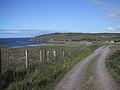
 Road to Melvich beach - geograph.org.uk - 240330.jpg 640 × 480; 69 KB
-
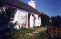 Rowan Bank Cottage in 1992 - geograph.org.uk - 579353.jpg 640 × 415; 104 KB
-
 Rubha an Tuir trig - geograph.org.uk - 427645.jpg 480 × 640; 108 KB
-
 Sheep grazing at Achridigill - geograph.org.uk - 594901.jpg 640 × 424; 127 KB
-
 Strath Halladale - geograph.org.uk - 169115.jpg 640 × 480; 77 KB
-
 The end of the A897 - geograph.org.uk - 257068.jpg 640 × 480; 79 KB
-
 The hills east of the River Halladale - geograph.org.uk - 595765.jpg 640 × 419; 47 KB
-
 The old cemetery at Kirkton - geograph.org.uk - 595800.jpg 454 × 567; 39 KB
-
 The Post Office Sheep (1995) - geograph.org.uk - 579380.jpg 429 × 640; 94 KB
-
 Waterfall - geograph.org.uk - 166448.jpg 640 × 480; 86 KB


_-_geograph.org.uk_-_494012.jpg)


_-_geograph.org.uk_-_579380.jpg)
