Category:Mendota Heights, Minnesota
Main Wikipedia article: Mendota Heights, Minnesota.
city in Dakota County, Minnesota, United States of America | |||||
| Upload media | |||||
| Instance of | |||||
|---|---|---|---|---|---|
| Location | Dakota County, Minnesota | ||||
| Located in or next to body of water | |||||
| Population |
| ||||
| Area |
| ||||
| Elevation above sea level |
| ||||
| official website | |||||
 | |||||
Subcategories
This category has the following 2 subcategories, out of 2 total.
R
- Resurrection Cemetery (18 F)
Media in category "Mendota Heights, Minnesota"
The following 29 files are in this category, out of 29 total.
-
1140 Centre Pointe Blvd - Mendota Heights, MN - panoramio.jpg 4,024 × 2,261; 3.13 MB
-
Abandoned by the Railroad (1445505740).jpg 3,456 × 2,304; 2.58 MB
-
Brown-college-mendota-heights-mn.png 200 × 100; 25 KB
-
Highway 110 and Highway 13 - Mendota Heights, MN - panoramio.jpg 4,128 × 2,322; 3.26 MB
-
Int35EnSignRoad1 (29844570205).jpg 2,400 × 1,600; 2.01 MB
-
Interstate 35E Bridge - panoramio (1).jpg 4,128 × 2,322; 3.25 MB
-
Interstate 35E Bridge - panoramio (2).jpg 4,128 × 2,322; 4.33 MB
-
Interstate 35E Bridge - panoramio (4).jpg 4,128 × 2,322; 2.85 MB
-
Interstate 35E Bridge - panoramio.jpg 4,128 × 2,322; 3 MB
-
Lexington Ave and Centre Pointe Dr - panoramio.jpg 4,128 × 2,322; 4.05 MB
-
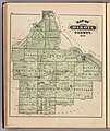
Map of Dakota County from the 1874 Minnesota State Atlas.jpg 5,604 × 6,645; 7.63 MB
-
Map of Inver Grove from the 1874 Minnesota State Atlas (cropped).jpg 1,067 × 1,244; 425 KB
-
Mc Donalds - panoramio (2).jpg 4,128 × 2,322; 3.83 MB
-
Mendota Corporate Centre - panoramio (1).jpg 3,411 × 1,920; 2.68 MB
-
Mendota Corporate Centre - panoramio.jpg 4,128 × 2,322; 4.38 MB
-
Mendota Heights, MN - panoramio (1).jpg 3,551 × 1,999; 1.94 MB
-
Mendota Heights, MN - panoramio.jpg 4,128 × 2,322; 2.85 MB
-
Mendota Work Camp No. 1 - 2016-04-12 - 1.jpg 7,360 × 4,912; 10.69 MB
-
Mendota Work Camp No. 1 - 2016-04-12 - 2.jpg 4,912 × 7,360; 12.38 MB
-
Mendota Work Camp No. 1 - 2016-04-12 - 3.jpg 7,360 × 4,912; 12.87 MB
-
Mendota Work Camp No. 1 - 2016-04-12 - 4.jpg 4,912 × 7,360; 12.18 MB
-
Minnesota River - panoramio (1).jpg 2,904 × 1,635; 1.76 MB
-
Minnesota State Highway 110 - panoramio.jpg 4,128 × 2,322; 3.84 MB
-
Minnesota State Highway 13 and Interstate 35E - panoramio.jpg 4,128 × 2,322; 2.42 MB
-
Railroad (1445665594).jpg 3,456 × 2,304; 2.6 MB
-
Railroad (1445670938).jpg 2,304 × 3,456; 3.41 MB
-
The Pilot Knob Marker - panoramio.jpg 2,592 × 1,936; 2.04 MB
-
Warning - Buried Fiber Optic Cable (42921581795).jpg 7,952 × 5,158; 22.69 MB


