Category:Mengelbergstraße 3, 5, 7, 9 und Tel-Aviv-Straße 1, 3, 5, 7 (Köln)
| Object location | | View all coordinates using: OpenStreetMap |
|---|
Media in category "Mengelbergstraße 3, 5, 7, 9 und Tel-Aviv-Straße 1, 3, 5, 7 (Köln)"
The following 2 files are in this category, out of 2 total.
-
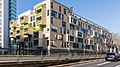
 Wohnhäuser Mengelbergstraße 3, 5 und 7, Köln-3465.jpg 4,480 × 2,987; 8.15 MB
-
 Wohnhäuser Mengelbergstraße, Tel-Aviv-Straße, Köln-0359.jpg 5,248 × 2,952; 11.85 MB

