Category:Menorah Garden
| Object location | | View all coordinates using: OpenStreetMap |
|---|
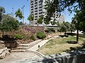
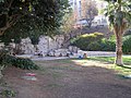
English: Menorah garden (Gan HaMenora; גן המנורה) in Jerusalem, also known as Shiber pit (Bor Shiber; בור שיבר) and Horse garden (Gan HaSus; גן הסוס).
עברית: גן המנורה בירושלים, הידוע גם בשמות בור שיבֶּר וגן הסוס.
Garden in Jerusalem, Israel | |||||
| Upload media | |||||
| Named after | |||||
|---|---|---|---|---|---|
| Location | Jerusalem, Quds Governorate, West Bank | ||||
| Inception |
| ||||
 | |||||
Subcategories
This category has only the following subcategory.
Media in category "Menorah Garden"
The following 34 files are in this category, out of 34 total.
-
 Dov Elbaum 2011.jpg 1,304 × 1,955; 1.96 MB
-
 Gan HaMenora P1140901.JPG 4,000 × 3,000; 4.82 MB
-
 Gan HaMenora P1140902.JPG 4,000 × 2,883; 3.39 MB
-
 Gan HaMenora P1140903.JPG 4,000 × 3,000; 4.5 MB
-
 Gan HaMenora P1140904.JPG 4,000 × 3,000; 4.78 MB
-
 Gan HaMenora P1140905.JPG 4,000 × 3,000; 4.74 MB
-
 Gan HaMenora P1140906.JPG 4,000 × 3,000; 4.6 MB
-
 Gan HaMenora P1140907.JPG 4,000 × 3,000; 4.63 MB
-
 Gan HaMenora P1140921.JPG 4,000 × 3,000; 4.89 MB
-
 Gan HaMenora P1140922.JPG 3,000 × 4,000; 4.3 MB
-
 Gan hamenorah 22.jpg 537 × 800; 137 KB
-
 Gan Menora.JPG 2,816 × 2,112; 1.18 MB
-
 Horse garden during the snow, 2.3.2012.jpg 2,448 × 3,264; 3.47 MB
-
 Horse Garden.jpg 3,264 × 2,448; 3.46 MB
-
 Horse statue, Gan Hamenora, Jerusalem 2011.JPG 2,112 × 2,816; 2.75 MB
-
 Horse Statue, Gan Hamenora, Jerusalem.jpg 4,288 × 2,848; 1.22 MB
-
 Jerusalem real estate protest 31.7.2011 cropped.jpg 525 × 394; 95 KB
-
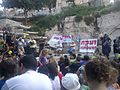 Jerusalem real estate protest 31.7.2011.jpg 1,600 × 1,200; 568 KB
-
 KingGeorgeStreetJerusalemMay062023 01.jpg 4,000 × 3,000; 15.37 MB
-
 Knesset Menorah at the Menorah garden in 1956.jpg 2,033 × 3,038; 1.49 MB
-
 Menorah Garden IMG 7416.jpg 5,200 × 2,378; 6.43 MB
-
 Menorah Garden IMG 7417.jpg 4,656 × 2,540; 5.32 MB
-
 Menorah Garden, Jerusalem, Israel circa 1960.jpg 771 × 800; 132 KB
-
 Modernistic bldg's on King George Ave. Mar. 1936 LOC matpc.03403.jpg 5,735 × 4,247; 2.31 MB
-
 PikiWiki Israel 46181 The Kneset Menorah.jpg 700 × 700; 163 KB
-
 Psalms 18-3 -My Shield (3456095236).jpg 3,264 × 2,448; 2.2 MB
-
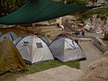 Real estate protest in Jerusalem 1.8.2011 01.jpg 2,816 × 2,112; 2.47 MB
-
 Shiber22.jpg 600 × 451; 101 KB
-
 Unveiling ceremony of the Knesset Menorah in 1956.jpg 2,892 × 2,175; 701 KB
-
 Window Stories 0.jpg 3,000 × 4,000; 3.19 MB
-
 Window Stories 4.jpg 3,000 × 4,000; 5.17 MB
-
 מגן דוד בבור שיבר-2 (3455275291).jpg 3,264 × 2,448; 3.1 MB
-
 מגן דוד בור שיבר-1 (3456090812).jpg 3,264 × 2,448; 2.86 MB
-
 פורים בירושלים - Purim in Jerusalem (3352208062).jpg 3,048 × 1,718; 1.26 MB


.jpg)


.jpg)
.jpg)
.jpg)