Category:Mereworth
village in the United Kingdom  | |||||
| Upload media | |||||
| Instance of | |||||
|---|---|---|---|---|---|
| Location | Tonbridge and Malling, Kent, South East England, England | ||||
| Said to be the same as | Mereworth (Wikimedia duplicated page, civil parish) | ||||
 | |||||
Subcategories
This category has the following 7 subcategories, out of 7 total.
H
L
M
- Mereworth Castle (9 F)
- Mereworth War Memorial (2 F)
O
W
- Wateringbury Stream (6 F)
Y
- Yotes Court (4 F)
Media in category "Mereworth"
The following 200 files are in this category, out of 382 total.
(previous page) (next page)-
 12th Tee on King's Hill Golf Course - geograph.org.uk - 1200582.jpg 640 × 481; 80 KB
-
 79, The Street - geograph.org.uk - 2622309.jpg 640 × 430; 62 KB
-
 A cleared area in Mereworth Woods - geograph.org.uk - 2644360.jpg 640 × 430; 98 KB
-
 A clearing, Mereworth Woods - geograph.org.uk - 2639239.jpg 640 × 430; 114 KB
-
 A field of Vegetales - geograph.org.uk - 2639198.jpg 640 × 430; 51 KB
-
 A leguminous crop - geograph.org.uk - 2639135.jpg 640 × 430; 55 KB
-
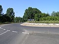 A roundabout on the A26 - geograph.org.uk - 28195.jpg 640 × 480; 68 KB
-
 A228, Malling Rd - geograph.org.uk - 2500575.jpg 640 × 430; 46 KB
-
 A26 approaching roundabout at Alders Wood - geograph.org.uk - 3835767.jpg 3,072 × 2,035; 4.45 MB
-
 Alongside Beech Road - geograph.org.uk - 4750575.jpg 4,608 × 3,456; 3.37 MB
-
 An avenue of trees, Mereworth Woods - geograph.org.uk - 2504942.jpg 640 × 430; 155 KB
-
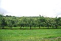 Apple Orchard - geograph.org.uk - 2627736.jpg 640 × 430; 78 KB
-
 Approaching roundabout on A26 - geograph.org.uk - 3836052.jpg 1,600 × 1,060; 540 KB
-
 Avenue from Mereworth Castle - geograph.org.uk - 4711604.jpg 4,608 × 3,456; 4.01 MB
-
 Barn, Baron's Place - geograph.org.uk - 2629460.jpg 640 × 430; 53 KB
-
 Barn, Yotes Court - geograph.org.uk - 2622593.jpg 640 × 430; 107 KB
-
 Barn, Yotes Court - geograph.org.uk - 2622601.jpg 640 × 430; 111 KB
-
 Barns at Yotes Court - geograph.org.uk - 2871090.jpg 640 × 480; 109 KB
-
 Baron's Place - geograph.org.uk - 2629450.jpg 640 × 412; 71 KB
-
 Barons Place - geograph.org.uk - 2639118.jpg 640 × 430; 61 KB
-
 Beech Rd - geograph.org.uk - 2654815.jpg 640 × 430; 87 KB
-
 Beech Road - geograph.org.uk - 4750587.jpg 4,608 × 3,456; 3.44 MB
-
 Beech Road - geograph.org.uk - 5169312.jpg 640 × 428; 247 KB
-
 Beech Road - geograph.org.uk - 5169316.jpg 428 × 640; 205 KB
-
 Beech Road, Mereworth - geograph.org.uk - 4886152.jpg 3,264 × 2,448; 2 MB
-
 Beech Road, Mereworth - geograph.org.uk - 4886260.jpg 3,264 × 2,448; 1.7 MB
-
 Beech Road, Mereworth - geograph.org.uk - 4886261.jpg 3,264 × 2,448; 3.32 MB
-
 Beech Road, Mereworth - geograph.org.uk - 4886273.jpg 3,264 × 2,448; 4.42 MB
-
 Beechmore, Mereworth - geograph.org.uk - 2622301.jpg 640 × 430; 71 KB
-
 Between high hedges - geograph.org.uk - 2654830.jpg 640 × 430; 109 KB
-
 Bridleway in Mereworth Woods - geograph.org.uk - 1200095.jpg 640 × 481; 151 KB
-
 Bridleway in Mereworth Woods - geograph.org.uk - 1200108.jpg 640 × 481; 137 KB
-
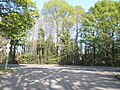
 Bridleway in Roadside Wood - geograph.org.uk - 1200188.jpg 640 × 481; 120 KB
-
 Bridleway into Mereworth Woods - geograph.org.uk - 1200112.jpg 640 × 481; 126 KB
-
 Bridleway junction in Mereworth Woods - geograph.org.uk - 1200103.jpg 640 × 481; 141 KB
-
 Bridleway off Mereworth Rd - geograph.org.uk - 2622578.jpg 640 × 430; 121 KB
-
 Bridleway to Yotes Court - geograph.org.uk - 2622589.jpg 640 × 430; 122 KB
-
 Bridleway, Mereworth Woods - geograph.org.uk - 3826092.jpg 640 × 480; 182 KB
-
 Building on Butcher's Lane - geograph.org.uk - 2660653.jpg 640 × 430; 47 KB
-
 Bull Farm House - geograph.org.uk - 1200591.jpg 640 × 481; 72 KB
-
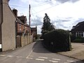
 Butcher's Lane - geograph.org.uk - 2660546.jpg 640 × 430; 63 KB
-
 Butcher's Lane - geograph.org.uk - 2660554.jpg 640 × 430; 76 KB
-
 Butcher's Lane - geograph.org.uk - 2660635.jpg 640 × 430; 61 KB
-
 Butcher's Lane, Mereworth - geograph.org.uk - 2660639.jpg 640 × 430; 104 KB
-
 Butchers Lane, Mereworth - geograph.org.uk - 4886109.jpg 3,264 × 2,448; 1.82 MB
-
 Butchers Lane, Mereworth - geograph.org.uk - 4886116.jpg 3,264 × 2,448; 2.01 MB
-
 Butchers Lane, Mereworth - geograph.org.uk - 4886128.jpg 3,264 × 2,448; 2.32 MB
-
 Butchers Lane, Mereworth - geograph.org.uk - 4886263.jpg 3,264 × 2,448; 2.79 MB
-
 Butchers Lane, Mereworth - geograph.org.uk - 4886264.jpg 3,264 × 2,448; 1.77 MB
-
 Butchers Lane, Mereworth - geograph.org.uk - 4886265.jpg 3,264 × 2,448; 2.77 MB
-
 Church Close, Mereworth - geograph.org.uk - 2622239.jpg 640 × 430; 74 KB
-
 Clear felled, Mereworth Woods - geograph.org.uk - 2503176.jpg 640 × 430; 95 KB
-
 Clear felling, Mereworth Woods - geograph.org.uk - 2504974.jpg 640 × 430; 94 KB
-
 Cleared area, Mereworth Woods - geograph.org.uk - 2503175.jpg 640 × 430; 101 KB
-
 Cleared area, Mereworth Woods - geograph.org.uk - 2504952.jpg 640 × 430; 102 KB
-
 Clearing in Mereworth Woods - geograph.org.uk - 2504953.jpg 640 × 430; 77 KB
-
 Conifers, Mereworth Wood - geograph.org.uk - 2644351.jpg 640 × 430; 128 KB
-
 Conifers, Roadside Wood - geograph.org.uk - 2639222.jpg 640 × 430; 116 KB
-
 Coppiced trees by a footpath - geograph.org.uk - 2627754.jpg 640 × 430; 139 KB
-
 Coppiced trees, Mereworth Woods - geograph.org.uk - 2504941.jpg 640 × 430; 163 KB
-
 Coppiced trees, Mereworth Woods - geograph.org.uk - 2504961.jpg 640 × 430; 149 KB
-
 Coppiced trees, Mereworth Woods - geograph.org.uk - 2654813.jpg 640 × 430; 139 KB
-
 Coppicing, Mereworth Woods - geograph.org.uk - 2644342.jpg 640 × 430; 135 KB
-
 Coppicing, Roadside Wood - geograph.org.uk - 2639208.jpg 640 × 430; 141 KB
-
 Cottage at Forge Farm - geograph.org.uk - 1569603.jpg 640 × 430; 151 KB
-
 Cottage at the end of Butcher's Lane - geograph.org.uk - 2660656.jpg 640 × 430; 66 KB
-
 Cottage by New Pound Lane - geograph.org.uk - 2639161.jpg 640 × 430; 59 KB
-
 Cottage on The Street - geograph.org.uk - 2622288.jpg 640 × 415; 66 KB
-
 Cottages, Kent Street - geograph.org.uk - 2654824.jpg 640 × 430; 79 KB
-
 Cottages, Kent Street - geograph.org.uk - 2985326.jpg 640 × 480; 119 KB
-
 Crossroads, Mereworth - geograph.org.uk - 2500581.jpg 640 × 399; 39 KB
-
 Crossroads, Mereworth - geograph.org.uk - 3826325.jpg 640 × 480; 121 KB
-
 Dam for a reservoir - geograph.org.uk - 2627752.jpg 640 × 430; 63 KB
-
 Danns Lane, Mereworth - geograph.org.uk - 4886041.jpg 3,264 × 2,448; 1.57 MB
-
 Derelict looking barn, New Pound - geograph.org.uk - 2639195.jpg 640 × 430; 68 KB
-
 Disused quarry near Mereworth Woods - geograph.org.uk - 3692530.jpg 4,000 × 3,000; 4.06 MB
-
 Drive to Yotes Court - geograph.org.uk - 2622573.jpg 640 × 430; 78 KB
-
 Entering Mereworth - geograph.org.uk - 2661997.jpg 640 × 430; 93 KB
-
 Entrance to Weald Granary - geograph.org.uk - 3826178.jpg 640 × 428; 106 KB
-
 Fairlawne Estate, Mereworth Woods - geograph.org.uk - 2503173.jpg 640 × 430; 117 KB
-
 Farm track off New Pound Lane - geograph.org.uk - 2639142.jpg 640 × 430; 53 KB
-
 Felled area, Mereworth Woods - geograph.org.uk - 2504973.jpg 640 × 430; 90 KB
-
 Field by the A26 - geograph.org.uk - 4569624.jpg 640 × 426; 63 KB
-
 Field near Yotes Court - geograph.org.uk - 2874610.jpg 640 × 480; 90 KB
-
 Field south of Mereworth Woods - geograph.org.uk - 2654814.jpg 640 × 430; 75 KB
-
 Fire beaters, Mereworth Woods - geograph.org.uk - 2504922.jpg 640 × 430; 148 KB
-
 Fire beaters, Mereworth Woods - geograph.org.uk - 2504936.jpg 640 × 430; 150 KB
-
 Fire Beaters, Mereworth Woods - geograph.org.uk - 2504967.jpg 640 × 430; 149 KB
-
 Fish pond, Swanton Valley - geograph.org.uk - 2629356.jpg 640 × 430; 125 KB
-
 Fish pond, Swanton Valley - geograph.org.uk - 2629365.jpg 640 × 430; 117 KB
-
 Fish Pond, Swanton Valley - geograph.org.uk - 4750598.jpg 4,608 × 3,456; 3.42 MB
-
 Fish Pond, Swanton Valley - geograph.org.uk - 4750601.jpg 4,608 × 3,456; 3.37 MB
-
 Fish Pond, Swanton Valley - geograph.org.uk - 4750605.jpg 4,608 × 3,456; 3.35 MB
-
 Flower festival at St Lawrence's Church, Mereworth - geograph.org.uk - 5550423.jpg 4,000 × 3,000; 4.59 MB
-
 Flower festival at St Lawrence's Church, Mereworth - geograph.org.uk - 5550426.jpg 4,000 × 3,000; 4.55 MB
-
 Flower festival at St Lawrence's Church, Mereworth - geograph.org.uk - 5550428.jpg 4,000 × 3,000; 4.68 MB
-
 Flower festival at St Lawrence's Church, Mereworth - geograph.org.uk - 5550429.jpg 4,000 × 3,000; 4.93 MB
-
 Footpath by World's End Wood - geograph.org.uk - 2629338.jpg 640 × 430; 80 KB
-
 Footpath entering Mereworth Woods - geograph.org.uk - 2512840.jpg 640 × 430; 148 KB
-
 Footpath in Mereworth Woods - geograph.org.uk - 2504945.jpg 640 × 430; 127 KB
-
 Footpath in Mereworth Woods - geograph.org.uk - 2512849.jpg 640 × 430; 155 KB
-
 Footpath north of New Pound - geograph.org.uk - 2639203.jpg 640 × 430; 135 KB
-
 Footpath off Beech Rd - geograph.org.uk - 2654816.jpg 640 × 430; 84 KB
-
 Footpath off Beech Road - geograph.org.uk - 4750578.jpg 4,608 × 3,456; 3.43 MB
-
 Footpath off Swanton Lane - geograph.org.uk - 2629373.jpg 640 × 430; 102 KB
-
 Footpath through Mereworth Woods - geograph.org.uk - 2654806.jpg 640 × 430; 134 KB
-
 Footpath to Herne Pound - geograph.org.uk - 2647112.jpg 640 × 430; 122 KB
-
 Footpath to Kent Street - geograph.org.uk - 2654823.jpg 640 × 430; 144 KB
-
 Footpath towards Offham - geograph.org.uk - 3826107.jpg 640 × 480; 104 KB
-
 Footpath, Mereworth Woods - geograph.org.uk - 2503171.jpg 640 × 430; 157 KB
-
 Footpath, Mereworth Woods - geograph.org.uk - 2654804.jpg 640 × 430; 126 KB
-
 Footpath, Roadside Wood - geograph.org.uk - 2639212.jpg 640 × 430; 139 KB
-
 Forest track, Roadside Wood - geograph.org.uk - 2639234.jpg 640 × 430; 120 KB
-
 Gateway on Tonbridge Road, Mereworth - geograph.org.uk - 4951558.jpg 2,048 × 1,536; 1.21 MB
-
 Green Painted Mobile Homes - geograph.org.uk - 1202720.jpg 640 × 481; 93 KB
-
 Green tunnel and barn - geograph.org.uk - 1200181.jpg 640 × 481; 111 KB
-
 Heraldic glass at St Lawrence's Church, Mereworth - geograph.org.uk - 5550417.jpg 4,000 × 3,000; 4.35 MB
-
 High hedges, New Pound Lane - geograph.org.uk - 2639129.jpg 640 × 430; 87 KB
-
 Horns Lane, Mereworth - geograph.org.uk - 4886137.jpg 3,264 × 2,448; 2.27 MB
-
 Horns Lane, Mereworth - geograph.org.uk - 4886262.jpg 3,264 × 2,448; 2.42 MB
-
 House on the A228 - geograph.org.uk - 2661926.jpg 640 × 430; 85 KB
-
 House on The Street - geograph.org.uk - 2622278.jpg 640 × 430; 58 KB
-
 House, New Pound Lane - geograph.org.uk - 2639150.jpg 640 × 430; 68 KB
-
 House, New Pound Lane - geograph.org.uk - 2639151.jpg 640 × 430; 85 KB
-
 House, The Street, Mereworth - geograph.org.uk - 2622264.jpg 640 × 430; 56 KB
-
 Houses near Yotes Court - geograph.org.uk - 2622605.jpg 640 × 430; 60 KB
-
 Houses on Beaufighter Road - geograph.org.uk - 1772012.jpg 640 × 427; 90 KB
-
 Houses on Kent Street - geograph.org.uk - 2654821.jpg 640 × 430; 71 KB
-
 Houses on The Street - geograph.org.uk - 2661937.jpg 640 × 430; 91 KB
-
 Hurricane Road at the junction of King Hill - geograph.org.uk - 4945041.jpg 2,048 × 1,536; 1.55 MB
-
 Hurricane Road, West Malling - geograph.org.uk - 4886278.jpg 3,264 × 2,448; 2.5 MB
-
 Hurst Wood - geograph.org.uk - 5030446.jpg 4,608 × 3,456; 3.41 MB
-
 In Mereworth Woods - geograph.org.uk - 2504921.jpg 640 × 430; 141 KB
-
 In Mereworth Woods - geograph.org.uk - 2644346.jpg 640 × 430; 138 KB
-
 In Mereworth Woods - geograph.org.uk - 2654809.jpg 640 × 430; 140 KB
-
 In Mereworth Woods - geograph.org.uk - 5169308.jpg 640 × 428; 305 KB
-
 Interior of St Lawrence Church, Mereworth - geograph.org.uk - 5536070.jpg 4,000 × 3,000; 4.7 MB
-
 Javelin Road, West Malling - geograph.org.uk - 4886276.jpg 3,264 × 2,448; 2.11 MB
-
 Kent Street - geograph.org.uk - 2654827.jpg 640 × 430; 91 KB
-
 Kent Street heading south - geograph.org.uk - 2654825.jpg 640 × 430; 95 KB
-
 Kent Street to Herne Pound - geograph.org.uk - 2654829.jpg 640 × 430; 92 KB
-
 Kent Street, Mereworth - geograph.org.uk - 4886266.jpg 3,264 × 2,448; 2.24 MB
-
 Kent Street, Mereworth - geograph.org.uk - 4886267.jpg 3,264 × 2,448; 1.7 MB
-
 Kent Street, Mereworth - geograph.org.uk - 4886268.jpg 3,264 × 2,448; 3.25 MB
-
 Kent Street, Mereworth - geograph.org.uk - 4886270.jpg 3,264 × 2,448; 1.94 MB
-
 Kent Street, Mereworth - geograph.org.uk - 4886271.jpg 3,264 × 2,448; 2.36 MB
-
 King Hill, A228 - geograph.org.uk - 4569641.jpg 640 × 384; 68 KB
-
 Langton Close, Mereworth - geograph.org.uk - 2622267.jpg 640 × 430; 81 KB
-
 Laurel Cottage, Mereworth - geograph.org.uk - 2622291.jpg 640 × 430; 82 KB
-
 Libbets Cottage - geograph.org.uk - 1202718.jpg 640 × 481; 112 KB
-
 Lodge to Mereworth Castle - geograph.org.uk - 4711601.jpg 4,608 × 3,456; 3.7 MB
-
 Lodge, Yotes Court - geograph.org.uk - 2622574.jpg 640 × 430; 87 KB
-
 Log pile, Mereworth Woods - geograph.org.uk - 2503172.jpg 640 × 430; 149 KB
-
 Log pile, Mereworth Woods - geograph.org.uk - 2503178.jpg 640 × 430; 128 KB
-
 Logs by the path, Mereworth Woods - geograph.org.uk - 2504910.jpg 640 × 430; 115 KB
-
 Logs, Mereworth Woods - geograph.org.uk - 2504928.jpg 640 × 430; 145 KB
-
 Looking along Beech Road - geograph.org.uk - 4750584.jpg 4,608 × 3,456; 3.33 MB
-
 Lord's Walk - geograph.org.uk - 2647097.jpg 640 × 430; 124 KB
-
 Lord's Walk - geograph.org.uk - 2647098.jpg 640 × 430; 133 KB
-
 Lord's Walk - geograph.org.uk - 2647103.jpg 640 × 430; 129 KB
-
 Lord's Walk - geograph.org.uk - 3692535.jpg 4,000 × 3,000; 4.53 MB
-
 Lord's Walk on the edge of Mereworth Woods - geograph.org.uk - 3692539.jpg 4,000 × 3,000; 4.27 MB
-
 Lord's Walk to King's Hill - geograph.org.uk - 2647110.jpg 640 × 430; 132 KB
-
 Lysander Road, West Malling - geograph.org.uk - 4886277.jpg 3,264 × 2,448; 2.59 MB
-
 Magnolia tree at 115 The Street - geograph.org.uk - 2871100.jpg 640 × 426; 170 KB
-
 Malling Rd - geograph.org.uk - 2500569.jpg 640 × 430; 48 KB
-
 Malling rd, A228 - geograph.org.uk - 4569635.jpg 640 × 426; 52 KB
-
 Malling Road at the junction of New Road - geograph.org.uk - 5229080.jpg 2,304 × 1,728; 848 KB
-
 Malling Road, Kent Street - geograph.org.uk - 4948832.jpg 2,048 × 1,536; 1.53 MB
-
 Malling Road, Kent Street - geograph.org.uk - 4948833.jpg 2,048 × 1,536; 1.43 MB
-
 Malling Road, Mereworth - geograph.org.uk - 5228909.jpg 2,304 × 1,728; 803 KB
-
 Mereworth churchyard - geograph.org.uk - 2985158.jpg 640 × 480; 122 KB
-
 Mereworth CP School - geograph.org.uk - 2622371.jpg 640 × 430; 92 KB
-
 Mereworth CP School - geograph.org.uk - 2622374.jpg 640 × 403; 65 KB
-

-
 Mereworth Road, Mereworth - geograph.org.uk - 4889393.jpg 3,264 × 2,448; 2.84 MB
-
 Mereworth Village Sign - geograph.org.uk - 1403837.jpg 480 × 640; 73 KB
-
 Mereworth village sign - geograph.org.uk - 2661919.jpg 640 × 430; 56 KB
-
 Mereworth Village Sign - geograph.org.uk - 4886079.jpg 2,448 × 3,264; 2.12 MB
-
 Mereworth Village Sign - geograph.org.uk - 4886087.jpg 3,264 × 2,448; 2.44 MB
-
 Mereworth Wood Ammunition Depot (49901460063).jpg 5,969 × 3,979; 8.09 MB
-
 Mereworth Wood Ammunition Depot (49901462953).jpg 5,793 × 3,862; 27.48 MB
-
 Mereworth Wood Ammunition Depot (49901474813).jpg 6,000 × 4,000; 23.11 MB
-
 Mereworth Wood Ammunition Depot (49901478578).jpg 6,000 × 4,000; 11.23 MB
-
 Mereworth Wood Ammunition Depot (49901481033).jpg 5,834 × 3,889; 7.01 MB
-
 Mereworth Wood Ammunition Depot (49901486718).jpg 5,901 × 3,934; 8.57 MB
-
 Mereworth Wood Ammunition Depot (49901499183).jpg 5,955 × 3,970; 10.75 MB
-
 Mereworth Wood Ammunition Depot (49901516638).jpg 6,000 × 4,000; 9.85 MB
-
 Mereworth Wood Ammunition Depot (49901968516).jpg 3,953 × 5,929; 27.27 MB
-
 Mereworth Wood Ammunition Depot (49901976431).jpg 5,942 × 3,961; 29.33 MB
-
 Mereworth Wood Ammunition Depot (49901978916).jpg 5,888 × 3,925; 26.32 MB
-
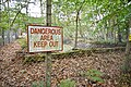 Mereworth Wood Ammunition Depot (49901988821).jpg 6,000 × 4,000; 29.39 MB
-
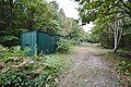 Mereworth Wood Ammunition Depot (49902000446).jpg 6,000 × 4,000; 9.27 MB
-
 Mereworth Wood Ammunition Depot (49902017496).jpg 6,000 × 4,000; 8.14 MB
-
 Mereworth Wood Ammunition Depot (49902033981).jpg 5,576 × 3,717; 7.12 MB
-
 Mereworth Wood Ammunition Depot (49902040096).jpg 6,000 × 4,000; 7.72 MB
-
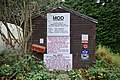 Mereworth Wood Ammunition Depot (49902292297).jpg 5,901 × 3,934; 25.79 MB
-
 Mereworth Wood Ammunition Depot (49902293877).jpg 6,000 × 4,000; 27.16 MB
-
 Mereworth Wood Ammunition Depot (49902294752).jpg 6,000 × 4,000; 8.46 MB
-
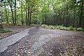 Mereworth Wood Ammunition Depot (49902306882).jpg 5,861 × 3,907; 9.92 MB


.jpg)
.jpg)
.jpg)
.jpg)
.jpg)
.jpg)
.jpg)
.jpg)
.jpg)
.jpg)
.jpg)
.jpg)
.jpg)
.jpg)
.jpg)
.jpg)
.jpg)
.jpg)
.jpg)
.jpg)