Category:Metacomet Trail
Blue-Blazed hiking trial that traverses the Metacomet Ridge of central Connecticut  | |||||
| Upload media | |||||
| Instance of | |||||
|---|---|---|---|---|---|
| Location | Connecticut | ||||
| Length |
| ||||
| Highest point |
| ||||
 | |||||
Subcategories
This category has the following 3 subcategories, out of 3 total.
Media in category "Metacomet Trail"
The following 7 files are in this category, out of 7 total.
-
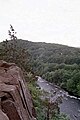 Farmingtonriver gorge.jpg 512 × 768; 39 KB
-
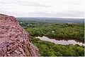
 Metacomet Trail 1.jpg 2,592 × 3,888; 1.75 MB
-
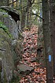 Metacomet Trail near Rattlesnake Mountain, October 24, 2007.jpg 1,600 × 2,400; 704 KB
-
 Prickly Pear CT Traprock.jpg 881 × 597; 630 KB
-
 Ragged Mountain CT.jpg 450 × 300; 19 KB
-
 South Mountain.jpg 817 × 571; 380 KB
-
 Will Warren's Den, bottom entrance.jpg 3,627 × 2,592; 2.23 MB


