Category:Metropolitana di Roma linea C - Pigneto
| Object location | | View all coordinates using: OpenStreetMap |
|---|
Rome Metro station  Atrio della stazione .png) | |||||
| Upload media | |||||
| Instance of |
| ||||
|---|---|---|---|---|---|
| Location | Rome, Metropolitan City of Rome, Lazio, Italy | ||||
| Street address |
| ||||
| Transport network | |||||
| Owned by | |||||
| Operator | |||||
| Maintained by | |||||
| Date of official opening |
| ||||
| Connecting line | |||||
| Adjacent station | |||||
 | |||||
Media in category "Metropolitana di Roma linea C - Pigneto"
The following 2 files are in this category, out of 2 total.
-
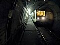 MC100 a Pigneto (metropolitana di Roma).jpg 4,000 × 3,000; 2.27 MB
-
 METRO C Roma Pigneto Atrio.JPG 6,000 × 3,376; 5.06 MB
.jpg)