Category:Micklefield
village and civil parish in West Yorkshire, UK | |||||
| Upload media | |||||
| Instance of | |||||
|---|---|---|---|---|---|
| Location | Leeds, West Yorkshire, Yorkshire and the Humber, England | ||||
 | |||||
English: Micklefield is a village and civil parish east of Leeds, West Yorkshire, England. It neighbours Garforth, Aberford and Brotherton and is close to the A1 Motorway. It is in the City of Leeds metropolitan borough. It has a population of 1,852.
Nederlands: Micklefield is een dorp (village) en civil parish in het bestuurlijke gebied City of Leeds, in het Engelse graafschap West Yorkshire. De civil parish telt
Subcategories
This category has the following 5 subcategories, out of 5 total.
Media in category "Micklefield"
The following 200 files are in this category, out of 285 total.
(previous page) (next page)-
 'Lower' Bragdale - geograph.org.uk - 3737606.jpg 1,024 × 768; 161 KB
-
 'Upper' Bragdale - geograph.org.uk - 3737589.jpg 1,024 × 768; 151 KB
-
 2000- Years Anglo Scottish Trade Route - geograph.org.uk - 4919996.jpg 1,200 × 799; 389 KB
-
 2000- Years Anglo Scottish Trade Route - geograph.org.uk - 4919998.jpg 1,200 × 799; 477 KB
-
 A brace of bus shelters - geograph.org.uk - 1910099.jpg 1,024 × 768; 105 KB
-
 A footpath to Micklefield - geograph.org.uk - 2267226.jpg 800 × 600; 222 KB
-
 A footpath to Micklefield - geograph.org.uk - 2267233.jpg 800 × 600; 251 KB
-
 A pair of winter trees, east of Warren Farm - geograph.org.uk - 3775635.jpg 1,024 × 768; 134 KB
-

-
 A1(M) - beware deer - geograph.org.uk - 2646805.jpg 640 × 428; 77 KB
-
 A1(M) - bridge near Micklefield - geograph.org.uk - 2646788.jpg 640 × 428; 77 KB
-
 A1(M) at Micklefield - geograph.org.uk - 2040827.jpg 640 × 480; 54 KB
-
 A1(M) near Micklefield - geograph.org.uk - 2040830.jpg 640 × 480; 43 KB
-
 A1(M) northbound - geograph.org.uk - 2646766.jpg 640 × 428; 73 KB
-
 A1(M) northbound - geograph.org.uk - 3035269.jpg 640 × 430; 38 KB
-
 A1(M) northbound - geograph.org.uk - 3035306.jpg 640 × 430; 34 KB
-
 A1(M), southbound - geograph.org.uk - 4806076.jpg 640 × 382; 20 KB
-
 About to drop in to Bragdale - geograph.org.uk - 3737569.jpg 1,024 × 768; 190 KB
-
 Access road and bridge over A1(M) to Micklefield - geograph.org.uk - 5333948.jpg 2,226 × 1,618; 1.39 MB
-
 Anonymous entrance to Sturton Grange Farm - geograph.org.uk - 3724317.jpg 1,600 × 1,200; 409 KB
-
 Bangla Takeaway, Micklefield - geograph.org.uk - 4442981.jpg 1,600 × 1,062; 1.07 MB
-
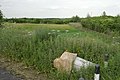
 Bare field south of Micklefield - geograph.org.uk - 6290508.jpg 1,024 × 768; 152 KB
-
 Bench at the south-east corner of Scott's Wood - geograph.org.uk - 3738354.jpg 1,024 × 768; 211 KB
-
 Bench near the A656 - geograph.org.uk - 4442677.jpg 1,600 × 1,062; 1.07 MB
-
 Benchmark on the railway bridge near Highroyds Wood - geograph.org.uk - 3163730.jpg 2,048 × 1,536; 600 KB
-
 Blands Arms Micklefield - geograph.org.uk - 5333943.jpg 2,304 × 1,728; 1.25 MB
-
 Bragdale - geograph.org.uk - 5920629.jpg 5,184 × 3,456; 6.33 MB
-
 Bragdale, looking east towards Coburnhill Wood - geograph.org.uk - 3164639.jpg 2,048 × 1,536; 628 KB
-
 Bragdale, looking west towards Hook Moor - geograph.org.uk - 3164631.jpg 2,048 × 1,536; 620 KB
-
 Bungalows on Churchville Terrace, Micklefield - geograph.org.uk - 4442809.jpg 1,600 × 1,062; 1.06 MB
-
 Central Store, Micklefield - geograph.org.uk - 6290485.jpg 1,024 × 768; 190 KB
-
 Church Lane entering Old Micklefield - geograph.org.uk - 1910098.jpg 1,024 × 768; 116 KB
-
 Churchyard hedgerow - geograph.org.uk - 1910038.jpg 1,024 × 768; 225 KB
-

-
-
 Churchyard tree - geograph.org.uk - 1910060.jpg 1,024 × 768; 196 KB
-
 Communications mast at Micklefield - geograph.org.uk - 4444089.jpg 1,600 × 1,062; 1.22 MB
-
 Cottage on Great North Road, Micklefield - geograph.org.uk - 5790452.jpg 1,024 × 768; 150 KB
-
 Cross paths in Scott's Wood - geograph.org.uk - 4093403.jpg 1,600 × 1,064; 853 KB
-
 Cutting by the A1(M) - geograph.org.uk - 4806077.jpg 640 × 388; 24 KB
-
 East View, New Micklefield - geograph.org.uk - 1910287.jpg 1,024 × 768; 158 KB
-
 Emerging crop, west of Hartly Wood - geograph.org.uk - 3777025.jpg 1,024 × 768; 199 KB
-
 Emerging crops, west of the footpath to Bragdale - geograph.org.uk - 3737531.jpg 1,024 × 768; 188 KB
-
 Entering Micklefield - geograph.org.uk - 3070160.jpg 800 × 600; 218 KB
-
 Entering Micklefield on Church Lane - geograph.org.uk - 2755144.jpg 640 × 480; 60 KB
-
 Enterprise Court, Pit Lane, Micklefield - geograph.org.uk - 3776357.jpg 1,024 × 768; 143 KB
-
 Entrance to Peckfield Quarry - geograph.org.uk - 3775654.jpg 1,024 × 768; 101 KB
-
 Farm bridge over the A1(M) near Mickleford - geograph.org.uk - 4443074.jpg 1,600 × 1,062; 910 KB
-
 Farm track and public footpath to Bragdale - geograph.org.uk - 3737558.jpg 1,024 × 614; 101 KB
-
 Farm track and public footpath, Micklefield - geograph.org.uk - 3737473.jpg 1,024 × 768; 119 KB
-
 Farm track going east from Hartly Wood cottages - geograph.org.uk - 3738441.jpg 1,024 × 768; 174 KB
-

-
 Farm track, southern boundary of Scott's Wood - geograph.org.uk - 3738362.jpg 1,024 × 768; 241 KB
-
 Farmland east of the footpath to Bragdale - geograph.org.uk - 3737539.jpg 1,024 × 768; 171 KB
-
 Farmland off the Great North Road - geograph.org.uk - 2755139.jpg 640 × 480; 44 KB
-
 Farmland on the west side of Sheep Dike - geograph.org.uk - 3776967.jpg 1,024 × 768; 159 KB
-
 Farmland south of Scott's Wood - geograph.org.uk - 3738374.jpg 1,024 × 768; 221 KB
-
 Farmland west of Lower Peckfield - Pit Lane - geograph.org.uk - 3775610.jpg 1,024 × 768; 193 KB
-
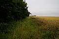
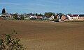
 Farmland west of Micklefield - geograph.org.uk - 6291338.jpg 1,024 × 768; 265 KB
-
 Farmland, Sunningdale - geograph.org.uk - 2755143.jpg 640 × 480; 50 KB
-
 Field and county boundary, north of Hartly Wood - geograph.org.uk - 3738458.jpg 1,024 × 768; 269 KB
-
 Field and county boundary, south of Scott's Wood - geograph.org.uk - 3738395.jpg 1,024 × 768; 194 KB
-
 Field track on the left of field to Old Micklefield - geograph.org.uk - 5334846.jpg 2,304 × 1,728; 1.37 MB
-
 Field track to Old Micklefield - geograph.org.uk - 4919289.jpg 4,000 × 3,000; 3.39 MB
-
 Field with buttercups - geograph.org.uk - 1910253.jpg 1,024 × 768; 188 KB
-
 Field with fenced footpath - geograph.org.uk - 1910250.jpg 1,024 × 768; 182 KB
-
 Finger post at Bragdale - geograph.org.uk - 4093471.jpg 1,600 × 1,064; 413 KB
-
 Finger post at Castle Hills - geograph.org.uk - 4443997.jpg 1,062 × 1,600; 966 KB
-
 Fingerpost in Ringhay Wood - geograph.org.uk - 4925966.jpg 1,200 × 799; 570 KB
-
 Fingerpost near Highroyds Wood - geograph.org.uk - 4443963.jpg 1,600 × 1,062; 1.14 MB
-
 Flush Bracket, Hook Moor Trigpoint - geograph.org.uk - 1933071.jpg 681 × 1,024; 195 KB
-
 Footbridge over the A1(M) - geograph.org.uk - 4793135.jpg 640 × 426; 26 KB
-
 Footbridge over the A1(M) - geograph.org.uk - 4806167.jpg 640 × 374; 21 KB
-

-
 Footbridge over the motorway at Micklefield - geograph.org.uk - 3164612.jpg 2,048 × 1,536; 574 KB
-
 Footbridge, A1(M) - geograph.org.uk - 3035273.jpg 640 × 430; 39 KB
-
 Footpath at Hartly Wood - geograph.org.uk - 4093292.jpg 1,600 × 1,064; 906 KB
-
 Footpath at Scott's Wood - geograph.org.uk - 4093397.jpg 1,600 × 1,064; 735 KB
-
 Footpath at Scotts Wood - geograph.org.uk - 4087728.jpg 1,600 × 1,064; 953 KB
-
 Footpath at Weet Wood - geograph.org.uk - 4093382.jpg 1,600 × 1,064; 617 KB
-
 Footpath bridge - geograph.org.uk - 1910258.jpg 1,024 × 768; 220 KB
-
 Footpath east of Micklefield - geograph.org.uk - 3737498.jpg 1,024 × 768; 150 KB
-
 Footpath in Coburnhill Wood - geograph.org.uk - 5920644.jpg 5,184 × 3,456; 4.46 MB
-
 Footpath in Hartly Wood - geograph.org.uk - 4443795.jpg 1,600 × 1,062; 1,014 KB
-
 Footpath leading to Coburnhill Wood - geograph.org.uk - 4087732.jpg 1,600 × 1,064; 947 KB
-
 Footpath level crossing in Highroyds Wood - geograph.org.uk - 3163711.jpg 2,048 × 1,536; 542 KB
-
 Footpath to Bragdale - geograph.org.uk - 4093455.jpg 1,600 × 1,064; 684 KB
-
 Footpath to Hartley Wood Cottages - geograph.org.uk - 4093294.jpg 1,600 × 1,064; 614 KB
-
 Footpath towards Hartly Wood - geograph.org.uk - 3164607.jpg 2,048 × 1,536; 564 KB
-
 Footpath towards Micklefield - geograph.org.uk - 3163702.jpg 2,048 × 1,536; 559 KB
-
 Footpath towards Micklefield - geograph.org.uk - 3724320.jpg 1,600 × 1,200; 715 KB
-
 Footpath towards Weet Wood - geograph.org.uk - 4093375.jpg 1,600 × 1,064; 555 KB
-
 Former entrance to Peckfield Colliery - geograph.org.uk - 3775619.jpg 1,024 × 768; 173 KB
-

-
 Gates to nowhere^ - geograph.org.uk - 1909970.jpg 1,024 × 768; 136 KB
-
 Geese in a field by Pit Lane - geograph.org.uk - 6291311.jpg 1,024 × 768; 185 KB
-
 Grassy area in the churchyard - geograph.org.uk - 1910053.jpg 1,024 × 768; 233 KB
-
 Great North Road - geograph.org.uk - 4614850.jpg 640 × 377; 42 KB
-
 Great North Road, Micklefield - geograph.org.uk - 4919999.jpg 1,200 × 799; 334 KB
-
 Hartley Wood Cottages - geograph.org.uk - 4093359.jpg 1,600 × 1,064; 595 KB
-
 Hedge on the north side of Peckfield Quarry road - geograph.org.uk - 3775656.jpg 1,024 × 768; 190 KB
-
 Hicks Memorial School, Micklefield - geograph.org.uk - 4919912.jpg 1,200 × 799; 413 KB
-
 Hook Moor - geograph.org.uk - 5920624.jpg 5,184 × 3,456; 7.69 MB
-
 Hook Moor Trigpoint - geograph.org.uk - 1933069.jpg 1,024 × 681; 209 KB
-
 Hook Moor Windfarm near Micklefield - geograph.org.uk - 4925950.jpg 1,200 × 799; 311 KB
-
 Hook Moor Windfarm near Micklefield - geograph.org.uk - 4925972.jpg 1,200 × 799; 302 KB
-
 Hook Moor Windfarm Substation - geograph.org.uk - 4925971.jpg 1,200 × 799; 301 KB
-
 Houses along Pit Lane (1) - geograph.org.uk - 3776345.jpg 1,024 × 768; 132 KB
-
 Houses by Peckfield crossing - geograph.org.uk - 6291336.jpg 1,024 × 768; 266 KB
-
 Houses on Churchville Drive, Micklefield - geograph.org.uk - 4919965.jpg 1,200 × 799; 446 KB
-
 Houses on Pit Lane - geograph.org.uk - 6291314.jpg 1,024 × 768; 164 KB
-
 Houses on The Great North Road, Micklefield - geograph.org.uk - 4443035.jpg 1,565 × 929; 500 KB
-
 Houses on The Great North Road, Micklefield - geograph.org.uk - 4919960.jpg 1,200 × 799; 354 KB
-
 Houses on West View, Micklefield - geograph.org.uk - 4441375.jpg 1,600 × 1,062; 868 KB
-
 Housing along Pit Lane - geograph.org.uk - 3776352.jpg 1,024 × 768; 146 KB
-
 Housing at Micklefield Station, road to station car park - geograph.org.uk - 5333939.jpg 2,300 × 1,724; 1.84 MB
-
 Hut by the side of the railway - geograph.org.uk - 4473807.jpg 3,264 × 2,448; 3.08 MB
-
 Junction of footpath and bridleway - geograph.org.uk - 1910267.jpg 1,024 × 768; 154 KB
-
 Kennels ^ Cattery near Micklefield - geograph.org.uk - 2267310.jpg 800 × 600; 248 KB
-
 Large fallen tree, Gunner Hill, Hartly Wood - geograph.org.uk - 3777008.jpg 1,024 × 768; 216 KB
-
 Large field west of Hartly Wood - geograph.org.uk - 3776944.jpg 1,024 × 768; 117 KB
-

-
 Looking south along Hartly Wood - geograph.org.uk - 3164604.jpg 2,048 × 1,536; 565 KB
-
 Looking south on the A656 - geograph.org.uk - 5334875.jpg 2,248 × 1,650; 1.81 MB
-
 M1 - geograph.org.uk - 3038387.jpg 640 × 467; 51 KB
-
 M1 southbound - geograph.org.uk - 2755138.jpg 640 × 480; 44 KB
-
 M1 west of Great North Road - geograph.org.uk - 5396393.jpg 640 × 480; 33 KB
-
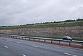 Magnesian Limestone by the A1(M) - geograph.org.uk - 3035295.jpg 640 × 430; 46 KB
-
 Marshy margins of a drainage pond on Sheep Dike - geograph.org.uk - 3776948.jpg 1,024 × 768; 128 KB
-
 Memorial in Micklefield churchyard - geograph.org.uk - 1910080.jpg 1,024 × 768; 225 KB
-
-
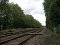
 Micklefield Junction - geograph.org.uk - 6290441.jpg 1,024 × 768; 188 KB
-
 Micklefield old fire station - geograph.org.uk - 1631733.jpg 640 × 427; 225 KB
-
 Micklefield Quarry SSSI - geograph.org.uk - 1910305.jpg 1,024 × 768; 138 KB
-
 Micklefield railway station, Yorkshire - geograph.org.uk - 3253814.jpg 1,024 × 731; 203 KB
-
 Micklefield Recreation Ground - geograph.org.uk - 6291343.jpg 1,024 × 768; 292 KB
-
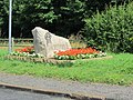
 Micklefield village sign - geograph.org.uk - 6290516.jpg 1,024 × 768; 247 KB
-
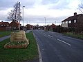
 Micklefield village sign on The Great North Road - geograph.org.uk - 4444079.jpg 1,600 × 1,105; 940 KB
-
 Micklefield village sign on The Great North Road - geograph.org.uk - 4444081.jpg 1,600 × 1,062; 808 KB
-
 Micklefield Youth and Adult Centre - geograph.org.uk - 808527.jpg 640 × 480; 75 KB
-
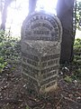
 Mileage Marker - geograph.org.uk - 4919969.jpg 1,200 × 820; 471 KB
-
 Milestone at SE431331.jpg 480 × 640; 335 KB
-
 Miners Mews, Pit Lane, Micklefield - geograph.org.uk - 3776383.jpg 1,024 × 768; 133 KB
-
 Modern housing, Great North Road, Micklefield - geograph.org.uk - 6290490.jpg 1,024 × 768; 144 KB
-
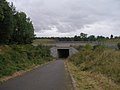 Motorway underpass at Castle Hills - geograph.org.uk - 3163708.jpg 2,048 × 1,536; 663 KB
-
 Near Micklefield - geograph.org.uk - 4614847.jpg 640 × 426; 49 KB
-
 New houses at the end of The Crescent - geograph.org.uk - 1910281.jpg 1,024 × 768; 141 KB
-

-
 New plantation at Hartly Wood Cottages - geograph.org.uk - 4093303.jpg 1,600 × 1,064; 672 KB
-
 New plantation, north-west of Peckfield Quarry - geograph.org.uk - 3776339.jpg 1,024 × 768; 124 KB
-
 New trees at Hartly Wood - geograph.org.uk - 4443791.jpg 1,600 × 1,062; 1.23 MB
-
 Newton Farm, Great North Road, Micklefield - geograph.org.uk - 6290499.jpg 1,024 × 768; 141 KB
-
 No bridge, no road, Micklefield - geograph.org.uk - 3737494.jpg 1,024 × 768; 210 KB
-
 No vehicles please on the public footpath - geograph.org.uk - 3776951.jpg 1,024 × 768; 144 KB
-
 Northern edge, Daniel Hartly's Wood - geograph.org.uk - 3738401.jpg 1,024 × 768; 202 KB
-
 Old Milestone by the A63, Great North Road (geograph 6035383).jpg 480 × 640; 340 KB
-
 Old quarry face - geograph.org.uk - 1910315.jpg 1,024 × 768; 175 KB
-
 One in the eye for the Gascoignes - geograph.org.uk - 5066668.jpg 1,024 × 767; 128 KB
-
 Path at Micklefield - geograph.org.uk - 4920000.jpg 1,200 × 799; 330 KB
-
-
 Path enters Peckfield Plantation near Mcklefield - geograph.org.uk - 4444093.jpg 1,600 × 1,062; 932 KB
-
 Path from Micklefield to the A656 - geograph.org.uk - 4442682.jpg 1,600 × 1,062; 1.19 MB
-
 Path from Micklefield to the A656 - geograph.org.uk - 4442684.jpg 1,600 × 1,062; 1.07 MB
-
 Path from Micklefield to the A656 - geograph.org.uk - 4442796.jpg 1,600 × 1,062; 1,021 KB
-
 Path heading north through Hartly Wood - geograph.org.uk - 3776985.jpg 768 × 1,024; 566 KB
-
 Path heading north towards Weet Wood - geograph.org.uk - 4087719.jpg 1,600 × 1,064; 430 KB
-
 Path heading west through Hartly Wood - geograph.org.uk - 3776988.jpg 1,024 × 768; 224 KB
-
 Path in Coburnhill Wood - geograph.org.uk - 4093408.jpg 1,600 × 1,064; 851 KB
-
 Path in Coburnhill Wood - geograph.org.uk - 4093449.jpg 1,600 × 1,064; 854 KB
-
 Path in Hartly Wood - geograph.org.uk - 4443797.jpg 1,600 × 1,062; 1.01 MB
-
 Path in Hartly Wood - geograph.org.uk - 4443799.jpg 1,600 × 1,062; 1.03 MB
-
 Path in Hartly Wood - geograph.org.uk - 4443802.jpg 1,600 × 1,062; 990 KB
-
 Path in Highroyds Wood - geograph.org.uk - 4443988.jpg 1,600 × 1,062; 1.03 MB
-
 Path in Highroyds Wood - geograph.org.uk - 4444002.jpg 1,600 × 1,062; 915 KB
-
 Path in Peckfield Plantation - geograph.org.uk - 4444096.jpg 1,600 × 1,062; 1.02 MB
-
 Path in Peckfield Plantation towards the A63 - geograph.org.uk - 4444104.jpg 1,600 × 1,062; 1.01 MB
-
 Path leading to Highroyds Wood - geograph.org.uk - 4443951.jpg 1,600 × 1,062; 947 KB
-
 Path leading to Hook Moor - geograph.org.uk - 4093463.jpg 1,600 × 1,064; 820 KB
-
 Path leading to Micklefield - geograph.org.uk - 4444047.jpg 1,600 × 1,062; 1.01 MB
-
 Path leading to Old Micklefield - geograph.org.uk - 4442797.jpg 1,600 × 1,062; 1.21 MB
-
 Path leading to Peckfield Plantation, Micklefield - geograph.org.uk - 4444085.jpg 1,600 × 1,062; 1.15 MB
-
 Path leading towards Hartly Wood - geograph.org.uk - 4443078.jpg 1,600 × 1,062; 909 KB
-
 Path to Bragdale - geograph.org.uk - 4093453.jpg 1,600 × 1,064; 543 KB
-
 Path to the northern boundary of Hartly Wood - geograph.org.uk - 3776991.jpg 1,024 × 768; 229 KB
-
 Path towards Lotherton - geograph.org.uk - 3164624.jpg 2,048 × 1,536; 610 KB
-
 Path towards Scott's Wood - geograph.org.uk - 4093387.jpg 1,600 × 1,064; 721 KB
-
 Path towards Scott's Wood - geograph.org.uk - 4093390.jpg 1,600 × 1,064; 697 KB
-
 Peckfield crossing - geograph.org.uk - 6291333.jpg 1,024 × 768; 365 KB
-
 Peckfield landfill site - geograph.org.uk - 6291296.jpg 1,024 × 768; 136 KB
-
 Pit Lane and Miners Mews, Micklefield - geograph.org.uk - 6290473.jpg 1,024 × 768; 186 KB
-
 Pit Lane, Micklefield - geograph.org.uk - 6291306.jpg 1,024 × 768; 368 KB
-
 Planting around Peckfill landfill site - geograph.org.uk - 6291305.jpg 1,024 × 768; 276 KB
-
 Playing Field at Micklefield School - geograph.org.uk - 4442837.jpg 1,600 × 1,062; 1.89 MB
-
 Pond off Pit Lane - geograph.org.uk - 6291317.jpg 1,024 × 768; 154 KB
-
 Pond to the east of Pit Lane - geograph.org.uk - 3776350.jpg 1,024 × 768; 149 KB
-
 Potato field off Church Lane - geograph.org.uk - 1910092.jpg 1,024 × 768; 178 KB
-
 Power lines near Old Micklefield - geograph.org.uk - 4442788.jpg 1,600 × 1,062; 919 KB
-
 Power Lines over field west of Old Micklefield - geograph.org.uk - 5334831.jpg 2,304 × 1,726; 1.35 MB
-
 Public bridleway and access track - geograph.org.uk - 3775596.jpg 1,024 × 768; 167 KB
-
 Public footpath and farm track to Bragdale - geograph.org.uk - 3737526.jpg 1,024 × 768; 138 KB


_-_beware_deer_-_geograph.org.uk_-_2646805.jpg)
_-_bridge_near_Micklefield_-_geograph.org.uk_-_2646788.jpg)
_at_Micklefield_-_geograph.org.uk_-_2040827.jpg)
_near_Micklefield_-_geograph.org.uk_-_2040830.jpg)
_northbound_-_geograph.org.uk_-_2646766.jpg)
_northbound_-_geograph.org.uk_-_3035269.jpg)
_northbound_-_geograph.org.uk_-_3035306.jpg)
,_southbound_-_geograph.org.uk_-_4806076.jpg)

_to_Micklefield_-_geograph.org.uk_-_5333948.jpg)


_-_geograph.org.uk_-_1910031.jpg)
_-_geograph.org.uk_-_1910046.jpg)


_-_geograph.org.uk_-_4806077.jpg)


_near_Mickleford_-_geograph.org.uk_-_4443074.jpg)


_-_geograph.org.uk_-_4793135.jpg)
_-_geograph.org.uk_-_4806167.jpg)
_near_Micklefield_-_geograph.org.uk_-_2515467.jpg)

_-_geograph.org.uk_-_3035273.jpg)


_-_geograph.org.uk_-_3776345.jpg)


_-_geograph.org.uk_-_3035295.jpg)


.jpg)


