Category:Mid-Western Highway
English: The Mid-Western Highway starts at Bathurst New South Wales, where it joins with the Great Western Highway over the Blue Mountains from Sydney. (→Mid-Western Highway)
Français : La Mid-Western Highway est un axe routier long de 522 km en Nouvelle-Galles du Sud en Australie. Orienté est-ouest, elle commence à Bathurst par un embranchement de la Great Western Highway. Elle traverse Blayney, Carcoar, Cowra et Grenfell. A Wyalong West, elle croise la Newell Highway et continue vers l'ouest par Rankins Springs pour s'achever à Hay où elle rejoint la Sturt Highway. (→Mid-Western Highway)
highway in New South Wales  | |||||
| Upload media | |||||
| Instance of | |||||
|---|---|---|---|---|---|
| Location | New South Wales, AUS | ||||
| Inception |
| ||||
| Length |
| ||||
| |||||
Subcategories
This category has the following 4 subcategories, out of 4 total.
Media in category "Mid-Western Highway"
The following 37 files are in this category, out of 37 total.
-
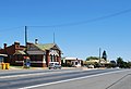
 Blayney Mid-Western Highway 001.JPG 3,576 × 2,376; 3.23 MB
-
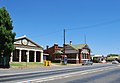
 Blayney Mid-Western Highway 002.JPG 3,872 × 2,592; 3.39 MB
-
 BlayneyStreetscape.jpg 2,627 × 1,367; 778 KB
-
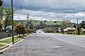
 BlayneyValley.jpg 2,816 × 2,112; 1.06 MB
-
 Caragabal Mid Western Highway Sign.JPG 6,016 × 4,000; 12.37 MB
-
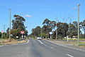 Caragabal Rail Crossing 001.JPG 5,672 × 3,792; 8.29 MB
-
 Caragabal Rail Crossing 002.JPG 6,016 × 4,000; 9.63 MB
-
 Caragabal Town Entry Sign 001.JPG 6,016 × 4,000; 9.97 MB
-
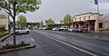
 CowraMainStreet.JPG 3,872 × 2,592; 2.37 MB
-
 Former NAB bank in Mandurama.jpg 2,000 × 1,333; 2.38 MB
-
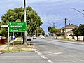
 Goolgowi Mid-Western Highway.JPG 3,872 × 2,592; 3.99 MB
-
 Goolgowi Rail Crossing & Roundabout.JPG 3,700 × 2,352; 3.34 MB
-
 Looking down the Mid-Western Highway in Mandurama 01.jpg 2,000 × 1,333; 2.78 MB
-
 Looking down the Mid-Western Highway in Mandurama 02.jpg 2,000 × 1,333; 2.71 MB
-
 Looking down the Mid-Western Highway in Mandurama 03.jpg 2,000 × 1,333; 2.49 MB
-
 Looking down the Mid-Western Highway in Mandurama.jpg 2,000 × 1,333; 3.12 MB
-
 Mandurama Mid-Western Highway 002.JPG 3,872 × 2,592; 3.95 MB
-
 Mandurama Mid-Western Highway Sign.JPG 3,720 × 2,532; 3.76 MB
-
 Mandurama Mid-Western Highway.JPG 3,872 × 2,592; 4.11 MB
-
 Mandurama Old Bank 001.JPG 3,564 × 2,408; 3.25 MB
-
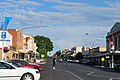
 Mid-Western Highway and the main street of Hay, NSW, 2022.jpg 3,698 × 2,774; 3.94 MB
-
 Old group of shops in Mandurama.jpg 2,000 × 1,333; 2.44 MB
-
 Rankins Springs Mid Western Highway Sign.JPG 3,872 × 2,592; 4.03 MB
-
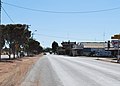
 Rankins Springs Mid Western Highway.JPG 3,632 × 2,432; 3.35 MB
-
 Refuge island and bollard located on the Mid-Western Highway in Mandurama.jpg 1,333 × 2,000; 2.68 MB
-
 Weethalle Mid-Western Highway 001.JPG 3,492 × 2,504; 3 MB
-
 Weethalle Mid-Western Highway 002.JPG 3,464 × 2,452; 3.3 MB
-
 Weethalle Mid-Western Highway 003.JPG 3,872 × 2,592; 4.01 MB
-
 Weethalle Mid-Western Highway Signs.JPG 3,872 × 2,592; 4.11 MB
-
 West Wyalong Banner.jpg 3,720 × 532; 987 KB
-
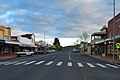
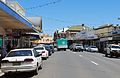 West Wyalong Main Street 001.JPG 3,768 × 2,452; 3.41 MB
-
 West Wyalong Main Street 002.JPG 3,628 × 2,512; 3.38 MB
-
 West Wyalong Main Street 003.JPG 3,720 × 2,540; 3.16 MB
-
 West Wyalong Main Street 004.JPG 3,568 × 2,296; 3.11 MB
-
 Wyalong Neeld Street.JPG 3,484 × 2,368; 2.84 MB
-
 Wyalong Newell Highway Mid-Western Highway.JPG 3,484 × 2,416; 3.32 MB
-
 WyalongTopTownTavern.JPG 2,272 × 1,704; 779 KB


