Category:Middleton, Suffolk
English: Middleton is a village in Suffolk, England. It is located approximately four miles east north east of Saxmundham. The village is on the B1122 east of Yoxford.

village and civil parish in Suffolk, UK  | |||||
| Upload media | |||||
| Instance of | |||||
|---|---|---|---|---|---|
| Location |
| ||||
 | |||||
Subcategories
This category has the following 6 subcategories, out of 6 total.
Media in category "Middleton, Suffolk"
The following 200 files are in this category, out of 288 total.
(previous page) (next page)-
 Ambleside sign - geograph.org.uk - 2491221.jpg 3,072 × 2,304; 1.54 MB
-

-
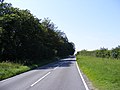
 B1122 (Leiston Road) by Annesons Corner - geograph.org.uk - 2555756.jpg 640 × 480; 243 KB
-
 B1122 Leiston Road - geograph.org.uk - 2491133.jpg 3,072 × 2,304; 1.5 MB
-
 B1122 Leiston Road ^ footpath to Pretty Road - geograph.org.uk - 2491126.jpg 3,072 × 2,304; 1.44 MB
-
 B1122 looking towards Yoxford - geograph.org.uk - 2491149.jpg 3,072 × 2,304; 1.32 MB
-
 B1122 towards Yoxford - geograph.org.uk - 5156386.jpg 640 × 480; 73 KB
-
 B1122 Yoxford Road - geograph.org.uk - 2018950.jpg 3,072 × 2,304; 1.27 MB
-
 B1122 Yoxford Road - geograph.org.uk - 2018953.jpg 3,072 × 2,304; 1.24 MB
-
 B1122 Yoxford Road - geograph.org.uk - 2021584.jpg 3,072 × 2,304; 1.38 MB
-
 B1122 Yoxford Road - geograph.org.uk - 2021587.jpg 3,072 × 2,304; 1.35 MB
-
 B1122 Yoxford Road - geograph.org.uk - 2491114.jpg 3,072 × 2,304; 1.37 MB
-
 B1122 Yoxford Road - geograph.org.uk - 2491119.jpg 3,072 × 2,304; 1.42 MB
-
 B1122 Yoxford Road ^ footpath - geograph.org.uk - 3523982.jpg 3,072 × 2,304; 1.3 MB
-

-
 B1122 Yoxford Road, Middleton Moor - geograph.org.uk - 1035762.jpg 3,072 × 2,304; 1.45 MB
-
 B1122 Yoxford Road, Middleton Moor - geograph.org.uk - 1035764.jpg 3,072 × 2,304; 1.4 MB
-
 B1125 junction with B1122 - geograph.org.uk - 3576076.jpg 3,516 × 2,383; 1.27 MB
-
 B1125 Leiston Road - geograph.org.uk - 2491145.jpg 3,072 × 2,304; 1.39 MB
-
 B1125 Leiston Road - geograph.org.uk - 2491163.jpg 2,304 × 3,072; 1.43 MB
-
 B1125 Leiston Road - geograph.org.uk - 2491165.jpg 2,304 × 3,072; 1.31 MB
-
 B1125 Leiston Road - geograph.org.uk - 2491230.jpg 3,072 × 2,304; 1.5 MB
-
 B1125 Leiston Road - geograph.org.uk - 2491251.jpg 3,072 × 2,304; 1.36 MB
-
 B1125 Leiston Road - geograph.org.uk - 2491263.jpg 3,072 × 2,304; 1.37 MB
-
 B1125 Leiston Road - geograph.org.uk - 2491269.jpg 3,072 × 2,304; 1.51 MB
-
 B1125 Leiston Road - geograph.org.uk - 3382893.jpg 3,072 × 2,304; 1.47 MB
-
 B1125 Reckford Road - geograph.org.uk - 3382876.jpg 3,072 × 2,304; 1.4 MB
-
 B1125 to Theberton - geograph.org.uk - 3409671.jpg 640 × 480; 62 KB
-
 Back Road Sign - geograph.org.uk - 2018795.jpg 3,072 × 2,304; 1.46 MB
-
 Back Road sign - geograph.org.uk - 2490750.jpg 3,072 × 2,304; 1.44 MB
-
 Back Road ^ Post Office Middleton Postbox - geograph.org.uk - 2018766.jpg 3,072 × 2,304; 1.43 MB
-
 Back Road, Middleton - geograph.org.uk - 2018789.jpg 3,072 × 2,304; 1.66 MB
-
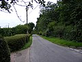 Back Road, Middleton - geograph.org.uk - 2018794.jpg 3,072 × 2,304; 1.44 MB
-
 Barn at Fordley Hall - geograph.org.uk - 2020777.jpg 3,072 × 2,304; 1.37 MB
-
 Barn at Hawthorn Farm - geograph.org.uk - 2060969.jpg 3,072 × 2,304; 1.26 MB
-
 Bend in Leiston Road (B1122) - geograph.org.uk - 5156378.jpg 640 × 480; 60 KB
-

-
 Claas 450 Dominator Combine - geograph.org.uk - 4589450.jpg 1,024 × 767; 240 KB
-
 Close up, Victorian postbox, Annesons Corner - geograph.org.uk - 5158370.jpg 1,151 × 2,428; 573 KB
-
 Cottage by the churchyard, Middleton - geograph.org.uk - 2555167.jpg 640 × 480; 233 KB
-
 Dead Oak - geograph.org.uk - 2280618.jpg 760 × 570; 177 KB
-

-

-
 Entering Middleton on B1125 Reckford Road - geograph.org.uk - 3382891.jpg 3,072 × 2,304; 1.43 MB
-
 Entrance to Ambleside ^ Fenn Farm - geograph.org.uk - 2491215.jpg 3,072 × 2,304; 1.65 MB
-
 Entrance to Vale Farm - geograph.org.uk - 3523940.jpg 3,072 × 2,304; 1.69 MB
-
 Farm building, Fordley Hall - geograph.org.uk - 5157873.jpg 640 × 480; 60 KB
-
 Farm Buildings at Vale Farm - geograph.org.uk - 3523946.jpg 3,072 × 2,304; 1.43 MB
-
 Farm buildings, Hawthorn Farm - geograph.org.uk - 5157854.jpg 640 × 480; 63 KB
-
 Farm house, Middleton Moor - geograph.org.uk - 2895764.jpg 1,600 × 944; 389 KB
-
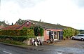 Farm shop. Reckford Farm - geograph.org.uk - 5156165.jpg 640 × 413; 53 KB
-
 Farm track (footpath), Annesons Corner - geograph.org.uk - 5158376.jpg 640 × 416; 113 KB
-
 Farm track off Fordley Road - geograph.org.uk - 5157870.jpg 640 × 480; 70 KB
-

-
 Farmland near Hawthorn Farm - geograph.org.uk - 5157856.jpg 640 × 480; 85 KB
-
 Farmland towards New Forest - geograph.org.uk - 5157877.jpg 640 × 480; 58 KB
-
 Fenn Farm sign - geograph.org.uk - 2491225.jpg 3,072 × 2,304; 1.53 MB
-
 Fiat 450 - geograph.org.uk - 4589439.jpg 1,024 × 768; 275 KB
-
 Field east of Hawthorn Road - geograph.org.uk - 5157849.jpg 640 × 480; 95 KB
-
 Field entrance at Vale Farm, North Green - geograph.org.uk - 2280669.jpg 760 × 570; 180 KB
-
 Field entrance off Fordley Road - geograph.org.uk - 3523941.jpg 3,072 × 2,304; 1.36 MB
-
 Field entrance off Fordley Road - geograph.org.uk - 3523954.jpg 3,072 × 2,304; 1.27 MB
-
 Field entrance off Fordley Road - geograph.org.uk - 3523988.jpg 3,072 × 2,304; 1.38 MB
-
 Field Entrance off Littlemoor Road - geograph.org.uk - 2020749.jpg 3,072 × 2,304; 1.44 MB
-
 Field entrance off the B1122-B1125 road junction - geograph.org.uk - 2491151.jpg 3,072 × 2,304; 1.45 MB
-
 Field Entrance on Fordley Road - geograph.org.uk - 2282179.jpg 3,072 × 2,304; 1.28 MB
-
 Field margin off Leiston Road - geograph.org.uk - 5156380.jpg 640 × 480; 76 KB
-
 Field near Vale Farm - geograph.org.uk - 5157872.jpg 640 × 480; 58 KB
-
 Field towards Plumtreehills Covert - geograph.org.uk - 5156383.jpg 640 × 480; 66 KB
-
 Field, Middleton - geograph.org.uk - 5156158.jpg 640 × 480; 63 KB
-
 Fletchers Lane, Middleton - geograph.org.uk - 2018780.jpg 3,072 × 2,304; 1.51 MB
-
 Flint and brick cottage in Middleton - geograph.org.uk - 2555154.jpg 640 × 586; 196 KB
-
 Footbridge on the footpath to Hawthorn Road - geograph.org.uk - 2517344.jpg 2,304 × 3,072; 1.64 MB
-
 Footpath - geograph.org.uk - 4589426.jpg 1,024 × 768; 179 KB
-
 Footpath across wheat field - geograph.org.uk - 5841973.jpg 1,280 × 1,280; 1.03 MB
-
 Footpath And Farm Drive - geograph.org.uk - 4589416.jpg 1,024 × 768; 245 KB
-
 Footpath And Sign - geograph.org.uk - 4589422.jpg 1,024 × 768; 255 KB
-
 Footpath off Hawthorn Road - geograph.org.uk - 5157858.jpg 640 × 480; 117 KB
-
 Footpath off Mill Street,Middleton - geograph.org.uk - 1726369.jpg 2,304 × 3,072; 1.43 MB
-
 Footpath off the B1122 Yoxford Road - geograph.org.uk - 3523983.jpg 3,072 × 2,304; 1.3 MB
-
 Footpath Sign - geograph.org.uk - 4589459.jpg 768 × 1,024; 334 KB
-
 Footpath to B1122 Yoxford Road - geograph.org.uk - 2489993.jpg 3,072 × 2,304; 1.42 MB
-
 Footpath to Dam Bridge - geograph.org.uk - 3382867.jpg 2,304 × 3,072; 1.52 MB
-
 Footpath to Dam Bridge - geograph.org.uk - 3382900.jpg 3,072 × 2,304; 1.68 MB
-
 Footpath to East Green - geograph.org.uk - 2282365.jpg 3,072 × 2,304; 1.62 MB
-
 Footpath to Fenstreet Road - geograph.org.uk - 2491283.jpg 2,304 × 3,072; 1.49 MB
-
 Footpath to Fenstreet Road - geograph.org.uk - 2491307.jpg 2,304 × 3,072; 1.51 MB
-
 Footpath to Hawthorn Road - geograph.org.uk - 2060931.jpg 2,304 × 3,072; 1.64 MB
-
 Footpath to Hawthorn Road - geograph.org.uk - 2060957.jpg 2,304 × 3,072; 1.64 MB
-
 Footpath to Hawthorn Road - geograph.org.uk - 2517335.jpg 2,304 × 3,072; 1.66 MB
-
 Footpath to Hawthorn Road - geograph.org.uk - 2517336.jpg 2,304 × 3,072; 1.66 MB
-
 Footpath to Hawthorn Road - geograph.org.uk - 2517345.jpg 2,304 × 3,072; 1.35 MB
-
 Footpath to Hawthorn Road - geograph.org.uk - 2517347.jpg 3,072 × 2,304; 1.34 MB
-
 Footpath to Hawthorn Road - geograph.org.uk - 2517348.jpg 2,304 × 3,072; 1.65 MB
-
 Footpath to Hawthorn ^ Trust Farms - geograph.org.uk - 2060945.jpg 2,304 × 3,072; 1.65 MB
-
 Footpath to Hawthorn ^ Trust Farms - geograph.org.uk - 2060946.jpg 3,072 × 2,304; 1.5 MB
-
 Footpath to Leiston Road - geograph.org.uk - 2491171.jpg 3,072 × 2,304; 1.51 MB
-
 Footpath to Leiston Road - geograph.org.uk - 2491172.jpg 3,072 × 2,304; 1.37 MB
-
 Footpath to Leiston Road - geograph.org.uk - 2491173.jpg 2,304 × 3,072; 1.62 MB
-
 Footpath to Mill Street - geograph.org.uk - 2490715.jpg 3,072 × 2,304; 1.62 MB
-
 Footpath to Mill Street - geograph.org.uk - 2490716.jpg 2,304 × 3,072; 1.41 MB
-
 Footpath to Moor Road - geograph.org.uk - 2490162.jpg 3,072 × 2,304; 1.51 MB
-
 Footpath to Moor Road - geograph.org.uk - 2490164.jpg 3,072 × 2,304; 1.37 MB
-
 Footpath to Moor Road - geograph.org.uk - 2491312.jpg 3,072 × 2,304; 1.47 MB
-
 Footpath to Moor Road - geograph.org.uk - 2491313.jpg 3,072 × 2,304; 1.62 MB
-
 Footpath to Pretty Road - geograph.org.uk - 2491128.jpg 3,072 × 2,304; 1.68 MB
-
 Footpath to Pretty Road - geograph.org.uk - 2491129.jpg 3,072 × 2,304; 1.47 MB
-
 Footpath to Pretty Road - geograph.org.uk - 2491131.jpg 3,072 × 2,304; 1.45 MB
-
 Footpath to Pretty Road - geograph.org.uk - 2491143.jpg 3,072 × 2,304; 1.52 MB
-
 Footpath to Pretty Road ^ entrance to Dovehouse Farm - geograph.org.uk - 2516462.jpg 3,072 × 2,304; 1.47 MB
-
 Footpath to Pretty Road ^ Entrance to Dovehouse Farm - geograph.org.uk - 2516464.jpg 2,304 × 3,072; 1.36 MB
-
 Footpath to Pretty Road ^ entrance to Dovehouse Farmr - geograph.org.uk - 2516481.jpg 3,072 × 2,304; 1.28 MB
-
 Footpath to the A12 Main Road - geograph.org.uk - 2020728.jpg 3,072 × 2,304; 1.45 MB
-
 Footpath to the A12 Main Road - geograph.org.uk - 2282370.jpg 3,072 × 2,304; 1.37 MB
-
 Footpath to the B1122 Yorford Road - geograph.org.uk - 2489997.jpg 2,304 × 3,072; 1.38 MB
-
 Footpath to the B1122 Yoxford Road - geograph.org.uk - 2489998.jpg 3,072 × 2,304; 1.44 MB
-
 Footpath to the Causeway - geograph.org.uk - 2490011.jpg 3,072 × 2,304; 1.42 MB
-
 Footpath to the Causeway - geograph.org.uk - 2490014.jpg 3,072 × 2,304; 1.48 MB
-
 Footpath to the Causeway - geograph.org.uk - 2490017.jpg 3,072 × 2,304; 1.43 MB
-
 Footpath to The Wash ^ Leiston Road - geograph.org.uk - 2491082.jpg 3,072 × 2,304; 1.63 MB
-
 Footpath to The Wash ^ Leiston Road - geograph.org.uk - 2491083.jpg 2,304 × 3,072; 1.52 MB
-
 Footpath to The Wash ^ Rubblestone Farm - geograph.org.uk - 2491104.jpg 3,072 × 2,304; 1.35 MB
-
 Footpath to The Wash ^ Title Road - geograph.org.uk - 2491185.jpg 3,072 × 2,304; 1.63 MB
-
 Footpath to The Wash ^ Title Road - geograph.org.uk - 2491189.jpg 3,072 × 2,304; 1.67 MB
-
 Footpath to The Wash ^ Title Road - geograph.org.uk - 2491191.jpg 2,304 × 3,072; 1.65 MB
-
 Footpath to Title Road - geograph.org.uk - 2491244.jpg 3,072 × 2,304; 1.62 MB
-
 Footpath to Title Road - geograph.org.uk - 2491249.jpg 2,304 × 3,072; 1.62 MB
-
 Footpath to Trust Farm - geograph.org.uk - 5157863.jpg 640 × 480; 64 KB
-
 Footpath to Wash Lane ^ Rubblestone Farm - geograph.org.uk - 2491107.jpg 3,072 × 2,304; 1.36 MB
-
 Footpath to Watermill Farm - geograph.org.uk - 2490738.jpg 3,072 × 2,304; 1.61 MB
-
 Footpath to Watermill Farm ^ The Causeway - geograph.org.uk - 2490054.jpg 3,072 × 2,304; 1.6 MB
-
 Footpath to Watermill Farm ^ The Causeway - geograph.org.uk - 2490075.jpg 3,072 × 2,304; 1.45 MB
-
 Footpaths - geograph.org.uk - 4589476.jpg 1,024 × 768; 182 KB
-
 Footpaths to Moor Road ^ Mill Street - geograph.org.uk - 2490158.jpg 3,072 × 2,304; 1.59 MB
-

-
 Fordley Road - geograph.org.uk - 1035740.jpg 3,072 × 2,304; 1.54 MB
-
 Fordley Road - geograph.org.uk - 2020781.jpg 3,072 × 2,304; 1.43 MB
-
 Fordley Road - geograph.org.uk - 2020785.jpg 3,072 × 2,304; 1.35 MB
-
 Fordley Road - geograph.org.uk - 2282191.jpg 3,072 × 2,304; 1.33 MB
-
 Fordley Road - geograph.org.uk - 2282193.jpg 3,072 × 2,304; 1.3 MB
-
 Fordley Road - geograph.org.uk - 4589456.jpg 1,024 × 768; 325 KB
-
 Fordley Road - geograph.org.uk - 5157867.jpg 640 × 480; 105 KB
-
 Fordley Road - geograph.org.uk - 5157878.jpg 640 × 480; 99 KB
-
 Fordley Road, Middleton - geograph.org.uk - 2282401.jpg 3,072 × 2,304; 1.39 MB
-
 Fordley Road, Middleton - geograph.org.uk - 2282404.jpg 3,072 × 2,304; 1.44 MB
-
 Fordley Road, Middleton - geograph.org.uk - 3523909.jpg 3,072 × 2,304; 1.45 MB
-
 Fordley Road, Middleton - geograph.org.uk - 3523972.jpg 3,072 × 2,304; 1.18 MB
-
 Fordley Road, Middleton - geograph.org.uk - 3524021.jpg 3,072 × 2,304; 1.38 MB
-
 Fordley Road, Middleton - geograph.org.uk - 3524043.jpg 3,072 × 2,304; 1.51 MB
-
 Gate to field - geograph.org.uk - 432321.jpg 640 × 481; 122 KB
-
 Gate, signpost and footpath. - geograph.org.uk - 517452.jpg 640 × 480; 159 KB
-
 George V Post Office Postbox - geograph.org.uk - 2018767.jpg 2,304 × 3,072; 1.45 MB
-
 Golden Acres - geograph.org.uk - 5157859.jpg 640 × 480; 66 KB
-
 Harvested Field - geograph.org.uk - 4589432.jpg 1,024 × 768; 195 KB
-
 Hawthorn Cottages sign - geograph.org.uk - 2516511.jpg 2,304 × 3,072; 1.44 MB
-
 Hawthorn Farm - geograph.org.uk - 5157853.jpg 640 × 480; 57 KB
-
 Hawthorn Farm Buildings - geograph.org.uk - 2060967.jpg 3,072 × 2,304; 1.4 MB
-
 Hawthorn Farm Buildings - geograph.org.uk - 2060973.jpg 3,072 × 2,304; 1.3 MB
-
 Hawthorn Farm Sign - geograph.org.uk - 2060972.jpg 3,072 × 2,304; 1.58 MB
-
 Hawthorn Road - geograph.org.uk - 2060877.jpg 3,072 × 2,304; 1.48 MB
-
 Hawthorn Road - geograph.org.uk - 2060882.jpg 3,072 × 2,304; 1.45 MB
-
 Hawthorn Road - geograph.org.uk - 2060949.jpg 3,072 × 2,304; 1.69 MB
-
 Hawthorn Road - geograph.org.uk - 2060959.jpg 2,304 × 3,072; 1.69 MB
-
 Hawthorn Road - geograph.org.uk - 5157848.jpg 640 × 480; 109 KB
-
 Hawthorn Road - geograph.org.uk - 5157850.jpg 640 × 480; 86 KB
-
 Hawthorn Road ^ the footpath to Hawthorn Road - geograph.org.uk - 2516517.jpg 3,072 × 2,304; 1.68 MB
-
 Hawthorn Road, Middleton - geograph.org.uk - 1440763.jpg 3,072 × 2,304; 1.48 MB
-
 Hawthorn Road, Middleton - geograph.org.uk - 2516491.jpg 2,304 × 3,072; 1.41 MB
-
 Hawthorn Road, Middleton - geograph.org.uk - 2516495.jpg 2,304 × 3,072; 1.39 MB
-
 Hawthorn Road, Middleton - geograph.org.uk - 2516525.jpg 2,304 × 3,072; 1.66 MB
-
 Hawthorn Road, Middleton ^ footpath to Hawthorn Road - geograph.org.uk - 2517331.jpg 2,304 × 3,072; 1.65 MB
-
 Junction of B1125 with B1122 - geograph.org.uk - 4066606.jpg 1,536 × 1,147; 1.09 MB
-
 Junction on B1125 for Middleton - geograph.org.uk - 4063549.jpg 1,536 × 1,153; 1.25 MB
-

-
 Leading to footpath to Church Road - geograph.org.uk - 2491240.jpg 3,072 × 2,304; 1.62 MB
-
 Leiston Road (B1125) - geograph.org.uk - 5156369.jpg 640 × 480; 74 KB
-
 Leiston Road west of Fenn Farm - geograph.org.uk - 3575907.jpg 3,240 × 2,306; 1.31 MB
-
 Leiston Road, Middleton - geograph.org.uk - 4033693.jpg 3,648 × 2,736; 3.15 MB
-
 Level Crossing - geograph.org.uk - 3372587.jpg 640 × 480; 131 KB
-
 Littlemoor Road - geograph.org.uk - 2020724.jpg 3,072 × 2,304; 1.63 MB
-
 Littlemoor Road - geograph.org.uk - 2020770.jpg 3,072 × 2,304; 1.34 MB
-
 Littlemoor Road, Middleton - geograph.org.uk - 2020732.jpg 3,072 × 2,304; 1.54 MB
-
 Littlemoor Road, Middleton - geograph.org.uk - 2020736.jpg 2,304 × 3,072; 1.63 MB
-
 Littlemoor Road, Middleton - geograph.org.uk - 2020755.jpg 3,072 × 2,304; 1.47 MB
-
 Littlemoor Road, Middleton Moor - geograph.org.uk - 2020710.jpg 3,072 × 2,304; 1.28 MB
-
 Littlemoor Road, Middleton Moor - geograph.org.uk - 2020712.jpg 3,072 × 2,304; 1.25 MB
-

-
 Middleton Road, B1122 - geograph.org.uk - 4166595.jpg 640 × 480; 122 KB
-
 Middleton Village - geograph.org.uk - 1441633.jpg 1,707 × 2,297; 955 KB
-
 Middleton Village Pump - geograph.org.uk - 1440877.jpg 3,072 × 2,304; 1.61 MB
-
 Middleton, benches outside The Bell Inn - geograph.org.uk - 5783560.jpg 1,024 × 682; 907 KB
-
 Middleton, churchyard sheep - geograph.org.uk - 5783421.jpg 819 × 1,024; 1.25 MB
-
 Middleton, cottages on The Street - geograph.org.uk - 5783414.jpg 1,024 × 731; 933 KB
-
 Middleton, Rectory Road - geograph.org.uk - 5783545.jpg 1,024 × 731; 961 KB
-
 Middleton, the corner of Rectory Road - geograph.org.uk - 5783381.jpg 1,024 × 731; 1 MB
-
 Mill Street sign - geograph.org.uk - 2491291.jpg 3,072 × 2,304; 1.6 MB
-
 Minsmere New Cut - geograph.org.uk - 3382865.jpg 2,304 × 3,072; 1.66 MB
-
 Minsmere New Cut ^ footpath to Dam Bridge - geograph.org.uk - 3382872.jpg 3,072 × 2,304; 1.68 MB
-
 Minsmere River, Middleton - geograph.org.uk - 177799.jpg 640 × 480; 135 KB
-
 Moor Road - geograph.org.uk - 2490030.jpg 3,072 × 2,304; 1.45 MB


_by_Annesons_Corner_-_geograph.org.uk_-_2555756.jpg)


_-_geograph.org.uk_-_5156378.jpg)


,_Annesons_Corner_-_geograph.org.uk_-_5158376.jpg)


_-_geograph.org.uk_-_5156369.jpg)


