Category:Middleton Cheney
village and civil parish in Northamptonshire, United Kingdom  | |||||
| Upload media | |||||
| Instance of | |||||
|---|---|---|---|---|---|
| Location | West Northamptonshire, Northamptonshire, East Midlands, England | ||||
| Population |
| ||||
| Area |
| ||||
| official website | |||||
 | |||||
Subcategories
This category has the following 2 subcategories, out of 2 total.
M
Media in category "Middleton Cheney"
The following 71 files are in this category, out of 71 total.
-

-
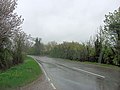
 A422 at east end of By pass - geograph.org.uk - 2742759.jpg 640 × 477; 69 KB
-

-
 A422 east nearing Purston Crossroads - geograph.org.uk - 2742764.jpg 640 × 401; 87 KB
-
 A422, Middleton Cheney - geograph.org.uk - 6166377.jpg 1,024 × 720; 186 KB
-
 Approach to Middleton Cheney - geograph.org.uk - 2400701.jpg 640 × 480; 63 KB
-
 B4525 passes Total Filling Station - geograph.org.uk - 3403902.jpg 3,648 × 2,736; 1.35 MB
-
 B4525 south of Chacoumbe Farm - geograph.org.uk - 3403923.jpg 3,580 × 2,624; 1.66 MB
-
 B4525 southeast of Chacombe Hill Farm - geograph.org.uk - 2926860.jpg 3,648 × 2,702; 1.27 MB
-
 B4525 west of Middleton Cheney - geograph.org.uk - 2926858.jpg 3,648 × 2,736; 1.98 MB
-
 B4525 west of Stanwell Farm - geograph.org.uk - 3403915.jpg 3,648 × 2,736; 1.84 MB
-
 Benchmark bracket on Middleton Cheney School - geograph.org.uk - 3473111.jpg 683 × 1,024; 315 KB
-

-

-
 Benchmark on Cottage ^1 - geograph.org.uk - 3473218.jpg 683 × 1,024; 134 KB
-
 Benchmark on Police House, ^30 Main Road - geograph.org.uk - 3473354.jpg 683 × 1,024; 198 KB
-
 Benchmark on renovated barn at Burgess Farm - geograph.org.uk - 3473371.jpg 683 × 1,024; 295 KB
-
 Benchmark on Stanwell Farm farmhouse - geograph.org.uk - 3427508.jpg 683 × 1,024; 261 KB
-
 Benchmark on ^46 Chacombe Road, 'Bob's Ground' - geograph.org.uk - 3473326.jpg 683 × 1,024; 257 KB
-
 Benchmark on ^8 Chacombe Road - geograph.org.uk - 3473292.jpg 683 × 1,024; 296 KB
-

-
 Crossing dismantled railway - geograph.org.uk - 2699899.jpg 640 × 480; 93 KB
-

-
 Crossroads Warkworth - geograph.org.uk - 118875.jpg 640 × 427; 89 KB
-
 Farmhouse at Stanwell Farm - geograph.org.uk - 3427518.jpg 1,024 × 683; 181 KB
-
 Farmland, Middleton Cheney - geograph.org.uk - 6166375.jpg 1,024 × 767; 236 KB
-
 Farthinghoe Recycling Centre - geograph.org.uk - 6295127.jpg 1,600 × 1,067; 508 KB
-
-

-

-
 Horton almshouses, Middleton Cheney - geograph.org.uk - 2400728.jpg 640 × 321; 35 KB
-
 Junction of footpath with bridleway track - geograph.org.uk - 3427549.jpg 683 × 1,024; 260 KB
-
 Junction of Glovers Lane and Chacombe Road - geograph.org.uk - 3429126.jpg 1,024 × 683; 147 KB
-
 Junction of section of old road with the B4525 - geograph.org.uk - 3427539.jpg 1,024 × 683; 234 KB
-
 Middleton Cheney bypass - geograph.org.uk - 436497.jpg 640 × 514; 112 KB
-
 Middleton Cheney School - geograph.org.uk - 3473130.jpg 1,024 × 683; 149 KB
-
 Middleton Cheney, almshouses - geograph.org.uk - 2239802.jpg 1,024 × 768; 124 KB
-
 Middleton Cheney, Braggintons Lane - geograph.org.uk - 164876.jpg 640 × 480; 131 KB
-
 Middleton Cheney, The New Inn - geograph.org.uk - 2239794.jpg 1,024 × 745; 138 KB
-
 Middleton Cheney, village green - geograph.org.uk - 2239784.jpg 1,024 × 768; 165 KB
-
 Middleton Cheney-Chenderit School - geograph.org.uk - 6294618.jpg 1,600 × 1,067; 467 KB
-
 Middleton Cheney-Glovers Lane - geograph.org.uk - 6294615.jpg 1,600 × 1,065; 357 KB
-
 Middleton Cheney-Lexton House - geograph.org.uk - 6294619.jpg 1,600 × 1,110; 446 KB
-
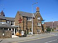
 Middleton Cheney-The Dolphin Inn - geograph.org.uk - 4762970.jpg 1,600 × 1,069; 356 KB
-
 Middleton Lodge Farm - geograph.org.uk - 202580.jpg 640 × 480; 50 KB
-
 Middleton Lodge Farm - geograph.org.uk - 436531.jpg 640 × 319; 75 KB
-
 Middleton Lodge Farm, Middleton Cheney - geograph.org.uk - 1206847.jpg 640 × 426; 107 KB
-
 New House, Glovers Lane - geograph.org.uk - 2793183.jpg 640 × 480; 70 KB
-
 Police House, ^30 Main Road - geograph.org.uk - 3473365.jpg 1,024 × 683; 177 KB
-
 Purston Nature Reserve - geograph.org.uk - 6295123.jpg 1,600 × 1,067; 596 KB
-
 Renovated stone barn at Burgess Farm - geograph.org.uk - 3473372.jpg 1,024 × 683; 135 KB
-

-
 Seven Shires Way - geograph.org.uk - 2699725.jpg 640 × 480; 99 KB
-
 Seven Shires Way - geograph.org.uk - 2699939.jpg 640 × 480; 78 KB
-
 The Dog Training Barn Middleton Cheney - geograph.org.uk - 3852301.jpg 640 × 480; 115 KB
-

-
 The Lodge, Mansion Hill - geograph.org.uk - 3473160.jpg 1,024 × 683; 181 KB
-
 The New Inn, Middleton Cheney - geograph.org.uk - 4249294.jpg 4,320 × 3,240; 4.41 MB
-
 Track to Stanwell Farm - geograph.org.uk - 1768602.jpg 640 × 480; 55 KB
-

-
 Bridge Over Brook - geograph.org.uk - 388603.jpg 640 × 480; 95 KB
-
 Disused road - geograph.org.uk - 436469.jpg 640 × 480; 105 KB
-
 Double step stile - geograph.org.uk - 436516.jpg 640 × 480; 146 KB
-
 Horton Almshouses, Middleton Cheney - geograph.org.uk - 165606.jpg 640 × 480; 74 KB
-

-
 The Dolphin Inn - geograph.org.uk - 202581.jpg 640 × 480; 66 KB
-
 The village green, Middleton Cheney - geograph.org.uk - 165608.jpg 640 × 480; 102 KB
-
 Thenford Road - geograph.org.uk - 422801.jpg 640 × 480; 88 KB
-
 Thenford Road - geograph.org.uk - 422916.jpg 640 × 437; 71 KB
-
 Track to Cold Harbour - geograph.org.uk - 422796.jpg 640 × 480; 70 KB
-
 ^8 Chacombe Road - geograph.org.uk - 3473304.jpg 1,024 × 683; 189 KB


