Category:Middleton Stoney
village and civil parish in Cherwell district, Oxfordshire, England  | |||||
| Upload media | |||||
| Instance of | |||||
|---|---|---|---|---|---|
| Location | Cherwell, Oxfordshire, South East England, England | ||||
| Population |
| ||||
| Area |
| ||||
| Different from | |||||
| official website | |||||
 | |||||
Subcategories
This category has the following 3 subcategories, out of 3 total.
M
P
- Middleton Park, Oxfordshire (4 F)
Media in category "Middleton Stoney"
The following 92 files are in this category, out of 92 total.
-
 Neale(1829) p5.140 - Middleton Park, Oxfordshire.jpg 1,888 × 1,615; 999 KB
-
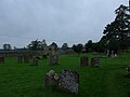
 All Saints church, Middleton Stoney - geograph.org.uk - 3228668.jpg 1,600 × 1,200; 371 KB
-

-

-

-
-

-

-
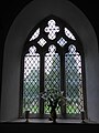
 All Saints, Middleton Stoney, font - geograph.org.uk - 4684061.jpg 480 × 640; 48 KB
-

-

-

-

-

-

-

-

-

-

-

-

-

-

-
 Ardley Road - geograph.org.uk - 4354634.jpg 640 × 480; 68 KB
-
 Ardley Road, Middleton Stoney - geograph.org.uk - 3997700.jpg 2,000 × 1,333; 743 KB
-
 Aves Ditch - geograph.org.uk - 439089.jpg 640 × 428; 140 KB
-
 Aves Ditch - geograph.org.uk - 439094.jpg 640 × 428; 126 KB
-
 B4030 westbound - geograph.org.uk - 4354378.jpg 640 × 480; 71 KB
-
 B430 arriving in Middleton Stoney - geograph.org.uk - 4077795.jpg 640 × 424; 90 KB
-
 B430 looking north - geograph.org.uk - 2836288.jpg 640 × 481; 52 KB
-
 Bicester Road into Middleton Stoney - geograph.org.uk - 4653151.jpg 1,500 × 1,125; 188 KB
-
 Cottages in Middleton Stoney - geograph.org.uk - 114073.jpg 640 × 481; 48 KB
-
 Entrance to Middleton Stoney - geograph.org.uk - 4354390.jpg 640 × 480; 80 KB
-
 Fields west of Ardley Road - geograph.org.uk - 3981852.jpg 2,000 × 1,343; 818 KB
-
 Gate to Aves Ditch - geograph.org.uk - 4657543.jpg 1,500 × 1,125; 492 KB
-
 Gate to Aves Ditch - geograph.org.uk - 4657548.jpg 1,125 × 1,500; 341 KB
-
 Heyford Road out of Middleton Stoney - geograph.org.uk - 4656175.jpg 1,500 × 1,125; 193 KB
-
 Houses on Ardley Road - geograph.org.uk - 3997649.jpg 2,000 × 1,402; 769 KB
-

-

-

-
-

-

-

-

-

-
 Lower Heyford Road - geograph.org.uk - 4354352.jpg 640 × 480; 64 KB
-
 Middleton Park - geograph.org.uk - 4354404.jpg 640 × 480; 78 KB
-
 School Building in Middleton Stoney - geograph.org.uk - 1040938.jpg 640 × 480; 53 KB
-

-

-
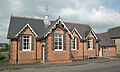 MiddletonStoney FormerSchool.JPG 3,000 × 1,800; 652 KB
-
 Near Park Farm - geograph.org.uk - 2031789.jpg 3,460 × 2,476; 2.5 MB
-
 Old Milestone by the B430, north of Oxford Lodge (geograph 6048694).jpg 1,190 × 1,536; 359 KB
-
 Outbuilding off Ardley Road - geograph.org.uk - 3997664.jpg 2,000 × 1,304; 874 KB
-
 Park Farm - geograph.org.uk - 1984555.jpg 2,048 × 1,536; 719 KB
-
 Pig farm - geograph.org.uk - 4354366.jpg 640 × 466; 75 KB
-
 Replaced Milestone on the B430 - geograph.org.uk - 703073.jpg 640 × 480; 100 KB
-
 Road Junction near Middleton Stoney - geograph.org.uk - 1040936.jpg 640 × 480; 49 KB
-
 Road junction on the B4030 - geograph.org.uk - 4657512.jpg 1,500 × 1,125; 137 KB
-
 Sheep - geograph.org.uk - 345069.jpg 640 × 480; 248 KB
-
 Sheep - geograph.org.uk - 345073.jpg 640 × 480; 248 KB
-
 The B4030 passes Park Farm - geograph.org.uk - 4657518.jpg 1,500 × 1,125; 188 KB
-
 The B4030 to Lower Heyford - geograph.org.uk - 4656177.jpg 1,500 × 1,125; 218 KB
-
 The B4030 to Lower Heyford - geograph.org.uk - 4656179.jpg 1,500 × 1,125; 239 KB
-
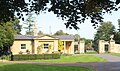 The Gate Lodge, Middleton Park (geograph 6608975).jpg 4,956 × 2,917; 1.87 MB
-
 The Jersey Arms - geograph.org.uk - 4354632.jpg 640 × 480; 83 KB
-
 The Jersey Arms in Middleton Stoney - geograph.org.uk - 4656173.jpg 1,500 × 1,113; 142 KB
-
 Track - geograph.org.uk - 4354362.jpg 640 × 480; 68 KB
-
 Village Hall, Middleton Stoney - geograph.org.uk - 3997637.jpg 2,000 × 1,374; 699 KB
-

-

-
 Across The Downs - geograph.org.uk - 442462.jpg 640 × 480; 109 KB
-
 Course of Stream through Middleton Park - geograph.org.uk - 464242.jpg 640 × 480; 141 KB
-
 Entrance to Stud farm - geograph.org.uk - 345152.jpg 640 × 480; 145 KB
-
 Farmland at Middleton Stoney - geograph.org.uk - 345080.jpg 640 × 480; 248 KB
-
 Farmland east of Middleton Stoney - geograph.org.uk - 439047.jpg 640 × 428; 115 KB
-
 Footpath to the Church - geograph.org.uk - 114079.jpg 640 × 481; 78 KB
-
 M40 - geograph.org.uk - 345180.jpg 640 × 480; 213 KB
-
 Muddy track to Slade Farm - geograph.org.uk - 345149.jpg 640 × 480; 135 KB
-
 Old Covert, Middleton Park - geograph.org.uk - 464233.jpg 640 × 480; 129 KB
-
 Pig Farming near Caulcott - geograph.org.uk - 440142.jpg 640 × 428; 105 KB
-
 The Downs, Middleton Park - geograph.org.uk - 464247.jpg 640 × 480; 130 KB
-
 The Road to Ashgrove Farm - geograph.org.uk - 345054.jpg 640 × 480; 214 KB
-
 The Road to Bucknell - geograph.org.uk - 114010.jpg 640 × 481; 38 KB
-
 The Road to Manor Farm - geograph.org.uk - 345076.jpg 640 × 480; 238 KB
-
 The Road to Simms Farm - geograph.org.uk - 345175.jpg 640 × 480; 140 KB
-
 The Road to Simms Farm - geograph.org.uk - 345178.jpg 640 × 480; 157 KB
-
 The Road to Spring Well Farm - geograph.org.uk - 345183.jpg 640 × 480; 147 KB
-

-
 What's in the Wood^ - geograph.org.uk - 442498.jpg 640 × 480; 101 KB
_p5.140_-_Middleton_Park,_Oxfordshire.jpg)


_-_geograph.org.uk_-_4683888.jpg)
_-_geograph.org.uk_-_4683890.jpg)
_-_geograph.org.uk_-_4683892.jpg)
_-_geograph.org.uk_-_4683894.jpg)


_-_geograph.org.uk_-_4684045.jpg)
_-_geograph.org.uk_-_4684047.jpg)
_-_geograph.org.uk_-_4684048.jpg)
_-_geograph.org.uk_-_4684049.jpg)
_-_geograph.org.uk_-_4684052.jpg)
_-_geograph.org.uk_-_4684053.jpg)
_-_geograph.org.uk_-_4684054.jpg)


_-_geograph.org.uk_-_4684062.jpg)
_-_geograph.org.uk_-_4684064.jpg)


_-_geograph.org.uk_-_4683895.jpg)
_-_geograph.org.uk_-_4683896.jpg)
_-_geograph.org.uk_-_4683899.jpg)
_-_geograph.org.uk_-_4683900.jpg)
_-_geograph.org.uk_-_4683902.jpg)
_-_geograph.org.uk_-_4683904.jpg)
_-_geograph.org.uk_-_4684034.jpg)
_-_geograph.org.uk_-_4684037.jpg)
_-_geograph.org.uk_-_4684065.jpg)


.jpg)


.jpg)


