Category:Milestones in Staffordshire
Ceremonial counties of England: Bedfordshire · Berkshire · Buckinghamshire · Cambridgeshire · Cheshire · Cornwall · Cumbria · Derbyshire · Devon · Dorset · Durham · East Riding of Yorkshire · East Sussex · Essex · Gloucestershire · Greater London · Greater Manchester · Hampshire · Herefordshire · Hertfordshire · Kent · Lancashire · Leicestershire · Lincolnshire · Merseyside · Norfolk · North Yorkshire · Northamptonshire · Northumberland · Nottinghamshire · Oxfordshire · Rutland · Shropshire · Somerset · South Yorkshire · Staffordshire · Suffolk · Surrey · Tyne and Wear · Warwickshire · West Midlands · West Sussex · West Yorkshire · Wiltshire · Worcestershire
City-counties: Bristol ·
Former historic counties:
Other former counties:
City-counties: Bristol ·
Former historic counties:
Other former counties:

Subcategories
This category has the following 3 subcategories, out of 3 total.
Media in category "Milestones in Staffordshire"
The following 200 files are in this category, out of 405 total.
(previous page) (next page)-
 A513 crossing the Trent & Mersey Canal at Alrewas (geograph 6867783).jpg 1,280 × 960; 484 KB
-
 Abandoned Canal Milepost and Railway - geograph.org.uk - 413700.jpg 480 × 640; 121 KB
-
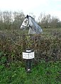 Canal milepost and horse, Alrewas - geograph.org.uk - 1595430.jpg 462 × 640; 141 KB
-
 Ashby Road (B5493) heading NE (geograph 6533981).jpg 1,024 × 683; 178 KB
-
 B5066 at Hopton Farm (geograph 5511604).jpg 1,280 × 859; 460 KB
-
 B5066 at Sandonbank (geograph 5511612).jpg 1,280 × 960; 472 KB
-
 B5405 towards Great Bridgeford (geograph 6459073).jpg 800 × 600; 180 KB
-
 Blackshaw Moor milepost - detail - geograph.org.uk - 1598274.jpg 480 × 640; 144 KB
-
 Milepost on the A523 - geograph.org.uk - 1549401.jpg 640 × 480; 92 KB
-
 Milepost on the A523 - geograph.org.uk - 1549414.jpg 640 × 480; 111 KB
-
 Milepost on the A523 - geograph.org.uk - 1549422.jpg 480 × 640; 130 KB
-
 Milepost on the A523 - geograph.org.uk - 1711012.jpg 1,600 × 1,067; 516 KB
-
 Milepost on the A523 - geograph.org.uk - 1712053.jpg 1,600 × 1,067; 384 KB
-
 The Morridge Side milepost - detail - geograph.org.uk - 1736946.jpg 480 × 640; 121 KB
-

-
 Brereton Parish milestone - detail (geograph 3487997).jpg 979 × 1,306; 493 KB
-
 Bungalows on Eccleshall Road (B5026) (geograph 6260548).jpg 640 × 480; 70 KB
-
 Burton Bridge, looking east (geograph 4003555).jpg 1,280 × 981; 193 KB
-
 Canal mile marker near Great Haywood in Staffordshire (geograph 6416278).jpg 960 × 1,280; 1.29 MB
-
 Canal Milemarker (geograph 6126405).jpg 1,153 × 1,718; 359 KB
-
 Canal Milemarker (geograph 6126412).jpg 1,140 × 1,730; 237 KB
-
 Canal Milemarker (geograph 6126482).jpg 1,158 × 1,770; 231 KB
-
 Canal Milemarker (geograph 6126501).jpg 1,168 × 1,773; 230 KB
-
 Canal Milemarker (geograph 6126505).jpg 1,158 × 1,737; 214 KB
-
 Canal Milemarker (geograph 6126545).jpg 1,129 × 1,743; 269 KB
-
 Canal Milemarker by the Shropshire Union Canal, Lapley (geograph 6076804).jpg 1,164 × 1,726; 262 KB
-
 Canal Milemarker north of Tavern Bridge, Wheaton Aston (geograph 6076456).jpg 1,135 × 1,730; 282 KB
-
 Canal milepost - geograph.org.uk - 394299.jpg 500 × 525; 353 KB
-
 Canal milepost - geograph.org.uk - 428147.jpg 480 × 640; 105 KB
-
 Canal milestone, north side (geograph 6562316).jpg 1,024 × 768; 436 KB
-
 Canal milestone, south side (geograph 6562320).jpg 1,024 × 768; 375 KB
-
 Cheddleton Heath milepost - detail - geograph.org.uk - 1402136.jpg 480 × 640; 140 KB
-
 Cheddleton milepost - detail - geograph.org.uk - 1402131.jpg 480 × 640; 96 KB
-
 Cheddleton milepost - detail - geograph.org.uk - 1483152.jpg 480 × 640; 114 KB
-
 Codsall milepost in detail - geograph.org.uk - 1395272.jpg 480 × 640; 147 KB
-
 Cold Norton milestone in its setting - geograph.org.uk - 1381388.jpg 640 × 480; 43 KB
-
 Cotes milestone - geograph.org.uk - 921376.jpg 480 × 640; 81 KB
-
 Detail of the Codsall Milestone - geograph.org.uk - 1267399.jpg 480 × 640; 141 KB
-
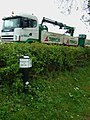
 Dunstall Gate tollhouse (geograph 6126538).jpg 1,024 × 768; 399 KB
-
 Earl's Drive by Counslow Plantation (geograph 4535141).jpg 1,200 × 900; 277 KB
-
 Ellenhall milestone - geograph.org.uk - 921394.jpg 480 × 640; 111 KB
-
 Gnosall milepost in its setting (geograph 4914599).jpg 1,142 × 857; 370 KB
-
 High Offley milestone - geograph.org.uk - 921408.jpg 480 × 640; 85 KB
-
 House on Ashby Road, with milestone (geograph 4003568).jpg 1,280 × 1,280; 298 KB
-
 Junction of Sandon Road and Within Lane (geograph 5507372).jpg 1,280 × 960; 308 KB
-
 Meir Heath milepost - detail - geograph.org.uk - 1483524.jpg 480 × 640; 109 KB
-
 Meir Heath milepost in its setting - geograph.org.uk - 1483528.jpg 640 × 480; 91 KB
-
 Mile Post - geograph.org.uk - 706470.jpg 427 × 640; 115 KB
-
 Mile Post on the edge of Denstone - geograph.org.uk - 99146.jpg 480 × 640; 141 KB
-
 Mileplate in Dimmingsdale Wood.jpg 1,536 × 2,048; 710 KB
-
 Milepost (geograph 5190636).jpg 1,024 × 683; 167 KB
-
 Milepost (geograph 5190677).jpg 1,024 × 683; 255 KB
-
 Milepost (geograph 5190699).jpg 1,024 × 683; 243 KB
-
 Milepost (geograph 5190719).jpg 1,024 × 683; 253 KB
-
 Milepost - geograph.org.uk - 469757.jpg 640 × 480; 92 KB
-

-
 Milepost at Checkley.jpg 1,600 × 1,200; 686 KB
-
 Milepost at Lodge Hill (geograph 3863794).jpg 1,280 × 960; 515 KB
-
 Milepost at NGR SJ 7636 4649.jpg 492 × 701; 43 KB
-
 Milepost at SJ 973 551.jpg 492 × 701; 65 KB
-
 Milepost at SJ 988 532.jpg 492 × 701; 59 KB
-
 Milepost at SJ 996 557.jpg 409 × 800; 123 KB
-
 Milepost at SK 00012 57696.jpg 492 × 701; 70 KB
-
 Milepost at Upper Tean.jpg 1,200 × 1,600; 643 KB
-
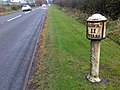
 Milepost on Eccleshall Road (B5026) (geograph 6172422).jpg 800 × 600; 168 KB
-
 Milepost on Eccleshall Road (B5026) (geograph 6172428).jpg 600 × 800; 186 KB
-
 Milepost on the Eccleshall Road (B5026), Ashley (geograph 6260552).jpg 573 × 800; 141 KB
-
 Milepost, Blounts Green.jpg 258 × 390; 31 KB
-
 Milepost, Milford - geograph.org.uk - 1022947.jpg 480 × 640; 117 KB
-
 Milestone (geograph 4898172).jpg 640 × 480; 131 KB
-
 Milestone 1 mile from Rugeley.jpg 492 × 701; 80 KB
-
 Milestone at 9954 4993.jpg 1,147 × 1,736; 428 KB
-
 Milestone at Greenhead, Kingsley.jpg 480 × 640; 187 KB
-
 Milestone at Hopton Farm (geograph 5511605).jpg 1,280 × 1,280; 440 KB
-
 Milestone at NGR SJ 988 543.jpg 492 × 701; 78 KB
-
 Milestone at Sandon (geograph 5522936).jpg 1,280 × 1,280; 728 KB
-
 Milestone at Sandon (geograph 5524121).jpg 1,280 × 1,280; 660 KB
-
 Milestone at Sandonbank (geograph 5511614).jpg 1,280 × 960; 590 KB
-
 Milestone in Little Haywood, Staffordshire (geograph 6917372).jpg 960 × 1,280; 1.22 MB
-
 Milestone in Rolleston bus shelter (geograph 3863040).jpg 1,280 × 960; 233 KB
-
 Milestone in Wall (geograph 6922809).jpg 640 × 480; 119 KB
-
 Milestone near Bridge No. 65, Coventry Canal.jpg 600 × 800; 218 KB
-
 Milestone near Overton End Farm, Biddulph.jpg 600 × 800; 604 KB
-
 Milestone on Main Road,Great Haywood (geograph 3628367).jpg 1,024 × 768; 288 KB
-
 Milestone on the A34 at Sandon Park (geograph 5524202).jpg 1,280 × 1,280; 794 KB
-
 Milestone on Weston Bank (geograph 5509993).jpg 1,280 × 1,280; 566 KB
-
 Milestone southeast of Bridge No. 53, Caldon Canal.jpg 1,177 × 1,744; 266 KB
-
 Milestone, 161 Congleton Road, Biddulph.jpg 492 × 701; 85 KB
-
 Milestone, Alrewas (geograph 6867759).jpg 960 × 1,280; 483 KB
-
 Milestone, Congleton Road, Biddulph.jpg 492 × 701; 74 KB
-
 Milestone, Creswell.jpg 710 × 761; 175 KB
-
 Milestone, Ellastone (geograph 5307372).jpg 960 × 1,280; 402 KB
-
 Milestone, Harewood.jpg 1,496 × 1,704; 492 KB
-
 Milestone, Leek Road, Cheadle.jpg 492 × 701; 59 KB
-
 Milestone, Longnor.jpg 496 × 702; 88 KB
-
 Milestone, Sandon Road at Within Lane (geograph 5507369).jpg 1,280 × 960; 556 KB
-
 Milestone, Stafford Street, Eccleshall.jpg 734 × 979; 400 KB
-
 Milestone, The Manor House.jpg 1,024 × 768; 158 KB
-
 Milestone, Township of Balterley, Staffordshire.JPG 1,051 × 1,483; 509 KB
-
 Milestone, Upper Gungate.jpg 1,024 × 768; 218 KB
-
 Mill Meece milestone - geograph.org.uk - 921382.jpg 480 × 640; 95 KB
-

-
 Modern roman milepost near Letocetum at Wall, Staffordshire.JPG 4,000 × 6,000; 7.42 MB
-
 Norbury Parish milestone - geograph.org.uk - 921425.jpg 480 × 640; 72 KB
-
 Norbury Parish milestone - geograph.org.uk - 921428.jpg 480 × 640; 94 KB
-
 Old Bridge Marker (geograph 6050471).jpg 790 × 1,178; 277 KB
-
 Old Bridge Marker by the A520, Cheddleton (geograph 6094913).jpg 1,177 × 1,711; 224 KB
-
 Old Caldon Canal milemarker now by Denstone bowling green (geograph 6095592).jpg 1,129 × 1,613; 158 KB
-
 Old Caldon Canal milemarker now by Denstone bowling green (geograph 6095601).jpg 1,166 × 1,737; 166 KB
-
 Old Central Cross by High Street, Cheadle (geograph 6044593).jpg 792 × 600; 251 KB
-
 Old Central Cross by Pown Street, Sheen (geograph 6072957).jpg 720 × 960; 155 KB
-
 Old Guide Stone in Tixall, east of Stafford (geograph 6037120).jpg 492 × 701; 45 KB
-
 Old milemarker (geograph 6098591).jpg 1,167 × 1,696; 181 KB
-
 Old milemarker (geograph 6098817).jpg 1,106 × 1,710; 245 KB
-
 Old milemarker (geograph 6099265).jpg 1,156 × 1,764; 302 KB
-
 Old milemarker Brewood parish (geograph 6076553).jpg 1,151 × 1,749; 268 KB
-
 Old milemarker by the Caldon Canal, Cheddleton (geograph 6083707).jpg 1,120 × 1,690; 274 KB
-
 Old milemarker by the Caldon Canal, Denford (geograph 6076744).jpg 1,125 × 1,716; 151 KB
-
 Old milemarker by the Caldon Canal, east of Endon (geograph 6094061).jpg 1,142 × 1,715; 279 KB
-
 Old milemarker by the Coventry Canal, Kettlebrook (geograph 6095595).jpg 1,127 × 1,727; 294 KB
-
 Old milemarker by the Coventry Canal, Tamworth (geograph 6076767).jpg 1,136 × 1,704; 314 KB
-

-
 Old milemarker by the Shropshire Union Canal, Brewood (geograph 6076790).jpg 1,137 × 1,726; 447 KB
-
 Old milemarker by the Shropshire Union Canal, Church Eaton (geograph 6095693).jpg 1,163 × 1,760; 331 KB
-
 Old milemarker by the Shropshire Union Canal, Church Eaton (geograph 6095726).jpg 1,176 × 1,770; 352 KB
-
 Old milemarker by the Shropshire Union Canal, Gnosall (geograph 6076693).jpg 1,157 × 1,726; 259 KB
-
 Old milemarker by the Shropshire Union Canal, Gnosall Heath (geograph 6095674).jpg 1,153 × 1,750; 198 KB
-
 Old milemarker by the Shropshire Union Canal, High Offley (geograph 6076771).jpg 1,138 × 1,750; 282 KB
-
 Old milemarker by the Shropshire Union Canal, Norbury (geograph 6102128).jpg 1,177 × 1,733; 262 KB
-
 Old milemarker by the Shropshire Union Canal, Wheaton Aston (geograph 6076796).jpg 1,177 × 1,746; 281 KB
-
 Old milemarker by the Trent & Mersey Canal, Alrewas (geograph 6095701).jpg 1,135 × 1,730; 232 KB
-
 Old milemarker by the Trent & Mersey Canal, Branston (geograph 6076718).jpg 1,137 × 1,753; 201 KB
-
 Old milemarker by the Trent & Mersey Canal, Hoo Mill Lock (geograph 6095892).jpg 1,153 × 1,717; 218 KB
-
 Old milemarker by the Trent & Mersey Canal, Kidsgrove (geograph 6095594).jpg 1,168 × 1,698; 225 KB
-
 Old milemarker by the Trent & Mersey Canal, Meaford (geograph 6076787).jpg 1,141 × 1,737; 237 KB
-
 Old milemarker by the Trent & Mersey Canal, near Sandon Lock (geograph 6095637).jpg 1,147 × 1,730; 313 KB
-
 Old milemarker by the Trent & Mersey Canal, Stone (geograph 6076737).jpg 1,176 × 1,750; 233 KB
-
 Old milemarker by the Trent and Mersey Canal, Aston Lock (geograph 6076673).jpg 1,176 × 1,750; 219 KB
-
 Old milemarker east of Norbury (geograph 6076417).jpg 1,144 × 1,740; 269 KB
-
 Old milemarker near Rue Hill, Norbury (geograph 6076482).jpg 1,138 × 1,763; 250 KB
-
 Old milemarker north of Brewood Bridge (geograph 6076411).jpg 1,145 × 1,758; 261 KB
-
 Old milemarker south of Cowley Double Bridge (geograph 6076510).jpg 1,171 × 1,726; 256 KB
-

-
 Old Milepost (geograph 5190624).jpg 683 × 1,024; 156 KB
-
 Old Milepost (geograph 5190693).jpg 683 × 1,024; 183 KB
-
 Old Milepost (geograph 5190716).jpg 683 × 1,024; 148 KB
-
 Old Milepost (geograph 6098278).jpg 492 × 701; 64 KB
-
 Old Milepost (geograph 6098342).jpg 324 × 400; 111 KB
-
 Old Milepost (geograph 6098351).jpg 492 × 701; 73 KB
-
 Old Milepost (geograph 6098524).jpg 492 × 701; 58 KB
-
 Old Milepost (geograph 6098638).jpg 492 × 701; 67 KB
-
 Old Milepost (geograph 6098840).jpg 492 × 701; 90 KB
-
 Old Milepost (geograph 6098892).jpg 492 × 701; 69 KB
-
 Old Milepost (geograph 6098918).jpg 265 × 400; 31 KB
-
 Old Milepost (geograph 6098938).jpg 492 × 701; 67 KB
-
 Old Milepost (geograph 6098955).jpg 533 × 800; 92 KB
-
 Old Milepost (geograph 6098988).jpg 484 × 700; 62 KB
-
 Old Milepost (geograph 6099035).jpg 492 × 701; 81 KB
-
 Old Milepost (geograph 6099038).jpg 492 × 701; 53 KB
-
 Old Milepost (geograph 6099043).jpg 492 × 701; 84 KB
-
 Old Milepost (geograph 6099090).jpg 492 × 701; 64 KB
-
 Old Milepost (geograph 6099107).jpg 492 × 701; 65 KB
-
 Old Milepost (geograph 6114673).jpg 911 × 1,404; 223 KB
-
 Old Milepost (geograph 6115052).jpg 1,536 × 2,048; 657 KB
-
 Old Milepost (geograph 6115311).jpg 1,536 × 2,048; 640 KB
-
 Old Milepost by Archford Moor, south of Hulme End (geograph 6048966).jpg 1,024 × 768; 192 KB
-

-
-

-
 Old Milepost by Rock Hill, Hints parish (geograph 6072248).jpg 450 × 600; 109 KB
-

-

-
 Old Milepost by the A34, south of Trentham (geograph 6037184).jpg 265 × 400; 69 KB
-
 Old Milepost by the A34, Tittensor (geograph 6048156).jpg 265 × 400; 29 KB
-

-

-
 Old Milepost by the A38, near Crown Inn Farm (geograph 6048228).jpg 533 × 800; 101 KB
-
 Old Milepost by the A38, Streethay (geograph 5524819).jpg 800 × 600; 166 KB
-
 Old Milepost by the A41, Holyhead Road, Codsall Parish (geograph 6044866).jpg 1,398 × 1,704; 478 KB
-
 Old Milepost by the A41, Holyhead Road, Codshall parish (geograph 6068576).jpg 1,395 × 1,704; 496 KB
-
 Old Milepost by the A449, Whittington (geograph 6068686).jpg 1,117 × 1,704; 352 KB
-

-

-
 Old Milepost by the A458, Cote Lane (geograph 6072884).jpg 492 × 701; 69 KB
-

-

-
 Old Milepost by the A5, Weeford (geograph 6097693).jpg 600 × 450; 133 KB
-

-
 Old Milepost by the A5005, Lightwood Road, Lightwood (geograph 6048154).jpg 1,504 × 2,272; 532 KB
-

-
 Old Milepost by the A5013, Walton (geograph 6098616).jpg 492 × 701; 77 KB
-

-

-

-
 Old Milepost by the A51, Lichfield Road, Sandon (geograph 6102328).jpg 1,551 × 1,704; 525 KB
-
 Old Milepost by the A51, Little Stoke (geograph 6048400).jpg 265 × 400; 30 KB
-

-

-

-

.jpg)


_heading_NE_(geograph_6533981).jpg)
.jpg)
.jpg)
.jpg)


.jpg)
_(geograph_6260548).jpg)
.jpg)
.jpg)
.jpg)
.jpg)
.jpg)
.jpg)
.jpg)
.jpg)
.jpg)
.jpg)


.jpg)
.jpg)


.jpg)
.jpg)

.jpg)

.jpg)
.jpg)


.jpg)
.jpg)
.jpg)
.jpg)


.jpg)


_(geograph_6172422).jpg)
_(geograph_6172428).jpg)
,_Ashley_(geograph_6260552).jpg)


.jpg)


.jpg)

.jpg)
.jpg)
.jpg)
.jpg)
.jpg)
.jpg)


.jpg)
.jpg)
.jpg)


.jpg)


.jpg)


.jpg)


.jpg)


.jpg)
.jpg)
.jpg)
.jpg)
.jpg)
.jpg)
.jpg)
.jpg)
.jpg)
.jpg)
.jpg)
.jpg)
.jpg)
.jpg)
.jpg)
.jpg)
.jpg)
.jpg)
.jpg)
.jpg)
.jpg)
.jpg)
.jpg)
.jpg)
.jpg)
.jpg)
.jpg)
.jpg)
.jpg)
.jpg)
.jpg)
.jpg)
.jpg)
.jpg)
.jpg)
.jpg)
.jpg)
.jpg)
.jpg)
.jpg)
.jpg)
.jpg)
.jpg)
.jpg)
.jpg)
.jpg)
.jpg)
.jpg)
.jpg)
.jpg)
.jpg)
.jpg)
.jpg)
.jpg)
.jpg)
.jpg)
.jpg)
.jpg)
.jpg)
.jpg)
.jpg)
.jpg)
.jpg)
.jpg)
.jpg)
.jpg)
.jpg)
.jpg)
.jpg)
.jpg)
.jpg)
.jpg)
.jpg)
.jpg)
.jpg)
.jpg)
.jpg)
.jpg)
.jpg)
.jpg)
.jpg)
.jpg)
.jpg)
.jpg)
.jpg)
.jpg)
.jpg)
.jpg)
.jpg)
.jpg)
.jpg)
.jpg)
.jpg)
.jpg)
.jpg)