Category:Mini roundabouts in the East Riding of Yorkshire
Ceremonial counties of England: Durham · East Riding of Yorkshire · Greater London · Greater Manchester · Hampshire · Lancashire · Norfolk · North Yorkshire · Somerset · Suffolk · Wiltshire ·
City-counties:
Former historic counties:
Other former counties:
City-counties:
Former historic counties:
Other former counties:
Media in category "Mini roundabouts in the East Riding of Yorkshire"
The following 42 files are in this category, out of 42 total.
-
 A footpath off Queen Street, Withernsea (geograph 2259107).jpg 800 × 600; 243 KB
-
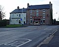
 Alexandra Hotel, Queen Street, Withernsea (geograph 5084234).jpg 1,200 × 799; 256 KB
-
 B1230 (geograph 5449335).jpg 640 × 426; 64 KB
-
 Beverley Road, Driffield - geograph.org.uk - 1532219.jpg 640 × 480; 82 KB
-
 Beverley Road, Kirk Ella (geograph 5194550).jpg 1,600 × 1,065; 706 KB
-
 Beverley, HU17 (geograph 3556006).jpg 3,279 × 2,185; 1.24 MB
-
 Bransholme, Kingston upon Hull current county-UA top (joint) (geograph 3325499).jpg 1,600 × 1,200; 547 KB
-
 Cartwright Lane, Beverley (geograph 2999483).jpg 3,872 × 2,592; 3.58 MB
-
 Driffield.jpg 800 × 533; 303 KB
-
 Endike Lane (west end) - geograph.org.uk - 390224.jpg 640 × 480; 134 KB
-
 Fair Maid, Cottingham - geograph.org.uk - 682022.jpg 640 × 512; 71 KB
-
 Houses on Church Hill - geograph.org.uk - 582520.jpg 640 × 480; 84 KB
-
 Hull Dogger Bank Abload Mini-Roundabout Mounting.jpg 4,176 × 2,784; 3.4 MB
-
 Hull Dogger Bank Abload Mini-Roundabout Prep.jpg 4,176 × 2,784; 3.45 MB
-
 Hull Road, Withernsea - geograph.org.uk - 1257880.jpg 640 × 428; 72 KB
-
 Kirk Ella Community School.jpg 640 × 480; 196 KB
-

-
 Main Road Bilton.jpg 640 × 480; 74 KB
-
 Middleton on the Wolds - geograph.org.uk - 7103.jpg 640 × 480; 94 KB
-
 Mini Roundabout, Marton Road - geograph.org.uk - 1709630.jpg 800 × 600; 107 KB
-

-
 Mini-roundabout on the B1232, Anlaby - geograph.org.uk - 1774424.jpg 640 × 480; 75 KB
-
 Queengate (geograph 5451857).jpg 640 × 426; 70 KB
-
 Queensgate - viewed from Admiral Walker Road (geograph 4592752).jpg 640 × 480; 74 KB
-
 Scarborough Road Roundabout - geograph.org.uk - 294500.jpg 640 × 480; 86 KB
-
 Seaside Road, Withernsea (geograph 3611224).jpg 1,024 × 768; 151 KB
-
 South Ella Drive, Kirk Ella (geograph 6117387).jpg 5,184 × 3,888; 5.24 MB
-
 South Street from the west - geograph.org.uk - 391905.jpg 640 × 448; 103 KB
-
 Street Scene, Driffield - geograph.org.uk - 592730.jpg 640 × 480; 85 KB
-
 Swanland Road Roundabout, Hessle - geograph.org.uk - 1343418.jpg 640 × 360; 51 KB
-
 Tesco, Withernsea (geograph 6054902).jpg 1,600 × 1,188; 195 KB
-
 The "Fair Maid", Baynard Avenue - geograph.org.uk - 390392.jpg 640 × 480; 95 KB
-
 The A614 Roundabout - geograph.org.uk - 1255144.jpg 640 × 480; 34 KB
-
 The Bell Hotel, Driffield - geograph.org.uk - 1506770.jpg 640 × 427; 305 KB
-
 The Charter Club on Pasture Road - geograph.org.uk - 1287176.jpg 640 × 480; 65 KB
-
 The New Inn Leven.jpg 640 × 480; 63 KB
-
 The Police Station Hessle.jpg 640 × 404; 176 KB
-
 The Spread Eagle - geograph.org.uk - 1409452.jpg 640 × 480; 78 KB
-
 The Spread Eagle, Withernsea (geograph 5657788).jpg 1,600 × 1,200; 336 KB
-
 The Weir from South Lane - geograph.org.uk - 260167.jpg 640 × 392; 145 KB
-
 Wright Street Roundabout - geograph.org.uk - 545823.jpg 640 × 480; 89 KB
-
 Wold Road mini roundabout - geograph.org.uk - 104013.jpg 640 × 471; 107 KB
.jpg)
.jpg)
.jpg)

.jpg)
.jpg)
_(geograph_3325499).jpg)
.jpg)

_-_geograph.org.uk_-_390224.jpg)


.jpg)
.jpg)

.jpg)
.jpg)


.jpg)


.jpg)


