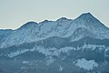
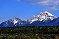
Category:Mittagskogel
| Object location | | View all coordinates using: OpenStreetMap |
|---|
mountain in the Karawanks at the border Carinthia / Slovenia  | |||||
| Upload media | |||||
| Instance of | |||||
|---|---|---|---|---|---|
| Location |
| ||||
| Mountain range |
| ||||
| Topographic prominence |
| ||||
| Topographic isolation |
| ||||
| Elevation above sea level |
| ||||
| Different from | |||||
 | |||||
Deutsch: Der Mittagskogel ist ein Berg der Karawanken an der österreichisch-slowenischen Staatsgrenze.
Français : Mittagskogel est un sommet des Alpes, à 2145 m, dans les Karavanke, entre l'Autriche (land de Carinthie) et la Slovénie.
Subcategories
This category has the following 3 subcategories, out of 3 total.
Media in category "Mittagskogel"
The following 158 files are in this category, out of 158 total.
-
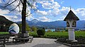
 "Egger Marterl" am Faaker See, Fotorahmen.jpg 4,933 × 2,889; 6.45 MB
-
 2014-10-22 09-49-48 Slovenia - Log pod Mangartom Strmec na Predelu.jpg 2,848 × 4,288; 6.89 MB
-
 2014-10-22 09-50-16 Slovenia - Planica.jpg 4,288 × 2,848; 9.14 MB
-
 2014-10-22 09-50-26 Slovenia - Soca Zapodnem.jpg 2,848 × 4,288; 6.52 MB
-
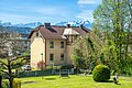
 AT-81556 und 34186 Schloss Damtschach 063.jpg 5,760 × 3,840; 4.09 MB
-
 Bannwaldweg 8 in Poertschach Blick auf den Woerther See 29112013 263.jpg 4,256 × 2,832; 8.63 MB
-
 Belska planina Kepa.jpg 2,272 × 1,704; 1.01 MB
-

-
 Bertahuette Mittagskogel 01.jpg 3,008 × 2,000; 1.54 MB
-
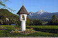
 Bildstock Egg am Faakersee.jpg 4,912 × 2,746; 5.45 MB
-
 Blick nach Finkenstein vom Dobratsch, Kärnten.jpg 1,500 × 1,000; 874 KB
-
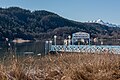
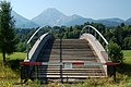 Cross-country skiing bridge, Mittagskogel.jpg 3,008 × 2,000; 3.87 MB
-
 Drau Im Winter (44982930).jpeg 2,048 × 1,360; 996 KB
-
 Drobollach Faaker See 2011-08-02.jpg 2,732 × 2,104; 3.13 MB
-
 Drobollacher Moor zwischen Mittageskogel und Faakersee, Kärnten, Österreich, EU.jpg 1,500 × 879; 1.23 MB
-
 Egg Faakersee Nischenbildstock 07052008 06.jpg 3,872 × 2,592; 1.65 MB
-
 Eingebettet zwischen Mittagskogel und Faaker See.jpg 1,280 × 853; 578 KB
-
 Faaker See and Mittagskogel.png 200 × 150; 63 KB
-
 Faaker See-Austria - panoramio (3).jpg 2,048 × 1,536; 433 KB
-
 Ferlach Kappel Pfarrhof und Pfarrkirche hl Zeno Ost-Ansicht 09102017 5601.jpg 4,928 × 3,280; 9.76 MB
-
 Finkenstein am Faaker See Altfinkenstein Mittagskogel 15042021 0812.jpg 7,360 × 4,912; 16.45 MB
-

-
 Finkenstein am Faaker See Mittagskogel 13022015 9807.jpg 4,928 × 3,280; 6.71 MB
-
 Finkenstein am Faaker See Mittagskogel 15042021 8852.jpg 4,928 × 3,280; 6.92 MB
-
 Finkenstein Faak am See Blick zum Mittagskogel 19102018 5063.jpg 7,360 × 4,912; 15.18 MB
-
 Finkenstein Faak am See mit Mittagskogel 31052008 11.jpg 3,872 × 2,592; 1.75 MB
-
 Maria Saal Karnburg Blick zum Mittagskogel 03032015 0308.jpg 7,360 × 4,912; 11 MB
-
 Mittagskogel 28012007 01.jpg 3,872 × 2,592; 1.05 MB
-
 Mittagskogel NO-Ansicht 17052021 8879.jpg 4,928 × 3,280; 5.18 MB
-
 Velden Göriach Blick zum Mittagskogel 18012022 9062.jpg 4,928 × 3,280; 7.29 MB
-
 Villach Mittagskogel 22042009 92.jpg 4,288 × 2,848; 3.2 MB
-
 Finkenstein Altfinkenstein Mittagskogel 18052007 02.jpg 2,580 × 2,424; 1,001 KB
-
 Sankt Veit an der Glan Beiersdorf Mittagskogel-Blick O-Ansicht 14042021 0777.jpg 7,360 × 4,912; 11.1 MB
-
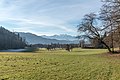
 Finkenstein Unteraichwald Aichwaldsee im Winter 04012009 06.jpg 2,848 × 2,136; 1.32 MB
-
 FinkensteinerMoor.JPG 3,872 × 2,592; 2.37 MB
-
 Gegendtal, Bezirk Villach Land, Kärnten.jpg 1,500 × 997; 1.63 MB
-
 Glock Horse Performance Center, Show Jumping, Treffen am Ossiachersee, Kärnten.jpg 3,928 × 2,028; 3.5 MB
-
 Hochspannungsleitung, Gemeinde Treffen, Gegendtal, Kärnten.jpg 4,912 × 2,256; 2.67 MB
-
 Kepa 01.JPG 2,736 × 3,648; 4.28 MB
-
 Kepa 02.JPG 3,648 × 2,736; 4.41 MB
-
 Kepa 03.JPG 3,648 × 2,736; 3.35 MB
-
 Kepa 04.JPG 3,648 × 2,736; 4.04 MB
-
 Kepa 05.JPG 3,648 × 2,736; 4.69 MB
-
 Kepa 2013.jpg 1,024 × 768; 151 KB
-
 Keutschach Rauth 2 vulgo STAUPITZ Hube Weinberg 29052010 866.jpg 4,288 × 2,848; 8.77 MB
-
 Kirschentheuer Karawanken 123.jpg 2,048 × 1,095; 1.8 MB
-
 Klagenfurt Trettnig Mittagskogel 08022008 03.jpg 2,464 × 1,632; 464 KB
-
 Kosiak Panorama SSW 20230714.jpg 25,557 × 4,485; 64.84 MB
-
 Krumpendorf Berthastraße 59 Villa Schwalbennest 23012018 2376.jpg 7,360 × 4,912; 21.87 MB
-
 Krumpendorf Berthastraße 59 Villa Schwalbennest O-Ansicht 03022022 2099.jpg 7,360 × 4,912; 15.29 MB
-
 Krumpendorf Blick auf Reifnitz und Mittagskogel 04022016 2709.jpg 4,928 × 3,280; 5.66 MB
-
 Krumpendorf Parkweg Kurpark am See-Ufer 18012016 0171.jpg 7,360 × 4,912; 24.46 MB
-
 Ludmannsdorf Selkach peninsula windmill 13122007 11.jpg 2,464 × 1,632; 386 KB
-
 Ludmannsdorf Selkach Zikkurat Gipfel 13122007 02.jpg 2,464 × 1,632; 741 KB
-

-
 Maria Rain Unterguntschach Blick auf Mittagskogel 30112015 2384.jpg 4,928 × 3,280; 9.14 MB
-
 Maria Rain Kaiserhütte (2).jpg 4,000 × 3,000; 2.62 MB
-

-
 Markus Pernhart - A view of Triglav and Mittagskogel.jpg 3,808 × 3,025; 1.69 MB
-
 Millstätter See von Nordost.jpg 1,776 × 1,055; 411 KB
-
 Mittagskogel - Kepa (28688094364).jpg 4,128 × 3,096; 1.75 MB
-
 Mittagskogel 01.jpg 1,556 × 1,035; 517 KB
-
 Mittagskogel Foehnwolken 15032008 01.jpg 2,464 × 1,632; 352 KB
-
 Mittagskogel Großsattel.JPG 2,048 × 1,536; 1.48 MB
-
 Mittagskogel in wintertime from Krumpendorf.JPG 2,048 × 1,536; 2.18 MB
-
 Mittagskogel von Altfinkenstein.jpg 4,608 × 3,456; 8.11 MB
-
 Mittagskogel von Villach aus.jpg 2,049 × 1,152; 914 KB
-
 Mittagskogel-Kepa, Aichwaldsee.jpg 3,008 × 2,000; 4.39 MB
-
 Mittagskogel.jpg 4,000 × 3,000; 2.55 MB
-
 Oswaldiberg02.JPG 2,048 × 1,536; 655 KB
-
 Oswaldiberg07.JPG 2,048 × 1,536; 657 KB
-
 Poertschach Parkhotel und Mittagskogel 06032011 063.jpg 4,288 × 2,848; 1.78 MB
-
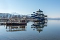
 Poertschach Wasserrutschenturm 09092007 04.jpg 3,872 × 2,592; 1.43 MB
-
 Poertschach Winklern und Mittagskogel 31012010 444.jpg 4,288 × 2,848; 7.7 MB
-
 Poertschach Halbinselpromenade Woerthersee-Blick Richtung Unterdellach 08032017 6496.jpg 7,360 × 4,912; 16.41 MB
-
 Poertschach Hauptstrasse Edelweiß-Bad Halbinsel-Blick 13012016 0061.jpg 7,360 × 4,912; 8.55 MB
-
 Poertschach Johannes-Brahms-Promenade Laterne mit Kletterrosen 27052017 8902.jpg 7,360 × 4,912; 20.07 MB
-
 Poertschach Johannes-Brahms-Promenade Promenadenbad Rutschenturm 08032017 6507.jpg 7,360 × 4,912; 16.25 MB
-
 Poertschach Johannes-Brahms-Promenade Promenadenbad Rutschenturm 08032017 6508.jpg 7,360 × 4,912; 15.36 MB
-
 Poertschach Johannes-Brahms-Promenade Promenadenbad Rutschenturm 17042017 7692.jpg 7,360 × 4,912; 14.9 MB
-
 Poertschach Johannes-Brahms-Promenade Wisteria-Bluete 03052016 1833.jpg 7,360 × 4,912; 18.64 MB
-
 Poertschach Landspitz MS Velden nach Abfahrt von Landebruecke 27052017 8855.jpg 7,360 × 4,912; 22.88 MB
-
 Poertschach Landspitz MS Velden nach Abfahrt von Landebruecke 27052017 8856.jpg 7,360 × 4,912; 24.09 MB
-
 Poertschach Niedere Gloriette Blick auf Woerthersee 28012007 05.jpg 3,760 × 2,528; 969 KB
-
 Poertschach Ostbucht Halbinsel Mittagskogel 28032015 1149.jpg 7,360 × 4,912; 16.43 MB
-
 Poertschach Woerther See Pyramidenkogel und Mittagskogel 08032017 6465.jpg 7,360 × 4,912; 11.88 MB
-
 Pörtschach am Wörther See Hauptstraße Edelweißbad Badesteg 21012018 2288.jpg 7,360 × 4,912; 17.31 MB
-
 Pörtschach am Wörther See Hauptstraße Edelweißbad Badesteg 21012018 2295.jpg 6,863 × 4,678; 16.58 MB
-
 Pörtschach Johannes-Brahms Promenade Bootssteg und Promenadenbad Rutschenturm 21012018 2337.jpg 6,882 × 4,822; 15.53 MB
-
 Pörtschach Winklern Gaisrückenstrasse Am Kåte Acker 12112017 1968.jpg 7,360 × 4,912; 22.36 MB
-
 Pörtschach Wörther See-Blick mit Ausflugsboot und Karawanken 31122017 2207.jpg 7,360 × 4,912; 12.96 MB
-
 Pörtschach Wörther See-Blick mit Blumeninsel und Advent-Boot 31122017 2202.jpg 7,360 × 4,711; 13.46 MB
-
 Pörtschach Wörther See-Blick mit Karawanken und Velden 31122017 2204.jpg 7,360 × 4,912; 12.7 MB
-
 Maria Wörth Wörther See Unterdellach Mittagskogel 10012023 9701.jpg 4,928 × 3,280; 7.89 MB
-
 Maria Wörth Wörther See Unterdellach Mittagskogel 10012023 9702.jpg 4,928 × 3,280; 9.32 MB
-
 Maria Wörth Wörther See Unterdellach Mittagskogel 10012023 9715.jpg 4,928 × 3,280; 7.74 MB
-
 Mittagskogel von Johannes-Brahms-Promenade in Poertschach 25012014 852.jpg 4,928 × 3,264; 8.23 MB
-
 Poertschach Halbinsel mit Mittagskogel 03022013 033.jpg 4,288 × 2,848; 2.51 MB
-
 Poertschach Johannes-Brahms-Promenade Promenadenbad Rutschenturm 21012016 0295.jpg 7,360 × 4,912; 12.83 MB
-
 Poertschach Johannes-Brahms-Promenade Promenadenbad Rutschenturm 46032016 0871.jpg 7,360 × 4,912; 16.38 MB
-
 Pörtschach 10.-Oktober-Straße 6 Appartementhaus NO-Ansicht 07042024 1016.jpg 4,928 × 3,280; 15.81 MB
-
 Pörtschach am Wörther See Halbinselpromenade 21012018 2327.jpg 7,360 × 4,912; 33.12 MB
-
 Pörtschach Halbinselpromenade Landspitz Schiffsanlegestelle 08032017 6501.jpg 7,360 × 4,912; 24.01 MB
-
 Pörtschach Halbinselpromenade Landspitz Schiffsanlegestelle 12022021 8626.jpg 4,928 × 3,280; 8.49 MB
-
 Pörtschach Hauptstrasse 261 Wörther See und Mittagskogel 03042015 0635.jpg 4,928 × 3,280; 8.57 MB
-
 Pörtschach Johannes-Brahms Promenade 24 Promenadenbad Rutschenturm 26122020 0296.jpg 7,360 × 4,912; 10.65 MB
-
 Pörtschach Johannes-Brahms-Promenade 24 Promenadenbad Rutschenturm 25112020 0238.jpg 7,360 × 4,912; 13.76 MB
-
 Pörtschach Johannes-Brahms-Promenade Blick zum Mittagskogel 12022021 8651.jpg 4,928 × 3,280; 5.77 MB
-
 Pörtschach Johannes-Brahms-Promenade Jilly Beach Bootshaus 07032021 0504.jpg 7,360 × 4,912; 15.43 MB
-
 Pörtschach Johannes-Brahms-Promenade Telefonzelle NO-Ansicht 07042024 1035.jpg 4,928 × 3,280; 13.92 MB
-
 Pörtschach Winklern Brockweg vulgo Brock Hof Nebengebäude Ost-Ansicht 30032019 6226.jpg 7,360 × 4,912; 26.7 MB
-
 Pörtschach Winklern Fronweg Wohnhäuser 06032011 4061.jpg 4,221 × 2,803; 2.06 MB
-
 Pörtschach Winklern Gaisrückenstraße Am Kåte Acker 12032017 6557.jpg 7,360 × 4,912; 21.94 MB
-
 Pörtschach Winklern Gaisrückenstraße Am Kåte Acker 12032017 6559.jpg 7,360 × 4,912; 26.96 MB
-
 Pörtschach Winklern Gaisrückenstraße Am Kåte NO-Ansicht 09012020 7967.jpg 7,360 × 4,912; 28.81 MB
-
 Pörtschach Winklern Gaisrückenstraße Am Kåte NO-Ansicht 09012020 7969.jpg 7,360 × 4,912; 26.39 MB
-
 Pörtschach Winklern Gaisrückenstraße Am Kåte NO-Ansicht 09012020 7972.jpg 7,360 × 4,912; 24.81 MB
-
 Pörtschach Winklern Gaisrückenstraße Am Kåte NO-Ansicht 09012020 7973.jpg 7,360 × 4,912; 24.54 MB
-
 Pörtschach Winklern Gaisrückenstraße Am Kåte NO-Ansicht 09012020 7975.jpg 7,360 × 4,912; 25.58 MB
-
 Pörtschach Winklern Gaisrückenstraße Am Kåte NO-Ansicht 12022020 8315.jpg 7,360 × 4,912; 22.86 MB
-
 Pörtschach Winklern Gaisrückenstraße Brock-Hof und Zocklwirt NO-Ansicht 24032022 2331.jpg 7,360 × 4,912; 23.23 MB
-
 Pörtschach Winklern Gaisrückenstraße Brock-Hof und Zocklwirt NO-Ansicht 24032022 2332.jpg 6,882 × 4,736; 24.48 MB
-
 Pörtschach Winklern Hauptstraße Edelweißbad Badesteg 18112015 9078.jpg 7,360 × 4,912; 15.18 MB
-
 Pörtschach Winklern Hauptstraße Edelweißbad Badesteg 25122023 0347.jpg 4,928 × 3,280; 9.4 MB
-
 Pörtschach Winklern Quellweg 38 Winklerner Alm 24032022 2318.jpg 7,360 × 4,912; 33.63 MB
-
 Pörtschach Winklern Quellweg Am Kåte Obstbaumkultur 29012020 8114.jpg 7,360 × 4,912; 24.34 MB
-
 Pörtschach Winklern Quellweg Am Kåte Obstbaumkultur 29012020 8115.jpg 7,360 × 4,912; 28.28 MB
-
 Pörtschach Winklern Quellweg Wanderweg 09012020 7990.jpg 7,360 × 4,912; 34.34 MB
-
 Pörtschach Winklern Quellweg Wanderweg 18022020 8346.jpg 7,360 × 4,912; 38.75 MB
-
 Pörtschach Winklern Tscheberweg 18 Wohnhaus NO-Ansicht 24032022 2321.jpg 7,360 × 4,912; 20.43 MB
-
 Pörtschach Wörther See Halbinsel mit Mittagskogel 08032017 6461.jpg 7,256 × 4,843; 15.58 MB
-
 Pörtschach Wörther See Halbinsel mit Mittagskogel 19022019 6058.jpg 7,360 × 4,912; 14.85 MB
-
 Pörtschach Wörther See Halbinsel mit Mittagskogel 19022019 6067.jpg 7,360 × 4,912; 11.36 MB
-
 Pörtschach Leonstein Blick auf den W-Teil des Wörther Sees 29032020 8596.jpg 7,242 × 4,833; 28.24 MB
-
 Schiefling am See Penken Techelweg Kathreinkogel 23092013 070.jpg 4,928 × 3,264; 9.31 MB
-
 Schiefling am See Penken Techelweg Mittagskogel 23092013 069.jpg 4,928 × 3,264; 8.92 MB
-
 St. Lambrecht (Rosegg).jpg 2,048 × 1,536; 642 KB
-
 Sunset At Faaker Lake In Villach Austria (124443089).jpeg 2,048 × 1,367; 348 KB
-
 Techelsberg Saag Blick über Wörther See zum Mittagskogel 24122019 7333.jpg 4,928 × 3,280; 6.68 MB
-
 Techelsberg am Wörther See Töschling Schloss Seefels und Mittagskogel 06012013 824.jpg 4,288 × 2,848; 917 KB
-
 Ulrichsberg von Saualm aus 04.JPG 4,000 × 3,000; 4.29 MB
-
 Velden Wörther See und Mittagskogel 06052019 6725.jpg 4,928 × 3,280; 8.81 MB
-
 Velden Pulpitsch Bildstock 14112010 468 DxO.jpg 4,288 × 2,848; 3.53 MB
-
 Velden Seecorso 10 Schlosshotel 24092013 2300.jpg 4,928 × 3,264; 11.47 MB
-
 Villach Innenstadt Drau Congress Center Brücke 15072020 9383.jpg 7,263 × 4,880; 16.07 MB
-
 Villach Innenstadt Europaplatz 1 Congress Center und Fußgängerbrücke 18082021 1187.jpg 7,360 × 4,912; 17.69 MB
-
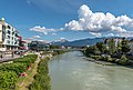
 Villach - Draubrücke.jpg 1,090 × 691; 481 KB
-
 Villach - panoramio (2).jpg 3,264 × 2,448; 4.39 MB
-
 Villach Bildstock.JPG 3,072 × 2,048; 3.65 MB
-
 Villach Mittagskogel.jpg 2,816 × 2,112; 3.74 MB
-
 Villach Pogoeriach 06022011 521.jpg 4,288 × 2,848; 1.95 MB
-
 Villach Pogoeriach 06022011 522.jpg 4,288 × 2,848; 2.34 MB
-
 Villach Sankt Agathen Friedensbrücke über die Drau 13042007 8253.jpg 2,500 × 1,673; 1.28 MB
-
 Villach, Austria - panoramio (17).jpg 5,184 × 3,456; 3.16 MB
-
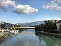
 Villach, die Drau, Blick zu den Karawanken, Fußgängerbrücke.jpg 2,551 × 1,701; 963 KB
-
 Wernberg Gottestal Pfarrkirche hl. Margareta und Friedhof 02072006 01.jpg 3,008 × 2,000; 1,010 KB
-
 Werzer-Bad-Eroeffnung Ost-Ansicht 01052013 113.jpg 4,928 × 3,264; 946 KB
-
 Werzer-Bad-Eroeffnung Seeblick 01052013 133.jpg 4,928 × 3,264; 1,010 KB


.jpeg)


.jpg)


.jpg)


.jpg)


.jpg)
.jpeg)


.jpg)


.jpg)


