Category:Molen Koningin Wilhelmina, Dongen
| Object location | | View all coordinates using: OpenStreetMap |
|---|
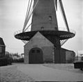
windmill in Dongen, Netherlands  | |||||
| Upload media | |||||
| Instance of | |||||
|---|---|---|---|---|---|
| Named after | |||||
| Location | Dongen, North Brabant, Netherlands | ||||
| Street address |
| ||||
| Located on street |
| ||||
| Has use | |||||
| Heritage designation |
| ||||
| Source of energy | |||||
 | |||||
|
This is a category about rijksmonument number 13216
|
| Address |
|
Media in category "Molen Koningin Wilhelmina, Dongen"
The following 11 files are in this category, out of 11 total.
-
 Dongen molen Koningin Wilhelmina.jpg 1,400 × 2,100; 1.55 MB
-
 Dorpsbebouwing met in het midden de korenmolen - Dongen - 20261055 - RCE.jpg 1,200 × 769; 149 KB
-
 KoninginWilhelmina-Dongen-2014-1.JPG 3,456 × 4,608; 5.06 MB
-
 KoninginWilhelmina-Dongen-2014-2.JPG 4,608 × 3,456; 5.58 MB
-
 KoninginWilhelmina-Dongen-2014-3.JPG 4,608 × 3,456; 6.51 MB
-
 KoninginWilhelmina-Dongen-2014-4.jpg 640 × 480; 62 KB
-
 Korenmolen Kon.Wilhelmina, aanzicht - Dongen - 20059492 - RCE.jpg 796 × 1,200; 159 KB
-
 Korenmolen Kon.Wilhelmina, exterieur - Dongen - 20059490 - RCE.jpg 1,200 × 1,193; 195 KB
-
 Korenmolen Kon.Wilhelmina, exterieur - Dongen - 20059491 - RCE.jpg 1,200 × 1,004; 144 KB
-
 Korenmolen, exterieur - Dongen - 20059489 - RCE.jpg 776 × 1,200; 100 KB
-
 Molen na restauratie - Dongen - 20059493 - RCE.jpg 1,200 × 804; 154 KB


