Category:Molen Ter Leede
| Object location | | View all coordinates using: OpenStreetMap |
|---|
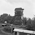
windmill in Leerdam, Netherlands  | |||||
| Upload media | |||||
| Instance of | |||||
|---|---|---|---|---|---|
| Location |
| ||||
| Street address |
| ||||
| Located on street |
| ||||
| Has use |
| ||||
| Heritage designation |
| ||||
| Source of energy | |||||
 | |||||
|
This is a category about rijksmonument number 24048
|
| Address |
|
Media in category "Molen Ter Leede"
The following 24 files are in this category, out of 24 total.
-
 2274378870055500858 - Flickr - bertknot.jpg 1,600 × 2,400; 566 KB
-
 Anne en Nel Wikipedia.jpg 1,937 × 1,453; 1.06 MB
-
 Bovenmolen van de polder - Leerdam - 20130212 - RCE.jpg 1,200 × 1,075; 311 KB
-
 Bovenmolen van de polder Brunsdel - Leerdam - 20130213 - RCE.jpg 1,200 × 1,163; 283 KB
-
 Leerdam - molen Ter Leede foto 2.jpg 1,200 × 1,200; 789 KB
-
 Leerdam - molen Ter Leede.jpg 1,000 × 1,500; 826 KB
-
 Leerdam met molen Ter Leede.JPG 1,200 × 800; 182 KB
-
 Leerdam, molen foto3 2010-06-27 11.20.JPG 2,592 × 3,456; 7.17 MB
-
 Molen COLL.S.J.BOUMA,GR.VOOR 42 - Unknown - 20484813 - RCE.jpg 629 × 900; 79 KB
-
 Overzicht van de achterzijde van de molen - Leerdam - 20382042 - RCE.jpg 1,200 × 1,200; 212 KB
-

-
 Wipwatermolen van de polder Bruinsdel en Hoog-Leerbroek - Leerdam - 20130226 - RCE.jpg 1,200 × 1,200; 245 KB
-
 Wipwatermolen van de polder Hoog Leerbroek en Bruinsdel - Leerdam - 20130219 - RCE.jpg 1,200 × 1,200; 254 KB
-

-

-
 Wipwatermolen, exterieur in restauratie - Leerdam - 20130221 - RCE.jpg 1,198 × 1,200; 262 KB
-
 Wipwatermolen, exterieur in restauratie - Leerdam - 20130222 - RCE.jpg 1,193 × 1,200; 174 KB
-

-
 Wipwatermolen, frontmuur achterwaterloop - Leerdam - 20130225 - RCE.jpg 1,200 × 1,200; 342 KB
-
 Wipwatermolen, in restauratie - Leerdam - 20130227 - RCE.jpg 1,193 × 1,200; 279 KB
-
 Wipwatermolen, in restauratie - Leerdam - 20130228 - RCE.jpg 1,200 × 1,200; 281 KB
-
 Wipwatermolen, oostelijke muur voorwaterloop - Leerdam - 20130223 - RCE.jpg 1,200 × 1,200; 431 KB
-
 Wipwatermolen, voorwaterloop - Leerdam - 20130224 - RCE.jpg 1,200 × 1,200; 383 KB
-
 ZH Leerdam, Ter Leede, wipmolen 02w.JPG 1,200 × 995; 617 KB


