Category:Molenbelt 4, Hattem
| Object location | | View all coordinates using: OpenStreetMap |
|---|
 | |||||
| Upload media | |||||
| Instance of | |||||
|---|---|---|---|---|---|
| Location | Hattem, Gelderland, Netherlands | ||||
| Street address |
| ||||
| Located on street |
| ||||
| Heritage designation |
| ||||
 | |||||
|
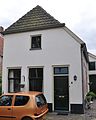
This is a category about rijksmonument number 20979
|
| Address |
|
Media in category "Molenbelt 4, Hattem"
The following 4 files are in this category, out of 4 total.
-
 Achtergevel - Hattem - 20103380 - RCE.jpg 1,200 × 1,195; 301 KB
-
 Hattem20979.jpg 2,357 × 2,939; 2.4 MB
-
 Overzicht voorgevel - Hattem - 20103377 - RCE.jpg 1,195 × 1,200; 301 KB
-
 Voorgevel - Hattem - 20103378 - RCE.jpg 1,200 × 1,195; 300 KB


