Category:Moleneind 12, Rijnsburg
| Object location | | View all coordinates using: OpenStreetMap |
|---|
building in Katwijk, Netherlands  | |||||
| Upload media | |||||
| Instance of | |||||
|---|---|---|---|---|---|
| Location | Rijnsburg, Katwijk, South Holland, Netherlands | ||||
| Street address |
| ||||
| Located on street |
| ||||
| Heritage designation |
| ||||
 | |||||
|
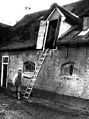
This is a category about rijksmonument number 33011
|
| Address |
|
Media in category "Moleneind 12, Rijnsburg"
The following 5 files are in this category, out of 5 total.
-
 Aanzicht - Rijnsburg - 20187029 - RCE.jpg 1,200 × 955; 253 KB
-
 Rijnsburg pand 17e of 18e eeuw.jpg 2,736 × 3,648; 3.55 MB
-

-
 Voorgevel - Rijnsburg - 20187030 - RCE.jpg 813 × 1,200; 242 KB
-