Category:Molstraat, Breda
| Object location | | View all coordinates using: OpenStreetMap |
|---|
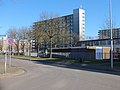
Nederlands: Afbeeldingen van de Molstraat, Breda in de wijk Biesdonk een onderdeel van het stadsdeel de Hoge Vucht in het noorden van Breda in de provincie Noord-Brabant in het zuiden van Nederland. De Molstraat begint nabij de rotonde op de straat de Doornboslaan, Breda en loopt door tot de kruising met de Brasschaatstraat, Breda. De Molstraat is niet ver van het Winkelcentrum Hoge Vucht.
street in Breda, the Netherlands | |||||
| Upload media | |||||
| Instance of | |||||
|---|---|---|---|---|---|
| Named after | |||||
| Location | Breda, North Brabant, Netherlands | ||||
| Street address |
| ||||
 | |||||
Subcategories
This category has only the following subcategory.
B
- Basisschool John F. Kennedy (4 F)
Media in category "Molstraat, Breda"
The following 5 files are in this category, out of 5 total.
-
 Biesdonk DSCF4830.jpg 2,048 × 1,536; 1.53 MB
-
 Gezonde Mooie Tanden DSCF4826.jpg 2,048 × 1,536; 1.56 MB
-
 Gezonde Mooie Tanden DSCF4829.jpg 2,048 × 1,536; 1.56 MB
-
 Roeselarestraat, Breda DSCF4866 copy.jpg 4,000 × 1,876; 1.51 MB
-
 Roeselarestraat, Breda DSCF4866.jpg 4,000 × 3,000; 4.62 MB


