Category:Moneydie
Media in category "Moneydie"
The following 51 files are in this category, out of 51 total.
-
 A road passing Drum Wood - geograph.org.uk - 5441848.jpg 1,024 × 683; 377 KB
-
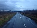 B8063 near Moneydie - geograph.org.uk - 3836778.jpg 1,600 × 1,200; 276 KB
-
 Barley, Moneydie - geograph.org.uk - 5441832.jpg 1,024 × 683; 304 KB
-
 Barley, Pitendynie - geograph.org.uk - 5442932.jpg 1,024 × 683; 283 KB
-
 Bench Mark, Smithy Cottage - geograph.org.uk - 2724411.jpg 480 × 640; 74 KB
-
 Blackhill - geograph.org.uk - 5441852.jpg 1,024 × 683; 342 KB
-
 Blackpark Farm - geograph.org.uk - 5442942.jpg 1,024 × 683; 299 KB
-
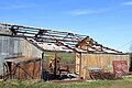 Burnt-out shed at Pittendynie - geograph.org.uk - 4425038.jpg 1,600 × 1,067; 495 KB
-
 Crops under netting - geograph.org.uk - 5441841.jpg 1,024 × 683; 298 KB
-
 Edge of Cosnakie Wood - geograph.org.uk - 5317956.jpg 1,600 × 1,067; 495 KB
-
 Entering Moneydie from the north (geograph 5317094).jpg 1,600 × 1,067; 457 KB
-
 Farm cottage at Pitendynie - geograph.org.uk - 5574974.jpg 800 × 533; 117 KB
-
 Farm road, Monydie - geograph.org.uk - 4800470.jpg 1,024 × 682; 279 KB
-
 Field at Pitendynie - geograph.org.uk - 5574980.jpg 1,024 × 682; 165 KB
-
 Fields by Moneydie - geograph.org.uk - 5441831.jpg 1,024 × 683; 320 KB
-
 Fields south of Moneydie Cottage - geograph.org.uk - 5818392.jpg 1,600 × 1,044; 352 KB
-
 Fleece-covered field, Moneydie - geograph.org.uk - 5818376.jpg 1,600 × 1,067; 394 KB
-
 Full barn at Pittendynie - geograph.org.uk - 5563295.jpg 5,184 × 3,888; 4.64 MB
-
 Gellybanks Wood - geograph.org.uk - 5441839.jpg 1,024 × 683; 361 KB
-
 Long straight on the B8063 - geograph.org.uk - 5563303.jpg 5,184 × 3,888; 5.99 MB
-
 Minor road near Moneydie - geograph.org.uk - 3836777.jpg 1,600 × 1,200; 476 KB
-
 Minor road near Moneydie - geograph.org.uk - 5574944.jpg 1,024 × 682; 206 KB
-
 Mixed woodland, Viewpark - geograph.org.uk - 2724469.jpg 640 × 480; 63 KB
-
 Mixed woodland, Viewpark - geograph.org.uk - 2724560.jpg 640 × 480; 76 KB
-
 Moneydie Church and Graveyard - geograph.org.uk - 727857.jpg 640 × 480; 101 KB
-
 Moneydie field - geograph.org.uk - 2550928.jpg 2,000 × 1,500; 568 KB
-
 Moneydie Smithy - geograph.org.uk - 5441835.jpg 1,024 × 683; 279 KB
-
 New forestry, Tavern Wood - geograph.org.uk - 5317054.jpg 1,600 × 1,067; 443 KB
-
 Old cottage and steading at Blackpark - geograph.org.uk - 5563281.jpg 5,184 × 3,888; 6.19 MB
-
 Pittendynie Farm - geograph.org.uk - 5317943.jpg 1,600 × 842; 189 KB
-
 Plough near Pittendynie - geograph.org.uk - 2724426.jpg 640 × 480; 78 KB
-
 Private drive to Viewpark - geograph.org.uk - 5574984.jpg 1,024 × 682; 191 KB
-
 Road (B8063) beside the felled Bothy Wood - geograph.org.uk - 6135378.jpg 4,000 × 3,000; 2.87 MB
-
 Road (B8063) near to Pitendynie Farm Cottages - geograph.org.uk - 6139251.jpg 4,000 × 3,000; 3.34 MB
-
 Road junction - geograph.org.uk - 5317064.jpg 1,600 × 1,067; 540 KB
-
 Road junction near Moneydie - geograph.org.uk - 2724402.jpg 640 × 480; 60 KB
-
 Road junction near Moneydie - geograph.org.uk - 4425025.jpg 1,600 × 1,067; 563 KB
-
 Road passing through Moneydie - geograph.org.uk - 6136433.jpg 4,000 × 3,000; 4.45 MB
-
 Road through the woods - geograph.org.uk - 5316753.jpg 1,600 × 1,067; 423 KB
-
 Road through the woods - geograph.org.uk - 5316764.jpg 1,600 × 1,067; 333 KB
-
 Ruin near Millhole - geograph.org.uk - 5442936.jpg 1,024 × 683; 364 KB
-
 Run chaps, someone with a camera^ - geograph.org.uk - 2724451.jpg 640 × 480; 76 KB
-
 Shochie Burn, Moneydie - geograph.org.uk - 2513853.jpg 397 × 640; 307 KB
-
 Smithy Cottage, Moneydie - geograph.org.uk - 5574958.jpg 1,024 × 666; 177 KB
-
 Sowing near Pittendynie - geograph.org.uk - 2724430.jpg 640 × 480; 98 KB
-
 Telephone Poles - geograph.org.uk - 5563287.jpg 5,184 × 3,888; 5.57 MB
-
 Track into Pitlandie Wood - geograph.org.uk - 5316761.jpg 1,600 × 1,067; 631 KB
-
 Track near Moneydie - geograph.org.uk - 2718364.jpg 640 × 480; 76 KB
-
 Wheat, Moneydie - geograph.org.uk - 5441836.jpg 1,024 × 683; 280 KB
-
 Shochie Burn, Moneydie - geograph.org.uk - 278391.jpg 640 × 480; 86 KB
-
 Tavern Wood - geograph.org.uk - 278392.jpg 640 × 480; 61 KB


.jpg)


_beside_the_felled_Bothy_Wood_-_geograph.org.uk_-_6135378.jpg)
_near_to_Pitendynie_Farm_Cottages_-_geograph.org.uk_-_6139251.jpg)


