Category:Mont Vernon, New Hampshire
| Object location | | View all coordinates using: OpenStreetMap |
|---|
human settlement in Hillsborough County, New Hampshire, United States of America   | |||||
| Upload media | |||||
| Instance of | |||||
|---|---|---|---|---|---|
| Location | Hillsborough County, New Hampshire | ||||
| Inception |
| ||||
| Population |
| ||||
| Area |
| ||||
| Elevation above sea level |
| ||||
| official website | |||||
 | |||||
Subcategories
This category has the following 4 subcategories, out of 4 total.
L
- Lamson Farm (4 F)
M
- Mont Vernon Town Hall (2 F)
Media in category "Mont Vernon, New Hampshire"
The following 5 files are in this category, out of 5 total.
-
 Alex Preston at Daland Library 2.0.jpg 561 × 800; 365 KB
-
 Alex Preston at Daland Library.jpg 674 × 800; 590 KB
-
 Appleton Academy, Mont Vernon, 1868.JPG 879 × 870; 191 KB
-
 Mont Vernon Congregational Church, Mont Vernon NH.jpg 3,264 × 2,448; 2 MB
-
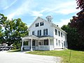 Police Department, Mont Vernon NH.jpg 3,264 × 2,448; 1.99 MB


