Category:Montana Secondary Highway 298
 | number: | (two hundred ninety-eight) |
|---|---|---|
| Secondary state highways in Montana: | 278 · 287 · 298 · 300 · 314 |
secondary state highway in Park and Sweet Grass counties in Montana, United States | |||||
| Upload media | |||||
| Instance of | |||||
|---|---|---|---|---|---|
| Location |
| ||||
| Transport network |
| ||||
| Inception |
| ||||
| Length |
| ||||
| Terminus | |||||
| |||||
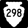
English: Media related to Montana Secondary Highway 298, a 25.655-mile (41.288 km) secondary state highway in Park and Sweet Grass counties in southwestern Montana, United States, that connects the Historic Main Boulder Ranger Station and Visitor Center in the Gallatin National Forest with U.S. Route 191 in in Big Timber.
Subcategories
This category has only the following subcategory.
Media in category "Montana Secondary Highway 298"
This category contains only the following file.
-
 MT-sec-298.svg 600 × 600; 9 KB