Category:Monte-Rosa-Hütte
| Object location | | View all coordinates using: OpenStreetMap |
|---|
mountain hut  | |||||
| Upload media | |||||
| Instance of | |||||
|---|---|---|---|---|---|
| Location | Valais, Switzerland | ||||
| Owned by | |||||
| Operator | |||||
| Inception |
| ||||
| Date of official opening |
| ||||
| Mountain range | |||||
| Elevation above sea level |
| ||||
| Maximum capacity |
| ||||
| official website | |||||
 | |||||
Subcategories
This category has the following 2 subcategories, out of 2 total.
A
- Alte Monte-Rosa-Hütte (14 F)
N
- Neue Monte-Rosa-Hütte (24 F)
Media in category "Monte-Rosa-Hütte"
The following 4 files are in this category, out of 4 total.
-
 Aerial Photo of Monte Rosa Massif - Wallis - Switzerland (cropped).jpg 4,481 × 4,450; 16.56 MB
-
 Aerial Photo of Monte Rosa Massif - Wallis - Switzerland.jpg 5,442 × 5,093; 24.59 MB
-
 Patrouille bei der Betempshütte - CH-BAR - 3236979.tif 3,000 × 2,135; 1.48 MB
-
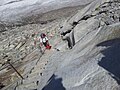 Salita alla Monte Rosa Hutte.jpg 2,048 × 1,536; 760 KB
.jpg)

