Category:Monte Mongioie
|
Monte Mongioie has an entry on OpenStreetMap (show). |
mountain in Italy  Monte Mongioie | |||||
| Upload media | |||||
| Instance of | |||||
|---|---|---|---|---|---|
| Part of |
| ||||
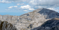
| Location | Province of Cuneo, Piedmont, Italy | ||||
| Mountain range | |||||
| Topographic prominence |
| ||||
| Topographic isolation |
| ||||
| Elevation above sea level |
| ||||
 | |||||
Media in category "Monte Mongioie"
The following 7 files are in this category, out of 7 total.
-
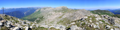 Bric Conoia NW view.png 6,963 × 1,744; 18.23 MB
-
 Lago Raschera e Monte Mongioie da Cima Ferlette.png 4,369 × 2,745; 13.82 MB
-
 Mongioie da SP1.jpg 1,024 × 684; 146 KB
-
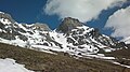 Mongioie. Canale delle Scaglie.jpg 3,264 × 1,832; 1,012 KB
-
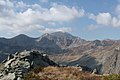 Mongioie01.jpg 1,024 × 683; 156 KB
-
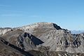 Monte Mongioie da Est.JPG 4,272 × 2,848; 4.77 MB
-
 Monte Mongioie da Pian Ballaur.png 3,954 × 2,011; 11.67 MB


