Home
Random
Nearby
Log in
Settings
Donate
About Wikimedia Commons
Disclaimers
Search
Category
:
Moody Bridge (Garberville, California)
Language
Watch
Edit
Media in category "Moody Bridge (Garberville, California)"
The following 26 files are in this category, out of 26 total.
General east to west elevated view of Moody Bridge placing it within and in relation to the surrounding rural environment. - Moody Bridge, Spanning South Fork Eel River, HAER CAL,12-GARB.V,1-20.tif
5,071 × 4,072; 19.7 MB
General elevation view (looking easterly) clearly shows aesthetic appeal of Moody Bridge. - Moody Bridge, Spanning South Fork Eel River, Garberville, Humboldt County, CA HAER CAL,12-GARB.V,1-17.tif
5,000 × 3,970; 18.93 MB
General elevation view from the southwest end of Moody Bridge. - Moody Bridge, Spanning South Fork Eel River, Garberville, Humboldt County, CA HAER CAL,12-GARB.V,1-2.tif
5,000 × 3,978; 18.97 MB
General South to North view of floor beam and stringer system used in Parker, Pin-Connected, Through Truss Bridge (Moody Bridge) near Garberville, California. - Moody Bridge, HAER CAL,12-GARB.V,1-1.tif
4,007 × 5,000; 19.11 MB
General view (looking northeast) of north abutment and approach timber structure of Moody Bridge. - Moody Bridge, Spanning South Fork Eel River, Garberville, Humboldt County, HAER CAL,12-GARB.V,1-18.tif
5,000 × 3,969; 18.93 MB
General view (looking west) clearly shows weathered concrete of south abutment of Moody Bridge. - Moody Bridge, Spanning South Fork Eel River, Garberville, Humboldt County, CA HAER CAL,12-GARB.V,1-19.tif
5,000 × 3,976; 18.96 MB
General view of pier and abutment structures from southeast end of Moody Bridge. - Moody Bridge, Spanning South Fork Eel River, Garberville, Humboldt County, CA HAER CAL,12-GARB.V,1-3.tif
4,672 × 3,736; 16.65 MB
General views of Moody Bridge, in descending order- 1) the northern approach with a partial 'barrel shot', 2) partial view of southern approach detailing bridge decking, HAER CAL,12-GARB.V,1-23.tif
3,993 × 5,000; 19.04 MB
A 'barrel shot' from north to south of Moody Bridge. This view clearly shows bridge timber decking. - Moody Bridge, Spanning South Fork Eel River, Garberville, Humboldt County, HAER CAL,12-GARB.V,1-16.tif
4,998 × 3,937; 18.77 MB
A 'barrel shot' from south to north of Moody Bridge. - Moody Bridge, Spanning South Fork Eel River, Garberville, Humboldt County, CA HAER CAL,12-GARB.V,1-4.tif
4,997 × 3,981; 18.97 MB
A 'barrel shot' from south to north of Moody Bridge. - Moody Bridge, Spanning South Fork Eel River, Garberville, Humboldt County, CA HAER CAL,12-GARB.V,1-7.tif
4,678 × 3,742; 16.7 MB
Detail view (looking east) of inclined end post pin connection of Moody Bridge. - Moody Bridge, Spanning South Fork Eel River, Garberville, Humboldt County, CA HAER CAL,12-GARB.V,1-6.tif
5,046 × 4,046; 19.47 MB
Detail view (looking east) of pin connection of vertical member at the third panel point north from south abutment of Moody Bridge. - Moody Bridge, Spanning South Fork Eel River HAER CAL,12-GARB.V,1-8.tif
5,000 × 3,956; 18.87 MB
Detail view (looking east) of pin connection of vertical tensile members at the fifth panel point north from south abutment of Moody Bridge. - Moody Bridge, Spanning South Fork HAER CAL,12-GARB.V,1-9.tif
5,000 × 3,994; 19.05 MB
Detail view (looking east) of pin connection of vertical tensile members between panels nine end ten of Moody Bridge - Moody Bridge, Spanning South Fork Eel River, Garberville, HAER CAL,12-GARB.V,1-11.tif
5,000 × 3,991; 19.03 MB
Detail view (looking east) of riveted cconnection of top chord and vertical members at the second panel point north from south abutment of Moody Bridge. - Moody Bridge, HAER CAL,12-GARB.V,1-12.tif
5,000 × 3,985; 19 MB
Detail view (looking north) of lower chord pin connection between panels four and fire of Moody Bridge. - Moody Bridge, Spanning South Fork Eel River, Garberville, Humboldt HAER CAL,12-GARB.V,1-13.tif
4,023 × 5,000; 19.19 MB
Detail view of north abutment pin connection of Moody Bridge - Moody Bridge, Spanning South Fork Eel River, Garberville, Humboldt County, CA HAER CAL,12-GARB.V,1-15.tif
5,000 × 4,007; 19.11 MB
Detail view of pin connected lower chord members at the north end of panel three of Moody Bridge. - Moody Bridge, Spanning South Fork Eel River, Garberville, Humboldt County, HAER CAL,12-GARB.V,1-14.tif
5,000 × 4,006; 19.1 MB
Detail view of pin connection truss members of central panel point of Moody Bridge. - Moody Bridge, Spanning South Fork Eel River, Garberville, Humboldt County, CA HAER CAL,12-GARB.V,1-10.tif
5,000 × 3,961; 18.89 MB
Detail view of sign suspended from portal strut (this sign was located at the same place at both ends of Moody Bridge). Bottom- General elevation view to southeast showing HAER CAL,12-GARB.V,1-22.tif
4,028 × 5,000; 19.21 MB
Detail view of south abutment roller connection of Moody Bridge. - Moody Bridge, Spanning South Fork Eel River, Garberville, Humboldt County, CA HAER CAL,12-GARB.V,1-5.tif
5,000 × 3,970; 18.93 MB
Moody Bridge truss repair plans showing existing area of damage along with repair procedures for correcting damage and returning truss to structural integrity. - Moody Bridge, HAER CAL,12-GARB.V,1-24.tif
5,000 × 3,950; 18.84 MB
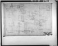
Original plan for Moody Bridge as prepared by G. W. Connors. - Moody Bridge, Spanning South Fork Eel River, Garberville, Humboldt County, CA HAER CAL,12-GARB.V,1-25.tif
5,000 × 3,964; 18.9 MB
Southern approach span plan and elevation views for pier and abutment structural changes required after flood of December 1955 on Moody Bridge. - Moody Bridge, Spanning South HAER CAL,12-GARB.V,1-21.tif
5,000 × 3,953; 18.85 MB
Southern approach span showing detail plan, elevation, and existing views for pier and abutment structural changes required after flood of December 1955. - Moody Bridge, HAER CAL,12-GARB.V,1-26.tif
5,000 × 3,953; 18.85 MB