Category:Moorland fires in the United Kingdom (controlled)
Media in category "Moorland fires in the United Kingdom (controlled)"
The following 23 files are in this category, out of 23 total.
-
 Burning Heather above Whey Gutter - geograph.org.uk - 1212854.jpg 640 × 480; 72 KB
-
 Controlled burning of heather in Midgley Moor - geograph.org.uk - 4478622.jpg 2,000 × 1,501; 800 KB
-

-
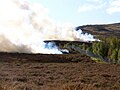
 Controlling gorse on Dartmoor 752.jpg 3,600 × 1,725; 2.49 MB
-
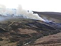
 Controlling gorse on Dartmoor 755.jpg 2,800 × 1,348; 1.27 MB
-
 Glen Quaich - geograph.org.uk - 1242679.jpg 480 × 640; 73 KB
-
 Heather Burning Near Whetstone Gate - geograph.org.uk - 331026.jpg 640 × 480; 51 KB
-
 Heather burning, Glen Quaich - geograph.org.uk - 1548689.jpg 640 × 480; 102 KB
-
 Heather burning.jpg 400 × 255; 25 KB
-

-

-
 Setting the heather on fire - geograph.org.uk - 1187676.jpg 640 × 452; 41 KB
-
 Swailing.jpg 3,216 × 2,734; 1.38 MB
-
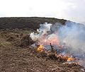
 The results of muirburn - geograph.org.uk - 855167.jpg 640 × 429; 112 KB
-
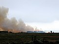
 Thwaite from above Scar Houses - geograph.org.uk - 700633.jpg 640 × 480; 46 KB
-
 View along route of Sleddale beck - geograph.org.uk - 628322.jpg 640 × 480; 54 KB
-
 Watching the para-gliders - geograph.org.uk - 695333.jpg 419 × 640; 145 KB
-

-
 Baysdale - controlled moor burning - geograph.org.uk - 150329.jpg 640 × 480; 64 KB
-

-

-

-
 Top End and the view over Westerdale - geograph.org.uk - 279835.jpg 640 × 365; 39 KB


