Category:Moorlands in East Lothian
Media in category "Moorlands in East Lothian"
The following 99 files are in this category, out of 99 total.
-
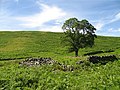
 Bridge over Fageny Water - geograph.org.uk - 840197.jpg 640 × 480; 72 KB
-
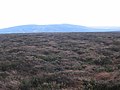
 Moorland, Ling Rig - geograph.org.uk - 1481089.jpg 640 × 480; 80 KB
-
 Newlands Hill - geograph.org.uk - 208805.jpg 639 × 458; 97 KB
-
 Wet area, head of Soonhope - geograph.org.uk - 1290523.jpg 480 × 640; 122 KB
-
 Aikieside Burn - geograph.org.uk - 1503404.jpg 640 × 480; 101 KB
-
 Aikieside Burn - geograph.org.uk - 1503432.jpg 640 × 480; 107 KB
-
 Below Kingside Rig - geograph.org.uk - 1423907.jpg 640 × 359; 79 KB
-
 Below Wanside Rig - geograph.org.uk - 150430.jpg 640 × 480; 82 KB
-
 Bleak Law - geograph.org.uk - 163997.jpg 640 × 480; 88 KB
-
 Bleak Law - geograph.org.uk - 167548.jpg 640 × 433; 81 KB
-
 Bleak Law - geograph.org.uk - 205743.jpg 640 × 480; 98 KB
-
 Blooming Heather^ - geograph.org.uk - 205669.jpg 640 × 480; 104 KB
-
 Brookside Burn - geograph.org.uk - 163991.jpg 480 × 640; 74 KB
-
 Bullhope Law - geograph.org.uk - 1493635.jpg 640 × 480; 134 KB
-
 Burn Hope - geograph.org.uk - 250497.jpg 640 × 480; 85 KB
-
 Burnt area, Hogs Law - geograph.org.uk - 285688.jpg 640 × 467; 78 KB
-
 Burnt heather, Priest Law - geograph.org.uk - 1496186.jpg 640 × 480; 109 KB
-
 Burnt hillside - geograph.org.uk - 1423955.jpg 640 × 359; 89 KB
-
 Burnt strip, Mid Hill - geograph.org.uk - 244964.jpg 640 × 480; 98 KB
-
 Butt number 5 - geograph.org.uk - 1494091.jpg 640 × 480; 136 KB
-
 Butts, Lowrans Law - geograph.org.uk - 1493650.jpg 640 × 480; 126 KB
-
 Clints Dod - geograph.org.uk - 244955.jpg 640 × 480; 97 KB
-
 Deep heather - geograph.org.uk - 244979.jpg 640 × 480; 100 KB
-
 Dog Law - geograph.org.uk - 303227.jpg 640 × 480; 84 KB
-
 Dunbar Common - geograph.org.uk - 163433.jpg 640 × 480; 99 KB
-
 Edge of newly burnt moorland - geograph.org.uk - 205665.jpg 640 × 480; 102 KB
-
 Edge of the moors. - geograph.org.uk - 150437.jpg 640 × 443; 76 KB
-
 Enclosure, Soonhope - geograph.org.uk - 515354.jpg 640 × 480; 104 KB
-
 Fall Burn seen from West Hopes - geograph.org.uk - 1423821.jpg 640 × 480; 83 KB
-
 Fank, Whalplaw Burn - geograph.org.uk - 286294.jpg 480 × 640; 95 KB
-
 Faseny Water - geograph.org.uk - 236821.jpg 640 × 480; 89 KB
-
 Garvald-Whiteadder road - geograph.org.uk - 8093.jpg 640 × 457; 83 KB
-
 Gate on the Herring Road - geograph.org.uk - 203136.jpg 640 × 480; 109 KB
-
 Goes Law - geograph.org.uk - 236808.jpg 640 × 480; 96 KB
-
 Grouse Butt - geograph.org.uk - 205684.jpg 640 × 480; 103 KB
-
 Grouse Moor, Sheil Rigg - geograph.org.uk - 121010.jpg 640 × 480; 249 KB
-
 Grouse moorland at Newbigging Rig - geograph.org.uk - 1438610.jpg 640 × 427; 133 KB
-
 Gullies, Hartside Edge - geograph.org.uk - 184005.jpg 640 × 480; 126 KB
-
 Hartside Edge - geograph.org.uk - 183998.jpg 640 × 480; 100 KB
-
 Head of Jock's Burn - geograph.org.uk - 285759.jpg 640 × 480; 102 KB
-
 Head of the Brookside Burn - geograph.org.uk - 163995.jpg 640 × 480; 83 KB
-
 Headshaw Burn - geograph.org.uk - 519260.jpg 640 × 480; 110 KB
-
 Headshaw Hill - geograph.org.uk - 519257.jpg 640 × 480; 138 KB
-
 Heather Moorland - geograph.org.uk - 205608.jpg 640 × 480; 87 KB
-
 Hog Hill - geograph.org.uk - 515324.jpg 640 × 480; 90 KB
-
 Hog Hill - geograph.org.uk - 515341.jpg 640 × 480; 100 KB
-
 Hogs Burn - geograph.org.uk - 285684.jpg 639 × 460; 89 KB
-
 Hope Hills - geograph.org.uk - 1423835.jpg 640 × 480; 89 KB
-
 Jock's Burn - geograph.org.uk - 285851.jpg 640 × 448; 73 KB
-
 Lammermuir heather 1 - geograph.org.uk - 180577.jpg 640 × 480; 144 KB
-
 Lammermuir heather 2 - geograph.org.uk - 180579.jpg 640 × 480; 121 KB
-
 Lammermuir heather 3 - geograph.org.uk - 180583.jpg 640 × 480; 118 KB
-
 Lammermuir heather 6 - geograph.org.uk - 180599.jpg 640 × 480; 145 KB
-
 Lammermuir roadside. - geograph.org.uk - 150422.jpg 640 × 368; 53 KB
-
 Ling Rig - geograph.org.uk - 203752.jpg 480 × 640; 73 KB
-
 Little Says Law - geograph.org.uk - 238607.jpg 640 × 480; 104 KB
-
 Little Says Law post - geograph.org.uk - 180603.jpg 640 × 480; 114 KB
-
 Longhope Rig - geograph.org.uk - 286280.jpg 640 × 480; 101 KB
-
 Mid Hill - geograph.org.uk - 244966.jpg 640 × 480; 104 KB
-
 Moor beside High Wood - geograph.org.uk - 151366.jpg 500 × 375; 84 KB
-
 Moorland Mosaic - geograph.org.uk - 205607.jpg 640 × 480; 94 KB
-
 Moorland on Hare Cleuch Rig - geograph.org.uk - 238674.jpg 480 × 640; 121 KB
-
 Moorland, Lammermuir Hills. - geograph.org.uk - 238629.jpg 640 × 445; 94 KB
-
 Mossy Burn - geograph.org.uk - 203144.jpg 640 × 480; 100 KB
-
 Newlands Hill - geograph.org.uk - 163979.jpg 640 × 480; 91 KB
-
 Newlands Hill - geograph.org.uk - 163998.jpg 640 × 480; 88 KB
-
 Newlands Hill - geograph.org.uk - 209381.jpg 640 × 480; 86 KB
-
 Newlands Hill - geograph.org.uk - 209386.jpg 640 × 480; 77 KB
-
 Nightmare terrain^ - geograph.org.uk - 205751.jpg 640 × 480; 88 KB
-
 North Hart Law - geograph.org.uk - 285858.jpg 640 × 480; 99 KB
-
 North Hart Law - geograph.org.uk - 286225.jpg 640 × 419; 54 KB
-
 Northern slopes of Harestone hill - geograph.org.uk - 180610.jpg 640 × 480; 119 KB
-
 Not the Nine Stone Ring - geograph.org.uk - 143140.jpg 640 × 480; 103 KB
-
 On Bleak Law. - geograph.org.uk - 9298.jpg 640 × 480; 75 KB
-
 On Dunbar Common - geograph.org.uk - 163430.jpg 640 × 480; 73 KB
-
 On Watch Law - geograph.org.uk - 184008.jpg 640 × 480; 97 KB
-
 Peat Law - geograph.org.uk - 285319.jpg 640 × 480; 104 KB
-
 Peat Law from Hogs Law - geograph.org.uk - 285677.jpg 640 × 480; 86 KB
-
 Priest Law - geograph.org.uk - 220575.jpg 640 × 480; 109 KB
-
 Rabbit hole - geograph.org.uk - 244968.jpg 640 × 480; 144 KB
-
 Railway hut, Aikieside - geograph.org.uk - 220562.jpg 640 × 480; 81 KB
-
 Rammer Cleuch - geograph.org.uk - 203705.jpg 640 × 480; 77 KB
-
 Rangely Kip - geograph.org.uk - 8090.jpg 640 × 392; 49 KB
-
 Redstone Rig - geograph.org.uk - 326138.jpg 640 × 480; 101 KB
-
 Riddell Law - geograph.org.uk - 515360.jpg 480 × 640; 114 KB
-
 Rook Law - geograph.org.uk - 244980.jpg 640 × 480; 72 KB
-
 Seenes Law - geograph.org.uk - 286274.jpg 640 × 480; 94 KB
-
 Sheep fank, Faseny Bridge - geograph.org.uk - 238656.jpg 640 × 480; 106 KB
-
 Sheep fold and track, Clints Dod - geograph.org.uk - 244944.jpg 640 × 480; 85 KB
-
 Soonhope - geograph.org.uk - 515350.jpg 640 × 480; 91 KB
-
 Soonhope - geograph.org.uk - 515363.jpg 640 × 480; 85 KB
-
 South Hart Law - geograph.org.uk - 285854.jpg 640 × 439; 81 KB
-
 The head of the Aikieside Burn - geograph.org.uk - 220581.jpg 640 × 480; 98 KB
-
 View to Spartleton - geograph.org.uk - 8092.jpg 640 × 381; 32 KB
-
 Wedder Law - geograph.org.uk - 285755.jpg 640 × 480; 105 KB
-
 West Hill. - geograph.org.uk - 106391.jpg 640 × 480; 56 KB
-
 Wester Dod - geograph.org.uk - 10365.jpg 640 × 480; 65 KB
-
 Whalplaw Burn - geograph.org.uk - 286259.jpg 640 × 480; 97 KB
-


