Category:Mossbank, Shetland Islands
village in the Shetland Islands, Scotland, UK  | |||||
| Upload media | |||||
| Instance of | |||||
|---|---|---|---|---|---|
| Location |
| ||||
 | |||||
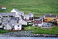
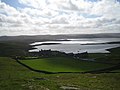
en:Mossbank, Shetland is a village in the north east of the Mainland of Shetland, Scotland. Originally served by an inter island ferry steamer from Lerwick, this ceased when the Yell Sound ferry commenced from the small port of Toft, approximately 1 mile further north. The village was profoundly changed in the early 80s when construction began on the nearby Sullom Voe oil terminal. Large amounts of temporary accommodation were erected to house the construction workforce, with the population expanding from 130 in the early 70s to about a thousand a decade later.}}
Media in category "Mossbank, Shetland Islands"
The following 66 files are in this category, out of 66 total.
-
 A968 below Hill of Neegarth - geograph.org.uk - 1180350.jpg 640 × 426; 87 KB
-
 A968 below Hill of Swinister - geograph.org.uk - 1180321.jpg 640 × 426; 70 KB
-
 Abandoned croft at Sandwick - geograph.org.uk - 1272419.jpg 640 × 480; 57 KB
-
 Approach to Scatsta Airfield - geograph.org.uk - 1180638.jpg 640 × 426; 37 KB
-

-
 Brei Water Bonidale - geograph.org.uk - 428851.jpg 640 × 275; 46 KB
-
 Burn of Laxobigging, Graven - geograph.org.uk - 693644.jpg 640 × 469; 79 KB
-
 Cairn mossbank.jpg 2,240 × 1,684; 815 KB
-
-
 Collafirth Pier, Delting. - geograph.org.uk - 644292.jpg 640 × 480; 50 KB
-
 Collafirth, Delting - geograph.org.uk - 345737.jpg 640 × 382; 45 KB
-
 Croft House Ruin - geograph.org.uk - 435431.jpg 640 × 480; 150 KB
-
 Foreshore - geograph.org.uk - 550542.jpg 640 × 480; 70 KB
-
 Gerda Water - geograph.org.uk - 710233.jpg 640 × 385; 32 KB
-
 Hill of Swinister - geograph.org.uk - 13925.jpg 640 × 399; 104 KB
-
 Houb of Scatsta - geograph.org.uk - 313527.jpg 600 × 384; 29 KB
-
 Jetty Wall - geograph.org.uk - 5233437.jpg 3,648 × 2,736; 4.32 MB
-
 Kirkabister Lunnasting - geograph.org.uk - 630603.jpg 640 × 517; 55 KB
-
 Landslide - geograph.org.uk - 578166.jpg 640 × 426; 72 KB
-
 Longa Water - geograph.org.uk - 345728.jpg 640 × 402; 37 KB
-
 Longa Water - geograph.org.uk - 553710.jpg 640 × 427; 75 KB
-
 Longa Water, Vidlin - geograph.org.uk - 146739.jpg 640 × 435; 52 KB
-
 Loomi Shun - geograph.org.uk - 428864.jpg 640 × 266; 39 KB
-
 Memorial cross - geograph.org.uk - 629837.jpg 640 × 421; 336 KB
-
 Mill Loch of Sandwick - geograph.org.uk - 435440.jpg 640 × 480; 101 KB
-
 Mill Loch of Sandwick - geograph.org.uk - 435445.jpg 640 × 480; 143 KB
-
 Mill Loch of Sandwick - geograph.org.uk - 435457.jpg 640 × 480; 129 KB
-
 Mirka Water - geograph.org.uk - 428837.jpg 640 × 416; 84 KB
-
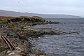
 Mossbank and Firths Voe - geograph.org.uk - 52989.jpg 640 × 432; 56 KB
-
 Mossbank from the east - geograph.org.uk - 5804802.jpg 1,600 × 1,067; 445 KB
-
 Mossbank from Yell Sound - geograph.org.uk - 3734273.jpg 1,024 × 682; 97 KB
-
 Mossbank Haa.jpg 1,024 × 768; 171 KB
-
 Mossbank Jetty - geograph.org.uk - 5233433.jpg 3,648 × 2,736; 4.24 MB
-
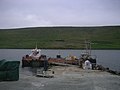
 Mossbank pier - geograph.org.uk - 874177.jpg 640 × 426; 59 KB
-
 Mossbank Primary School - geograph.org.uk - 1065397.jpg 640 × 426; 71 KB
-

-
 Mossbank view from old crossing - geograph.org.uk - 5193760.jpg 3,648 × 2,736; 4.09 MB
-
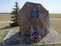
 Mossbank, Delting Disaster Memorial - geograph.org.uk - 3736849.jpg 640 × 480; 87 KB
-
 Mossbank, Delting Memorial detail - geograph.org.uk - 3736851.jpg 640 × 480; 62 KB
-
 Mossbank, large white house - geograph.org.uk - 3736856.jpg 640 × 480; 50 KB
-
 Mossbank, postbox № ZE2 2, Firth - geograph.org.uk - 2651316.jpg 640 × 480; 72 KB
-
 Mossbank, postbox № ZE2 98 - geograph.org.uk - 3558674.jpg 480 × 640; 96 KB
-
 Mossbank, Shetland - geograph.org.uk - 5922993.jpg 800 × 600; 657 KB
-
 Mossbank, the jetty - geograph.org.uk - 3736861.jpg 640 × 480; 70 KB
-
 Mossbank, the post office - geograph.org.uk - 3558679.jpg 480 × 640; 66 KB
-
 Mossbank, the Welcome Inn - geograph.org.uk - 3736853.jpg 640 × 480; 43 KB
-

-
 Mossbank.1. Shetland.jpg 3,872 × 2,592; 2.28 MB
-
 Mossbank.2. Shetland.jpg 3,872 × 2,592; 1.06 MB
-
 MossbankFromTheAir.JPG 2,832 × 2,128; 2.26 MB
-
 MV Hendra arriving at Vidlin Pier - geograph.org.uk - 157826.jpg 640 × 480; 76 KB
-
 Outrabister House - geograph.org.uk - 533473.jpg 640 × 480; 73 KB
-
 Queen Victoria Rock - geograph.org.uk - 629895.jpg 640 × 539; 392 KB
-
 Rain cloud over Mossbank - geograph.org.uk - 4764386.jpg 1,024 × 682; 92 KB
-
 Ruined mill - geograph.org.uk - 550595.jpg 640 × 480; 79 KB
-
 South Ayre, Dales Voe - geograph.org.uk - 2862.jpg 529 × 347; 125 KB
-
 Starns Water - geograph.org.uk - 428829.jpg 640 × 328; 56 KB
-

-
 Sunbeams over Mossbank - geograph.org.uk - 1042741.jpg 640 × 395; 39 KB
-
 Sunrise over Mossbank from Toft - geograph.org.uk - 4218165.jpg 1,024 × 681; 77 KB
-
 Sunrise over Mossbank from Toft - geograph.org.uk - 4218167.jpg 1,024 × 681; 72 KB
-
 The Pier at Mossbank, Shetland - geograph.org.uk - 198058.jpg 640 × 480; 62 KB
-
 Toft, two ferries - geograph.org.uk - 3651627.jpg 640 × 480; 50 KB
-
 Colla Firth, Shetland - geograph.org.uk - 198063.jpg 640 × 480; 74 KB
-
 Pier at Colla Firth, Shetland - geograph.org.uk - 198066.jpg 640 × 480; 113 KB
-
 West Lunna Voe - geograph.org.uk - 90863.jpg 640 × 480; 68 KB


