Category:Mount Baker National Forest
| Upload media | |||||
| Instance of | |||||
|---|---|---|---|---|---|
| Location | Washington, Pacific Northwest, Washington, Pacific States Region | ||||
 | |||||
English: Mount Baker National Forest, in the U.S. state of Washington, was established in 1924 and combined with Snoqualmie National Forest in 1974 to become Mount Baker-Snoqualmie National Forest.
Subcategories
This category has the following 2 subcategories, out of 2 total.
P
Media in category "Mount Baker National Forest"
The following 70 files are in this category, out of 70 total.
-

-

-

-

-

-

-

-

-

-

-
-

-

-
-
-

-

-
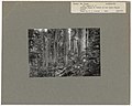
 Cedars along Mt Baker Highway, ca 1927 (WASTATE 1447).jpg 425 × 600; 62 KB
-
-
 Communications- Radios - Washington - DPLA - f49910cb70197fc4af0062d7de6cbe2f.jpg 5,130 × 3,912; 1.93 MB
-
 Groups- Forest Service Non -Technical - DPLA - 0c9747ad4ee77e44f98515a17d7357f0.jpg 3,930 × 2,748; 1.05 MB
-

-
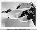
 Hikers next to an ice cliff, Mount Baker, 1906 (WASTATE 2235).jpeg 356 × 600; 15 KB
-
 Hiking - Riding - Washington - DPLA - 2e757a02063ec7a1f20a0e94e2d65d59.jpg 1,910 × 2,971; 742 KB
-
 Ice formations on glacier, Mount Baker, 1906 (WASTATE 2231).jpeg 768 × 448; 27 KB
-
 Image Lake.jpg 3,008 × 2,000; 1.45 MB
-
 Lake Scenes - Washington - DPLA - 328d0daffd55b9ddd46c365e82f316b5.jpg 4,715 × 3,870; 2.53 MB
-
 Lake Scenes - Washington - DPLA - 5c4233574274ddedae82dc848533b45c.jpg 4,727 × 3,888; 2.66 MB
-
 Lake Scenes - Washington - DPLA - b9ae0c7497567f974f75be5934bfabc1.jpg 4,727 × 3,852; 2.46 MB
-

-
 Logging- Falling- Power Saws - DPLA - 278e7939ea4457cbc011718f64c12d4c.jpg 2,713 × 3,900; 1.42 MB
-
 Logging- Loading Logs - Washington - DPLA - 729e40a094142d34e55b12dd764e5860.jpg 4,752 × 3,876; 2.74 MB
-
-

-
 Mount Shuksan.png 3,840 × 2,160; 5.31 MB
-

-

-

-

-
-

-
 Ptarmigan perched on rocks, Mount Baker, 1906 (WASTATE 2236).jpeg 768 × 445; 23 KB
-
 Recreation Improvements - Washington - DPLA - 2a307a1c67e55c76fa5fa10593c2d827.jpg 4,781 × 3,786; 2.96 MB
-

-
 Ross Lake Reservoir, Mount Baker National Forest, 1954 - NARA - 299062.jpg 3,000 × 1,718; 1.07 MB
-
 Scenery and Landscapes - Washington - DPLA - 8580f7f2fb8426b75e7ba87c594ef0e5.jpg 4,747 × 3,797; 1.58 MB
-
 Scenery- Landscapes - DPLA - 3d5570a397ce263a9623577d0b52c233.jpg 3,888 × 2,661; 859 KB
-
 Scenery- Landscapes - DPLA - dd4f6b90383432ddf6ca00e9e6707b85.jpg 3,983 × 2,748; 968 KB
-
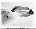 Ski slope near Gargoyle Ridge region (511312121).jpg 900 × 734; 314 KB
-
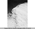
 Skier at Ptarmigan Ridge (511310677).jpg 765 × 616; 225 KB
-
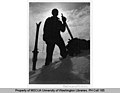
 Skier on Coleman Glacier, Mount Baker (511285930).jpg 765 × 621; 195 KB
-
-
-
 Skier ten miles from Mount Baker summit (511286080).jpg 765 × 614; 255 KB
-

-
 Spathularia flavida 43547953.jpg 1,536 × 2,048; 950 KB
-
 Spathularia flavida 43547971.jpg 1,536 × 2,048; 1.33 MB
-

-

-

-
-

-

-

-
 Timber Management- Types - Washington - DPLA - b7e721ca9b19cba1df306d99549d0cf3.jpg 4,805 × 3,850; 2.51 MB
-
 Timber Stand Improvement - General - DPLA - 720304bf9c9e7d3aa3f540a07eff8aa1.jpg 2,832 × 4,117; 1.65 MB
-

-

-
 Two skiers near Gargoyle Ridge (509705206).jpg 900 × 732; 385 KB
-

.jpg)
.jpg)
.jpg)
.jpg)


.jpg)


.jpeg)
.jpeg)

.jpeg)


.jpeg)


.jpg)

.jpeg)
.jpeg)
.jpeg)


.jpeg)


.jpg)
.jpg)
.jpg)
.jpg)
.jpg)
.jpg)
.jpg)


.jpeg)
.jpeg)


.jpg)
.jpg)
.jpg)
.jpg)