Category:Moynalty
town in Leinster, Ireland  | |||||
| Upload media | |||||
| Instance of | |||||
|---|---|---|---|---|---|
| Location | Meath, Leinster, Ireland | ||||
 | |||||
English: Moynalty is a village in the north-west of County Meath in Ireland. It is located at the junction of the R194 and R164 regional roads 8 km north of Kells, near the border with County Cavan. It was part of the Kells Poor Law Union. The Owenroe river (Irish: An Abhainn Rua) flows through the town.
Gaeilge: Sráidbhaile in iar-thuaisceart Chontae na Mí is ea Maigh nEalta (Moynalty as Béarla). Tá sé gar don teorainn le Contae an Chabháin.
Subcategories
This category has the following 3 subcategories, out of 3 total.
Media in category "Moynalty"
The following 23 files are in this category, out of 23 total.
-

-
 Cottage with character at Moynalty - geograph.org.uk - 3802231.jpg 1,024 × 859; 189 KB
-

-
 Fáilte go Maigh nEalta - Welcome to Moynalty - geograph.org.uk - 2652299.jpg 1,024 × 557; 167 KB
-
 IMG MoynaltyTidyTown2993.jpg 3,888 × 2,592; 3.46 MB
-
 Main Street, Moynalty - geograph.org.uk - 2652337.jpg 1,024 × 600; 131 KB
-
 Main Street, Moynalty, Co Meath - geograph.org.uk - 3802221.jpg 1,024 × 619; 110 KB
-
 McCabe's Bar and Lounge at Moynalty - geograph.org.uk - 3802217.jpg 1,024 × 631; 88 KB
-
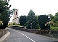 Moynalty Parish Church of the Church of Ireland - geograph.org.uk - 3631710.jpg 1,024 × 755; 154 KB
-
 Moynalty Phone Box.jpg 4,016 × 5,800; 3.56 MB
-
 Moynalty Vintage Co Meath Ireland - geograph.org.uk - 4315159.jpg 2,048 × 1,536; 1.22 MB
-
 Moynalty.JPG 623 × 486; 170 KB
-
 River Blackwater (Meath) - geograph.org.uk - 1773972.jpg 1,024 × 683; 230 KB
-
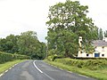
 Road into Moynalty, County Meath - geograph.org.uk - 303166.jpg 640 × 480; 88 KB
-
 Scoil Naomh Mhuire, Moynalty, Co. Meath - geograph.org.uk - 3631269.jpg 1,024 × 572; 76 KB
-

-
 St Mary's Cemetery, Moynalty, Co Meath - geograph.org.uk - 3631542.jpg 1,024 × 716; 139 KB
-
 Taking one's leave of Moynalty along the R164 - geograph.org.uk - 2652385.jpg 1,024 × 725; 118 KB
-
 The Church of Ireland Parish Church at Moynalty - geograph.org.uk - 2652264.jpg 1,024 × 767; 155 KB
-

-
 The R164 at Donore, south of Moynalty - geograph.org.uk - 2654210.jpg 1,024 × 767; 178 KB
-
 The R164 north of Moynalty - geograph.org.uk - 2652501.jpg 1,024 × 673; 231 KB
-


_-_geograph.org.uk_-_1773972.jpg)


