Category:Muirhouses, West Dunbartonshire

Muirhouses consists of two farms, East and West Muirhouse, but they appear to be conflated into one community.
Subcategories
This category has the following 3 subcategories, out of 3 total.
E
- East Muirhouse (3 F)
- East Muirhouse trig point (2 F)
W
- West Muirhouse (6 F)
Media in category "Muirhouses, West Dunbartonshire"
The following 12 files are in this category, out of 12 total.
-
 Hanging Stone - geograph.org.uk - 49169.jpg 640 × 480; 130 KB
-
 Hills and fields north of Muirhouses - geograph.org.uk - 1261046.jpg 640 × 480; 114 KB
-
 Keep off my patch^ - geograph.org.uk - 1623265.jpg 640 × 480; 83 KB
-
 Looking to forest behind the Muirhouses - geograph.org.uk - 855038.jpg 640 × 480; 196 KB
-
 Replaced stone wall - geograph.org.uk - 1623271.jpg 480 × 640; 106 KB
-
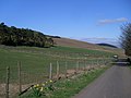
 Road to the Muirhouses - geograph.org.uk - 854978.jpg 640 × 480; 227 KB
-
 Rough grazing above Muirhouses Farm - geograph.org.uk - 1617958.jpg 640 × 321; 83 KB
-
 Sheep grazing near the Muirhouses - geograph.org.uk - 855013.jpg 640 × 480; 225 KB
-
 Sheep hiding under a tree - geograph.org.uk - 49167.jpg 640 × 480; 170 KB
-
 Sheep in field - geograph.org.uk - 855016.jpg 640 × 480; 183 KB
-
 Silhouetted bull - geograph.org.uk - 855025.jpg 640 × 480; 178 KB
-
 Tree growing out of a gatepost - geograph.org.uk - 49164.jpg 640 × 480; 131 KB


