Category:Mullaghglass
village in the United Kingdom | |||||
| Upload media | |||||
| Instance of | |||||
|---|---|---|---|---|---|
| Location | Latt | ||||
| Different from | |||||
 | |||||
English: Mullaghglass is a small village in County Armagh, Northern Ireland. In the 2001 Census it had a population of 135 people. It lies within the Newry and Mourne District Council area.
Media in category "Mullaghglass"
The following 65 files are in this category, out of 65 total.
-
-
 Approaching the Craigmore Viaduct from the West - geograph.org.uk - 6106577.jpg 2,988 × 3,017; 7.6 MB
-
 Autumn on the Newry Canal - geograph.org.uk - 4225054.jpg 4,000 × 2,664; 4.08 MB
-
 Below the Craigmore Viaduct - geograph.org.uk - 6106565.jpg 3,000 × 4,000; 2.6 MB
-
 Bessbrook Masonic Hall on Maytown Road - geograph.org.uk - 6095087.jpg 3,476 × 1,978; 2.91 MB
-
 Bessbrook Orange Hall in Millvale Road - geograph.org.uk - 6095284.jpg 3,854 × 2,252; 4.03 MB
-
 Bessbrook River Bridge on Millvale Road, Bessbrook - geograph.org.uk - 6095514.jpg 3,461 × 2,173; 5.81 MB
-
 Bessbrook River rushing past the Craigmore Exact Factory - geograph.org.uk - 6106474.jpg 1,779 × 1,334; 1.89 MB
-
 Bungalows on Millvale Road - geograph.org.uk - 3980436.jpg 1,024 × 736; 126 KB
-
 C.R.Morrow car dealership on Millvale Road, Bessbrook - geograph.org.uk - 6095486.jpg 3,765 × 2,035; 2.77 MB
-
 Close Up to Ireland's Tallest Railway Viaduct - geograph.org.uk - 4706431.jpg 1,280 × 720; 474 KB
-
 Crabtree Hill, Mullaghglass - geograph.org.uk - 3861504.jpg 640 × 480; 120 KB
-
 Crabtree Hill, Mullaghglass - geograph.org.uk - 3861513.jpg 640 × 480; 91 KB
-

-
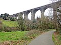
 Craigmore Viaduct - geograph.org.uk - 3602679.jpg 2,592 × 1,936; 1.83 MB
-
 Craigmore Viaduct - geograph.org.uk - 4671769.jpg 1,632 × 918; 411 KB
-
 Craigmore Viaduct from Millvale Road - geograph.org.uk - 3979561.jpg 1,024 × 731; 120 KB
-
 Craigmore Viaduct from the bridge spanning the Bessbrook - geograph.org.uk - 6106458.jpg 3,910 × 2,878; 6.9 MB
-
 Craigmore Viaduct from the Camlough Road - geograph.org.uk - 6096135.jpg 1,950 × 932; 901 KB
-
 Craigmore Viaduct from the grounds of Derrymore House - geograph.org.uk - 6097240.jpg 2,812 × 1,858; 2.12 MB
-
 Craigmore Viaduct from the Millvale Road - geograph.org.uk - 5323919.jpg 2,839 × 1,403; 400 KB
-
 Derelict House Near Millvale Road - geograph.org.uk - 4707302.jpg 1,280 × 720; 373 KB
-
 Derelict houses off the Craigmore Cycling and Walking Path - geograph.org.uk - 6106594.jpg 3,574 × 2,518; 6.49 MB
-
 Derrywilligan Road, Mullaghglass - geograph.org.uk - 3861502.jpg 640 × 480; 101 KB
-
 Drumnakelly Road, Mullaghglass - geograph.org.uk - 1506766.jpg 640 × 480; 90 KB
-
 Dublin-bound Enterprise Train approaching Newry Station - geograph.org.uk - 6102018.jpg 3,552 × 1,814; 3.42 MB
-
 Engineering works Northwest of Newry - geograph.org.uk - 4671256.jpg 800 × 586; 114 KB
-

-

-

-
 House above the A28 at Mullaghglass - geograph.org.uk - 5275387.jpg 4,000 × 3,000; 3 MB
-
 Houses on Latt Road, Mullaghglass - geograph.org.uk - 5276327.jpg 3,201 × 2,378; 1.14 MB
-

-
 Kidd's Road, Millvale - geograph.org.uk - 6095535.jpg 4,000 × 3,000; 6.27 MB
-

-
 Millvale Road crossing the Bessbrook River - geograph.org.uk - 6095510.jpg 3,957 × 2,027; 4.15 MB
-
-
 Mullaghglass townland - geograph.org.uk - 3861507.jpg 3,264 × 2,448; 3.19 MB
-
 Newry Youth Resource Centre - geograph.org.uk - 6123016.jpg 3,040 × 1,936; 3.05 MB
-
 Red, White and Blue painted kerbstones at Mullaghglass - geograph.org.uk - 5276210.jpg 2,818 × 1,907; 1.08 MB
-
 Riverside Crescent, Bessbrook - geograph.org.uk - 6095491.jpg 3,600 × 1,990; 4.26 MB
-
 Road at Mullaghglass - geograph.org.uk - 3861518.jpg 3,264 × 2,448; 3.03 MB
-
 Rock Road at Mullaghglass - geograph.org.uk - 1506777.jpg 640 × 480; 124 KB
-
 Signs at Mullaghglass - geograph.org.uk - 1506768.jpg 640 × 480; 102 KB
-
 South bound Enterprise Train crossing the Craigmore Viaduct - geograph.org.uk - 6102015.jpg 3,357 × 1,835; 3.45 MB
-
 Stoneyford Road at Hillview - geograph.org.uk - 1506781.jpg 640 × 480; 133 KB
-
 Stoneyford Road at Mullaghglass - geograph.org.uk - 1506773.jpg 640 × 480; 158 KB
-
 Stoneyford Road at the White Mountain - geograph.org.uk - 1506797.jpg 640 × 480; 108 KB
-

-
 The A1 (Belfast Road) at Carnbane - geograph.org.uk - 3746595.jpg 1,024 × 769; 84 KB
-
 The A1 viaduct from the A28 (Armagh) Road - geograph.org.uk - 5275360.jpg 4,000 × 3,000; 2.49 MB
-
 The Bessbrook River approaching the Craigmore Viaduct - geograph.org.uk - 6102023.jpg 4,000 × 3,000; 3.04 MB
-

-
 The Craigmore Viaduct from the A25 (Camlough Road) - geograph.org.uk - 5925404.jpg 3,744 × 2,618; 4.8 MB
-
 The Craigmore Viaduct, Bessbrook - geograph.org.uk - 4989307.jpg 1,600 × 816; 219 KB
-
 The Dublin Enterprise - geograph.org.uk - 2778325.jpg 640 × 424; 215 KB
-

-
 The highest arches on the Craigmore Viaduct - geograph.org.uk - 6106541.jpg 4,000 × 3,000; 2.42 MB
-
 The loftiest arches of the Craigmore Viaduct - geograph.org.uk - 6106557.jpg 4,000 × 3,000; 6.92 MB
-
 The northern end of Craigmore Viaduct, Newry - geograph.org.uk - 3982842.jpg 1,024 × 707; 96 KB
-
 The northern end of the Craigmore Viaduct - geograph.org.uk - 4989309.jpg 1,600 × 902; 242 KB
-
 The Southern end of the 18 Arches Bridge - geograph.org.uk - 6106519.jpg 3,932 × 2,906; 7.33 MB
-
 The southern end of the Craigmore Viaduct - geograph.org.uk - 6102014.jpg 2,604 × 1,914; 2.34 MB
-
 The White Mountain - geograph.org.uk - 1506800.jpg 640 × 480; 101 KB
-
 Unnamed lane linking the A28 with Goragh Road - geograph.org.uk - 5277690.jpg 3,849 × 2,887; 1.41 MB


_at_Carnbane_-_geograph.org.uk_-_3746595.jpg)
_Road_-_geograph.org.uk_-_5275360.jpg)


_-_geograph.org.uk_-_5925404.jpg)


