Category:Mungrisdale
English: Mungrisdale is a small village in the north east of the English Lake District.
village and civil parish in Cumbria, United Kingdom  | |||||
| Upload media | |||||
| Instance of | |||||
|---|---|---|---|---|---|
| Location | Eden, Cumbria, North West England, England | ||||
| Said to be the same as | Mungrisdale (Wikimedia duplicated page, civil parish) | ||||
 | |||||
Subcategories
This category has the following 9 subcategories, out of 9 total.
B
H
- Hutton Moor End (8 F)
- Hutton Roof, Eden (1 F)
K
M
- Mungrisdale Common (16 F)
S
- Souther Fell (13 F)
Media in category "Mungrisdale"
The following 200 files are in this category, out of 886 total.
(previous page) (next page)-
 A fine pair - geograph.org.uk - 6240987.jpg 1,600 × 778; 494 KB
-
 A lone walker ascends Sharp Edge - geograph.org.uk - 2562507.jpg 960 × 720; 222 KB
-
 A seven barred gate. - geograph.org.uk - 97786.jpg 640 × 454; 62 KB
-
 A66 by the Mungrisdale turning - geograph.org.uk - 3093682.jpg 800 × 568; 70 KB
-
 A66 near Lisco - geograph.org.uk - 3376381.jpg 640 × 480; 474 KB
-
 A66 near Lowside - geograph.org.uk - 3376397.jpg 640 × 480; 516 KB
-
 Abandoned house at Farend - geograph.org.uk - 5353790.jpg 1,499 × 879; 1.54 MB
-
 Abandoned Mines - geograph.org.uk - 3479708.jpg 640 × 427; 471 KB
-
 Above Blackhazel Beck - geograph.org.uk - 5421613.jpg 1,920 × 1,280; 540 KB
-
 Above Mungrisdale - geograph.org.uk - 2498467.jpg 2,560 × 1,920; 2.1 MB
-
 Above The Fold - geograph.org.uk - 2929613.jpg 2,560 × 1,920; 2.07 MB
-
 Above The Fold - geograph.org.uk - 4577194.jpg 4,608 × 3,456; 3.59 MB
-
 Above The Glenderamackin - geograph.org.uk - 2929597.jpg 2,560 × 1,920; 731 KB
-
 Across Miller Moss to the 609m top - geograph.org.uk - 2525208.jpg 640 × 480; 52 KB
-
 Adit and Waterfall - geograph.org.uk - 3479775.jpg 640 × 427; 502 KB
-
 An easy crossing of the River Caldew - geograph.org.uk - 1961948.jpg 640 × 480; 99 KB
-
 Approaching Knott from the east - geograph.org.uk - 5779418.jpg 2,592 × 1,944; 1.71 MB
-
 Approaching Lingy Hut - geograph.org.uk - 3285478.jpg 2,560 × 1,920; 2.07 MB
-
 Approaching Little Lingy Hill - geograph.org.uk - 4919966.jpg 4,608 × 3,072; 3.18 MB
-
 Approaching Mungrisdale from the north - geograph.org.uk - 1749294.jpg 800 × 530; 149 KB
-
 Approaching the hut on Great Lingy Hill - geograph.org.uk - 4234298.jpg 3,776 × 2,520; 3.91 MB
-
 Approaching the summit of Carrock Fell - geograph.org.uk - 2595344.jpg 2,592 × 1,944; 1.67 MB
-
 Apronful of Stones - geograph.org.uk - 2331896.jpg 4,320 × 3,240; 2.87 MB
-
 Arm o' Grain - geograph.org.uk - 2000293.jpg 427 × 640; 319 KB
-
 Arm o' Grain - geograph.org.uk - 2389257.jpg 2,560 × 1,920; 1.31 MB
-
 Arm o' Grain - geograph.org.uk - 898583.jpg 480 × 640; 115 KB
-
 Ascending Brandy Gill - geograph.org.uk - 3479754.jpg 427 × 640; 431 KB
-
 Ascending Carrock Fell - geograph.org.uk - 2887894.jpg 2,560 × 1,920; 1,022 KB
-
 Ascending Carrock Fell - geograph.org.uk - 2888389.jpg 2,560 × 1,920; 2.15 MB
-
 Ascending Coomb Height - geograph.org.uk - 3895927.jpg 2,560 × 1,920; 2.08 MB
-
 Ascending Coomb Height - geograph.org.uk - 3895929.jpg 2,560 × 1,920; 2.1 MB
-
 Ascending Souther Fell - geograph.org.uk - 3840340.jpg 2,560 × 1,920; 1.99 MB
-
 Atkinson Pike and Foule Crag - geograph.org.uk - 3676676.jpg 4,608 × 3,456; 6.21 MB
-
 Autumn colours on the lane to Newsham - geograph.org.uk - 5164067.jpg 640 × 480; 348 KB
-
 Back road from Scales to Mungrisdale - geograph.org.uk - 3857818.jpg 480 × 640; 112 KB
-
 Back Road to Mungrisdale - geograph.org.uk - 1177040.jpg 640 × 427; 80 KB
-
 Bales under the trees - geograph.org.uk - 5164064.jpg 640 × 480; 316 KB
-
 Bank stabilisation, River Glenderamackin - geograph.org.uk - 5973251.jpg 640 × 427; 125 KB
-
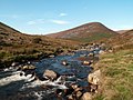
 Bannerdale - geograph.org.uk - 2757819.jpg 2,560 × 1,920; 1.03 MB
-
 Bannerdale - geograph.org.uk - 2758620.jpg 2,560 × 1,920; 850 KB
-
 Bannerdale - geograph.org.uk - 2987663.jpg 2,560 × 1,920; 1.85 MB
-
 Bannerdale Beck - geograph.org.uk - 2036542.jpg 640 × 480; 114 KB
-
 Bannerdale Beck - geograph.org.uk - 2757817.jpg 2,560 × 1,920; 844 KB
-
 Bannerdale Crags - geograph.org.uk - 1520586.jpg 640 × 480; 83 KB
-
 Bannerdale Crags - geograph.org.uk - 1814110.jpg 3,072 × 2,304; 2.93 MB
-
 Bannerdale Crags - geograph.org.uk - 1835854.jpg 2,048 × 1,536; 1.05 MB
-
 Bannerdale Crags - geograph.org.uk - 2023001.jpg 640 × 480; 88 KB
-
 Bannerdale Crags - geograph.org.uk - 286661.jpg 640 × 426; 90 KB
-
 Bannerdale Crags - geograph.org.uk - 2927836.jpg 800 × 600; 326 KB
-
 Bannerdale Crags - geograph.org.uk - 3991156.jpg 4,320 × 3,240; 2.61 MB
-
 Bannerdale Crags - geograph.org.uk - 3991185.jpg 4,320 × 3,240; 2.8 MB
-
 Bannerdale Crags summit - geograph.org.uk - 2214444.jpg 640 × 480; 82 KB
-
 Bannerdale Crags the East Ridge - geograph.org.uk - 694941.jpg 480 × 640; 85 KB
-
 Bannerdale Crags, east ridge - geograph.org.uk - 3991163.jpg 3,240 × 4,320; 2.95 MB
-
 Bannerdale Valley - geograph.org.uk - 2927849.jpg 800 × 600; 315 KB
-
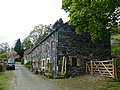
 Barn at Undercrag - geograph.org.uk - 559001.jpg 640 × 480; 168 KB
-
 Barn north-east of Southerfell Cottage.jpg 1,800 × 1,350; 650 KB
-
 Beck near Moss Dyke Farm - geograph.org.uk - 1032479.jpg 640 × 521; 135 KB
-
 Bells Farm, Berrier - geograph.org.uk - 2595428.jpg 2,592 × 1,944; 1.49 MB
-
 Berrier Head Farm - geograph.org.uk - 5164117.jpg 640 × 480; 250 KB
-
 Bield above Poddy Gill - geograph.org.uk - 3285453.jpg 2,560 × 1,920; 1.08 MB
-
 Bield above the Caldew - geograph.org.uk - 3689026.jpg 2,560 × 1,920; 2.14 MB
-
 Blackhazel Beck - geograph.org.uk - 1027404.jpg 640 × 480; 97 KB
-
 Blackhazel Beck - geograph.org.uk - 1520675.jpg 640 × 268; 46 KB
-
 Blackhazel Beck - geograph.org.uk - 1961973.jpg 640 × 480; 76 KB
-
 Blackhazel Beck - geograph.org.uk - 2758623.jpg 2,560 × 1,920; 517 KB
-
 Blackhazel Beck - geograph.org.uk - 5421601.jpg 1,762 × 1,175; 503 KB
-
 Blackhazel Beck - geograph.org.uk - 5421611.jpg 1,920 × 1,280; 547 KB
-
 Blake Hills Farm - geograph.org.uk - 2634499.jpg 3,872 × 2,592; 4.56 MB
-
 Blakebeck - geograph.org.uk - 97158.jpg 640 × 427; 105 KB
-
 Blencathra in the Clouds - geograph.org.uk - 1175538.jpg 640 × 427; 46 KB
-
 Boggy path leaving Bowscale Fell - geograph.org.uk - 5507222.jpg 640 × 427; 30 KB
-
 Boulder problem, foot of Carrock Fell - geograph.org.uk - 1046755.jpg 640 × 480; 104 KB
-
 Boulders in the River Caldew - geograph.org.uk - 2627081.jpg 1,500 × 1,125; 1.44 MB
-
 Boulders on moorland north of Mosedale - geograph.org.uk - 2622572.jpg 1,500 × 952; 1.28 MB
-
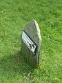
 Boundary Stone 2, Low Mill.jpg 1,800 × 1,350; 778 KB
-
 Boundary Stone near Carrhead footbridge.jpg 480 × 640; 364 KB
-
 Boundary Stone, Low Mill.jpg 1,350 × 1,800; 808 KB
-
 Bowscale - geograph.org.uk - 2695561.jpg 3,888 × 2,592; 1.43 MB
-
 Bowscale - geograph.org.uk - 5163751.jpg 640 × 480; 284 KB
-
 Bowscale Fell - geograph.org.uk - 4863605.jpg 640 × 480; 105 KB
-
 Bowscale Fell summit - geograph.org.uk - 3991193.jpg 4,315 × 2,160; 1.3 MB
-
 Bowscale Fell Summit Cairn - geograph.org.uk - 2927800.jpg 800 × 600; 290 KB
-
 Bowscale Fell, Far East Top - geograph.org.uk - 4177081.jpg 4,608 × 3,456; 3.62 MB
-
 Bowscale Moss - geograph.org.uk - 2631844.jpg 1,500 × 941; 1.09 MB
-
 Bowscale Moss - geograph.org.uk - 3748463.jpg 2,592 × 1,944; 1.14 MB
-
 Bowscale Moss - geograph.org.uk - 5163770.jpg 640 × 480; 292 KB
-
 Bowscale Moss - geograph.org.uk - 5291317.jpg 1,600 × 1,067; 331 KB
-
 Bowscale Moss - geograph.org.uk - 5507252.jpg 640 × 427; 45 KB
-
 Bowscale Tarn - geograph.org.uk - 1520540.jpg 640 × 480; 77 KB
-
 Bowscale Tarn - geograph.org.uk - 2633156.jpg 3,872 × 2,592; 4.21 MB
-
 Bowscale Tarn - geograph.org.uk - 3675036.jpg 4,608 × 3,456; 5.03 MB
-
 Bowscale Tarn - geograph.org.uk - 3991207.jpg 4,320 × 3,240; 4.09 MB
-
 Bowscale Tarn - geograph.org.uk - 4863587.jpg 640 × 480; 111 KB
-
 Bowscale Tarn - geograph.org.uk - 4921310.jpg 4,585 × 3,057; 2.58 MB
-
 Bowscale Tarn - geograph.org.uk - 5291315.jpg 1,600 × 1,067; 397 KB
-
 Bowscale Tarn - geograph.org.uk - 5507212.jpg 640 × 427; 62 KB
-
 Bowscale Tarn - geograph.org.uk - 5965879.jpg 640 × 427; 74 KB
-
 Bracken-covered hillside near Mungrisdale - geograph.org.uk - 2629135.jpg 3,872 × 2,592; 4.03 MB
-
 Bracken-covered slopes above Mungrisdale - geograph.org.uk - 2634467.jpg 3,872 × 2,592; 5.28 MB
-
 Brandy Gill - geograph.org.uk - 3479724.jpg 640 × 427; 452 KB
-
 Brandy Gill - geograph.org.uk - 3479745.jpg 427 × 640; 472 KB
-
 Brandy Gill - geograph.org.uk - 3479759.jpg 640 × 427; 373 KB
-
 Brandy Gill - geograph.org.uk - 3479765.jpg 640 × 427; 417 KB
-
 Brandy Gill - geograph.org.uk - 4345422.jpg 427 × 640; 119 KB
-
 Brandy Gill - geograph.org.uk - 5177653.jpg 640 × 427; 583 KB
-
 Bridge near Wallthwaite - geograph.org.uk - 2353132.jpg 4,224 × 3,168; 2.94 MB
-
 Bridge over Bullfell Beck - geograph.org.uk - 2036554.jpg 640 × 479; 111 KB
-
 Bridge over Grainsgill Beck - geograph.org.uk - 4234243.jpg 3,776 × 2,520; 4.33 MB
-
 Bridge over Grainsgill Beck - geograph.org.uk - 5675578.jpg 2,592 × 1,944; 2.84 MB
-

-
 Bridge over the Glenderamackin - geograph.org.uk - 5976760.jpg 2,000 × 1,500; 3.77 MB
-

-
 Bridge over the River Glenderamackin - geograph.org.uk - 3857776.jpg 640 × 480; 52 KB
-
 Bridge over the River Glenderamackin - geograph.org.uk - 3857779.jpg 640 × 480; 86 KB
-
 Bridleway to Bowscale Tarn - geograph.org.uk - 3674981.jpg 4,608 × 3,456; 5.36 MB
-
 Bridleway to Bowscale Tarn - geograph.org.uk - 3676841.jpg 4,608 × 3,456; 5.37 MB
-
 Bridleway to Bowscale Tarn - geograph.org.uk - 5291311.jpg 1,600 × 1,067; 459 KB
-
 Brow Top Farm, Hutton Roof - geograph.org.uk - 2595386.jpg 2,592 × 1,944; 1.87 MB
-
 Brunt Knott - geograph.org.uk - 1028756.jpg 640 × 480; 94 KB
-
 Buck Kirk - geograph.org.uk - 2695579.jpg 2,592 × 3,888; 1.8 MB
-
 Buildings at Bowscale - geograph.org.uk - 5291304.jpg 1,600 × 1,067; 416 KB
-
 By Blackhazel Beck - geograph.org.uk - 1961963.jpg 640 × 480; 109 KB
-
 By Further Gill Sike - geograph.org.uk - 2888372.jpg 2,560 × 1,920; 2.08 MB
-
 By The Caldew - geograph.org.uk - 2027502.jpg 2,560 × 1,920; 1.7 MB
-
-
 Cairn at the top of Bowscale Fell - geograph.org.uk - 2633151.jpg 3,872 × 2,592; 4.67 MB
-
 Cairn on Bannerdale Crags - geograph.org.uk - 2927862.jpg 800 × 600; 345 KB
-
 Cairn on Carrock Fell - geograph.org.uk - 3285464.jpg 2,560 × 1,920; 2.09 MB
-
 Cairn on Coomb Height - geograph.org.uk - 3895934.jpg 2,560 × 1,920; 2.12 MB
-
 Cairn on Mungrisdale Common - geograph.org.uk - 2987593.jpg 2,560 × 1,920; 2.05 MB
-
 Cairn on Mungrisdale Common - geograph.org.uk - 4546647.jpg 1,500 × 1,064; 1.78 MB
-
 Cairn on Souther Fell - geograph.org.uk - 2629676.jpg 3,872 × 2,592; 3.29 MB
-
 Caldew valley at Swineside - geograph.org.uk - 5177704.jpg 640 × 427; 407 KB
-
 Camp under Bowscale Fell - geograph.org.uk - 4576748.jpg 4,608 × 3,456; 3.91 MB
-

-
 Carrock Fell - geograph.org.uk - 3479800.jpg 640 × 427; 427 KB
-
 Carrock Fell - geograph.org.uk - 3479802.jpg 640 × 427; 388 KB
-
 Carrock Fell - geograph.org.uk - 3675028.jpg 4,608 × 3,456; 5.51 MB
-
 Carrock Fell Mine - geograph.org.uk - 3479739.jpg 640 × 427; 423 KB
-
 Carrock Fell Mine - geograph.org.uk - 3500775.jpg 640 × 424; 279 KB
-
 Carrock Fell Mine - geograph.org.uk - 3500777.jpg 640 × 424; 275 KB
-
 Carrock Fell Mine - geograph.org.uk - 3500779.jpg 640 × 424; 254 KB
-
 Carrock Fell Mine - Harding Vein (geograph 4564228).jpg 424 × 640; 95 KB
-
 Carrock Fell Mine - Harding Vein - geograph.org.uk - 3239150.jpg 530 × 800; 121 KB
-
 Carrock Fell Mine - Harding Vein - geograph.org.uk - 3239156.jpg 424 × 640; 76 KB
-
 Carrock Fell Mine - Harding Vein - geograph.org.uk - 4564233.jpg 640 × 424; 60 KB
-
 Carrock Fell Mine - Harding Vein - geograph.org.uk - 4564546.jpg 424 × 640; 91 KB
-
 Carrock Fell Mine - Harding Vein - geograph.org.uk - 4564551.jpg 408 × 640; 65 KB
-

-
 Carrock Fell Mine - Hornfels and Granite - geograph.org.uk - 3239152.jpg 800 × 530; 134 KB
-
 Carrock Fell Mine - Smith Vein - geograph.org.uk - 3239149.jpg 800 × 530; 144 KB
-
 Carrock Fell Mine - Smith Vein - geograph.org.uk - 3239161.jpg 800 × 530; 116 KB
-
 Carrock Fell Mine - Smith Vein - geograph.org.uk - 4564224.jpg 428 × 640; 94 KB
-
 Carrock Fell Mine - Vein - geograph.org.uk - 3239147.jpg 800 × 530; 122 KB
-
 Carrock Fell Mineralisation - geograph.org.uk - 3500774.jpg 640 × 424; 275 KB
-
 Carrock Fell Mineralisation - geograph.org.uk - 3500776.jpg 640 × 424; 276 KB
-
 Carrock Fell Mineralisation - geograph.org.uk - 3500778.jpg 640 × 424; 273 KB
-
 Carrock Fell Mineralisation - geograph.org.uk - 3500780.jpg 640 × 424; 265 KB
-
 Carrock Fell Mines - geograph.org.uk - 2000530.jpg 640 × 427; 315 KB
-
 Carrock Fell Tungsten Mine - geograph.org.uk - 3470787.jpg 640 × 424; 63 KB
-
 Carrock Fell Tungsten Mine - geograph.org.uk - 3470789.jpg 424 × 640; 90 KB
-
 Carrock Fell W-As Mine - Harding Vein - geograph.org.uk - 4621176.jpg 426 × 640; 259 KB
-
 Carrock Mine - geograph.org.uk - 2389272.jpg 1,920 × 2,560; 1.77 MB
-
 Carrock Mine - geograph.org.uk - 2389282.jpg 1,920 × 2,560; 1.19 MB
-
 Chapel Side - geograph.org.uk - 2695301.jpg 3,888 × 2,592; 2.03 MB
-

-
 Climbing Grainsgill Beck - geograph.org.uk - 2000291.jpg 427 × 640; 264 KB
-

-

-
 Cloven Stone - geograph.org.uk - 4863567.jpg 640 × 480; 131 KB
-
 Col at head of The Glendermackin Valley - geograph.org.uk - 4039879.jpg 640 × 426; 406 KB
-
 Col Between Bannerdale Crags and Blencathra - geograph.org.uk - 2987575.jpg 2,560 × 1,920; 773 KB
-
 Colourful Hagg - geograph.org.uk - 3245229.jpg 1,847 × 1,526; 1 MB
-
 Coomb Height - geograph.org.uk - 5779409.jpg 2,592 × 1,944; 1.53 MB
-
 Cottage and postbox at Berrier - geograph.org.uk - 5164826.jpg 640 × 480; 307 KB
-
 Cow Snout Wood - geograph.org.uk - 2595410.jpg 2,592 × 1,944; 1.82 MB
-
 Cow Snout Wood - geograph.org.uk - 4320521.jpg 1,500 × 1,086; 1.49 MB
-
 Cows near Mungrisdale - geograph.org.uk - 2629119.jpg 3,872 × 2,592; 3.8 MB
-
 Crags at the top of the east ridge. - geograph.org.uk - 5788734.jpg 640 × 427; 65 KB
-
 Crook-a-Fleet - geograph.org.uk - 2695320.jpg 3,817 × 2,487; 3.09 MB
-
 Crook-a-Fleet farm - geograph.org.uk - 4970124.jpg 1,600 × 1,210; 274 KB
-
 Crook-a-Fleet.jpg 1,800 × 1,350; 451 KB
-
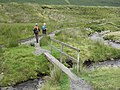
 Crossing of the Bannerdale Beck - geograph.org.uk - 3857797.jpg 640 × 480; 105 KB
-
 Cumbria Way at Mosedale - geograph.org.uk - 1961905.jpg 640 × 480; 73 KB
-
 Cumbria Way near Swineside - geograph.org.uk - 1961915.jpg 640 × 480; 52 KB
-
 Cumbrian landscape - geograph.org.uk - 5164092.jpg 640 × 480; 300 KB
-
 Descending Blue Screes, Atkinson Pike - geograph.org.uk - 2103008.jpg 960 × 720; 307 KB
-
 Descending Bowscale Fell - geograph.org.uk - 3845065.jpg 2,560 × 1,920; 647 KB
-
 Descending Carrock Fell - geograph.org.uk - 3090002.jpg 2,560 × 1,920; 2.14 MB
-
 Descent From Mousewaite Col - geograph.org.uk - 1175605.jpg 640 × 427; 67 KB
-
 Descent of Bowscale Fell - geograph.org.uk - 2634419.jpg 3,872 × 2,592; 3.97 MB
-
 Distant view of Sharp Edge - geograph.org.uk - 3991123.jpg 4,320 × 3,240; 2.34 MB
-
 Disused Mine workings at Carrock - geograph.org.uk - 2370459.jpg 709 × 1,024; 180 KB
-
 Driveway to Low Murrah - geograph.org.uk - 5164096.jpg 640 × 480; 323 KB
-
 Dry stone walls - geograph.org.uk - 4970120.jpg 1,600 × 1,200; 350 KB
-
 Drycomb Beck - geograph.org.uk - 1749233.jpg 800 × 530; 236 KB
-
 Drycomb Beck - geograph.org.uk - 4969710.jpg 900 × 1,200; 241 KB
-
 East face of Carrock Fell - geograph.org.uk - 1046757.jpg 640 × 480; 75 KB
-
 East face of Carrock Fell - geograph.org.uk - 1046758.jpg 480 × 640; 92 KB


.jpg)


