Category:Munnikenhof, Grijpskerke
| Object location | | View all coordinates using: OpenStreetMap |
|---|
building in the Netherlands  | |||||
| Upload media | |||||
| Instance of | |||||
|---|---|---|---|---|---|
| Location |
| ||||
| Street address |
| ||||
| Located on street |
| ||||
| Heritage designation |
| ||||
 | |||||
|
This is a category about rijksmonument number 28125
|
| Address |
|
Media in category "Munnikenhof, Grijpskerke"
The following 62 files are in this category, out of 62 total.
-
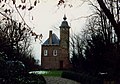 't Munnikenhof.jpg 2,106 × 1,482; 439 KB
-
 Baluster van brug - Grijpskerke - 20129512 - RCE.jpg 1,200 × 1,200; 583 KB
-
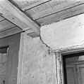
 Binnenkant zuidgevel op verdieping - Grijpskerke - 20129560 - RCE.jpg 1,190 × 1,200; 410 KB
-
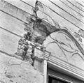
 Detail - Grijpskerke - 20129554 - RCE.jpg 1,198 × 1,200; 293 KB
-
 Detail metselwerk westgevel - Grijpskerke - 20129556 - RCE.jpg 1,190 × 1,200; 451 KB
-

-
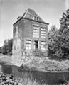
 Exterieur - Grijpskerke - 20129504 - RCE.jpg 847 × 1,200; 189 KB
-
 Exterieur - Grijpskerke - 20129505 - RCE.jpg 831 × 1,200; 178 KB
-
 Exterieur Ingang traptoren - Grijpskerke - 20129520 - RCE.jpg 1,198 × 1,200; 371 KB
-
 Exterieur ingang traptoren - Grijpskerke - 20129525 - RCE.jpg 960 × 1,200; 295 KB
-
 Exterieur noord-oost zijde - Grijpskerke - 20129528 - RCE.jpg 964 × 1,200; 230 KB
-
 Exterieur noord-oost zijde trap toren - Grijpskerke - 20129530 - RCE.jpg 958 × 1,200; 179 KB
-
 Exterieur noord-west en zuid-west gevel - Grijpskerke - 20129509 - RCE.jpg 955 × 1,200; 345 KB
-
 Exterieur noordoost-gevel - Grijpskerke - 20129532 - RCE.jpg 959 × 1,200; 256 KB
-
 Exterieur noordwest-gevel bovendeel - Grijpskerke - 20129516 - RCE.jpg 1,191 × 1,200; 325 KB
-
 Exterieur vanuit het westen - Grijpskerke - 20129523 - RCE.jpg 1,200 × 1,181; 290 KB
-
 Exterieur vanuit het westen - Grijpskerke - 20129527 - RCE.jpg 1,200 × 1,200; 304 KB
-
 Exterieur vanuit het zuiden - Grijpskerke - 20129524 - RCE.jpg 1,200 × 955; 323 KB
-
 Exterieur west-zijde - Grijpskerke - 20129531 - RCE.jpg 965 × 1,200; 313 KB
-
 Exterieur zuid-hoek - Grijpskerke - 20129521 - RCE.jpg 1,200 × 1,199; 534 KB
-
 Exterieur zuid-oost en zuid-west gevel - Grijpskerke - 20129514 - RCE.jpg 972 × 1,200; 333 KB
-
 Exterieur zuid-oost en zuidwest-gevel - Grijpskerke - 20129526 - RCE.jpg 964 × 1,200; 341 KB
-
 Exterieur zuid-oost gevel onderste deel - Grijpskerke - 20129513 - RCE.jpg 1,188 × 1,200; 492 KB
-
 Exterieur zuid-west gevel - Grijpskerke - 20129510 - RCE.jpg 977 × 1,200; 360 KB
-
 Exterieur zuid-west gevel traptoren onderste raam - Grijpskerke - 20129511 - RCE.jpg 1,200 × 1,195; 449 KB
-
 Exterieur zuid-west zijde traptoren - Grijpskerke - 20129522 - RCE.jpg 1,194 × 1,200; 313 KB
-
 Exterieur zuid-west zijde traptoren bovendeel - Grijpskerke - 20129519 - RCE.jpg 1,200 × 1,199; 297 KB
-
 Exterieur zuid-zijde - Grijpskerke - 20129529 - RCE.jpg 1,200 × 967; 236 KB
-
 Exterieur zuidwest-gevel bovendeel - Grijpskerke - 20129518 - RCE.jpg 1,200 × 1,200; 410 KB
-
 Exterieur, ingang traptoren - Grijpskerke - 20129517 - RCE.jpg 1,200 × 1,194; 369 KB
-
 Exterieur, west-zijde - Grijpskerke - 20129515 - RCE.jpg 956 × 1,200; 263 KB
-
 Funderingsresten ten zuiden van traptoren - Grijpskerke - 20129558 - RCE.jpg 1,200 × 1,200; 470 KB
-
 Funderingsvesten tegen westgevel - Grijpskerke - 20129557 - RCE.jpg 1,200 × 1,188; 489 KB
-
 Het huis Munniekenhof bij het dorp Grijpskerk in Walcheren, RP-T-1890-A-2287.jpg 5,730 × 4,246; 4.01 MB
-
 Interieur begane grond sleutelstuk - Grijpskerke - 20129539 - RCE.jpg 1,193 × 1,200; 300 KB
-
 Interieur begane grond, sleutelstuk - Grijpskerke - 20129547 - RCE.jpg 1,199 × 1,200; 345 KB
-
 Interieur kamer begane grond noord-oost zijde - Grijpskerke - 20129552 - RCE.jpg 1,200 × 956; 193 KB
-
 Interieur kamer begane grond noord-oost zijde - Grijpskerke - 20129553 - RCE.jpg 1,200 × 954; 216 KB
-
 Interieur kap zuid-west zijde - Grijpskerke - 20129533 - RCE.jpg 1,200 × 948; 206 KB
-
 Interieur kap zuid-west zijde - Grijpskerke - 20129543 - RCE.jpg 1,190 × 1,200; 251 KB
-
 Interieur kelder - Grijpskerke - 20129544 - RCE.jpg 1,200 × 1,196; 184 KB
-
 Interieur noord-hoek verdieping - Grijpskerke - 20129536 - RCE.jpg 1,200 × 965; 178 KB
-
 Interieur noord-west zijde begane grond - Grijpskerke - 20129534 - RCE.jpg 1,200 × 960; 203 KB
-
 Interieur traptoren - Grijpskerke - 20129548 - RCE.jpg 1,192 × 1,200; 323 KB
-
 Interieur traptoren bij ingang - Grijpskerke - 20129551 - RCE.jpg 1,190 × 1,200; 270 KB
-
 Interieur traptoren raam noordwest-gevel - Grijpskerke - 20129541 - RCE.jpg 1,200 × 1,197; 330 KB
-
 Interieur traptoren toegang tot verdieping - Grijpskerke - 20129540 - RCE.jpg 1,193 × 1,200; 316 KB
-
 Interieur traptoren van bovendeel - Grijpskerke - 20129545 - RCE.jpg 1,200 × 1,199; 319 KB
-
 Interieur zolder noord-hoek - Grijpskerke - 20129537 - RCE.jpg 1,200 × 961; 289 KB
-
 Interieur zuid-hoek verdieping - Grijpskerke - 20129538 - RCE.jpg 1,200 × 1,200; 372 KB
-
 Interieur zuid-west zijde verdieping - Grijpskerke - 20129535 - RCE.jpg 1,200 × 960; 224 KB
-
 Interieur zuid-west zijde verdieping - Grijpskerke - 20129549 - RCE.jpg 1,196 × 1,200; 307 KB
-
 Interieur, onderkant trap bij ingang - Grijpskerke - 20129546 - RCE.jpg 1,196 × 1,200; 390 KB
-
 Interieur, traptreden in traptoren bij kelder - Grijpskerke - 20129550 - RCE.jpg 1,196 × 1,200; 351 KB
-
 Interieur, zoldervloer - Grijpskerke - 20129542 - RCE.jpg 1,200 × 1,197; 353 KB
-
 Jac.Catsweg, aanzicht - Grijpskerke - 20129508 - RCE.jpg 1,200 × 804; 239 KB
-
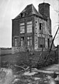
 Munnikenhof.jpg 3,008 × 2,000; 1.08 MB
-
 Overzicht - Grijpskerke - 20404531 - RCE.jpg 784 × 1,200; 154 KB
-
 Overzicht met torentje - Grijpskerke - 20129507 - RCE.jpg 894 × 1,200; 307 KB
-
 Overzicht voorgevel met traptoren - Grijpskerke - 20352678 - RCE.jpg 1,183 × 1,200; 400 KB
-
 Reproductie van gravure - Grijpskerke - 20129506 - RCE.jpg 1,200 × 809; 223 KB
-
 Zuidzijde traptoren begane grond - Grijpskerke - 20129559 - RCE.jpg 1,200 × 1,197; 461 KB


