Category:Mur et rampant de la Gagère
Le rampant de la Gagère supportait le réservoir de fuite du pont-siphon du Garon.
| Object location | | View all coordinates using: OpenStreetMap |
|---|
Media in category "Mur et rampant de la Gagère"
The following 8 files are in this category, out of 8 total.
-
 Mur de la Gagère. 001.JPG 4,272 × 2,848; 3.17 MB
-
 Mur de la Gagère. 002.JPG 4,272 × 2,848; 5.63 MB
-
 Mur de la Gagère. 003.JPG 2,848 × 4,272; 4.11 MB
-
 Mur de la Gagère. 004.JPG 4,272 × 2,848; 5.63 MB
-
 Rampant de la Gagère. 001.JPG 2,848 × 4,272; 6.53 MB
-
 Rampant de la Gagère. 002.JPG 4,272 × 2,848; 5.82 MB
-
 Rampant de la Gagère. 003.JPG 4,272 × 2,848; 6.51 MB
-
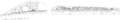 Réservoir de fuite du pont-siphon du Garon.png 1,755 × 287; 235 KB


