Category:NARA images of Inyo County, California
English: Images from NARA—the National Archives and Records Administration — of Inyo County, California from the 19th and 20th centuries.
- Includes images from the Environmental Protection Agency's NARA Program to photographically document subjects of Environmental Concern, compiled 1972—1977.
Media in category "NARA images of Inyo County, California"
The following 65 files are in this category, out of 65 total.
-
 Ansel Adams - National Archives 79-AA-D01.jpg 3,000 × 2,198; 852 KB
-
 Ansel Adams - National Archives 79-AA-D02.jpg 3,000 × 2,244; 753 KB
-
 Ansel Adams - National Archives 79-AA-D03.jpg 3,000 × 2,361; 657 KB
-
 Ansel Adams - National Archives 79-AA-L01.jpg 3,000 × 1,992; 848 KB
-
 Ansel Adams - National Archives 79-AA-L02.jpg 3,000 × 1,923; 795 KB
-
 California - Haiwee Reservoirs - NARA - 23935507.jpg 4,350 × 3,382; 1.71 MB
-
 California - Haiwee Reservoirs - NARA - 23935509.jpg 4,350 × 3,382; 3.47 MB
-
 California - Inyo Mountains - NARA - 23934401.jpg 4,459 × 3,400; 7.31 MB
-
 California - Lavic through Ubehebe Crater - NARA - 23935501.jpg 4,350 × 3,382; 3.78 MB
-
 California - Lavic through Ubehebe Crater - NARA - 23935505.jpg 4,350 × 3,382; 2.98 MB
-
 California - Owens Lake - NARA - 23934759.jpg 3,304 × 2,408; 687 KB
-
 California - Palomar Observator through Parker Dam - NARA - 23934815.jpg 4,438 × 3,382; 2.54 MB
-
 California - Palomar Observator through Parker Dam - NARA - 23934817.jpg 4,438 × 3,382; 2.73 MB
-
 California - Rose Valley - NARA - 23934999.jpg 4,438 × 3,382; 2.35 MB
-
 California - Skidoo through South Pasadena - NARA - 23935369.jpg 4,350 × 3,382; 3.27 MB
-
 VIEW OF SIERRA NEVADA NEAR CAMP INDEPENDENCE, CALIFORNIA - NARA - 524186.jpg 3,000 × 2,495; 3.9 MB
-
 CAMP INDEPENDENCE, HOSPITAL, SIERRA NEVADA, CALIFORNIA - NARA - 524159.jpg 3,000 × 2,488; 3.59 MB
-
 CAMP INDEPENDENCE, SIERRA NEVADA, CALIFORNIA - NARA - 524155.jpg 3,000 × 2,475; 3.62 MB
-
 CAMP INDEPENDENCE, SIERRA NEVADA, CALIFORNIA - NARA - 524156.jpg 3,000 × 2,497; 3.67 MB
-
 CAMP INDEPENDENCE, SIERRA NEVADA, CALIFORNIA - NARA - 524157.jpg 3,000 × 2,515; 3.77 MB
-
-
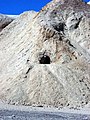
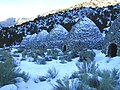 Death Valley Scenic Byway - Charcoal Kilns in Death Valley - NARA - 7717912.jpg 1,200 × 900; 1.13 MB
-
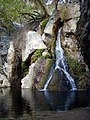
 Death Valley Scenic Byway - Darwin Falls - NARA - 7717920.jpg 1,024 × 1,520; 424 KB
-
 Death Valley Scenic Byway - Darwin Falls From Above - NARA - 7717922.jpg 916 × 1,200; 1.12 MB
-
 Death Valley Scenic Byway - Darwin Falls in the Panamint Region - NARA - 7717921.jpg 900 × 1,200; 1.11 MB
-
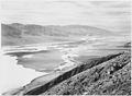
 Death Valley Scenic Byway - Dried Up Lakeshore in Badwater - NARA - 7717897.jpg 2,048 × 1,536; 2.02 MB
-
 Death Valley Scenic Byway - Teakettle Junction in Death Valley - NARA - 7717993.jpg 2,207 × 1,485; 594 KB
-
 Death Valley Scenic Byway - The Ubehebe Crator - NARA - 7718000.jpg 1,024 × 693; 988 KB
-
 Death Valley Scenic Byway - Ubehebe Crater - NARA - 7717999.jpg 1,024 × 678; 930 KB
-
 DEATH VALLEY, CALIFORNIA - NARA - 524165.jpg 3,000 × 2,523; 3.21 MB
-

-
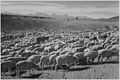
 Flock in Owens Valley.jpg 1,825 × 1,205; 557 KB
-
 FURNACE CREEK, EAST SIDE OF DEATH VALLEY, CALIFORNIA - NARA - 524163.jpg 3,000 × 2,499; 3.64 MB
-
 KEARSAGE MINING COMPANY, KEARSAGE, CALIFORNIA - NARA - 524152.jpg 3,000 × 2,498; 4.63 MB
-
 KEARSARGE MINING COMPANY, KEARSARGE, CALIFORNIA - NARA - 524263.jpg 3,000 × 2,507; 5.31 MB
-

-

-
-

-
-

-

-

-

-

-
-

-

-

-

-

-

-

-
-

-
-

-

-

-

-

-

-
 To Manzanar.gif 600 × 489; 100 KB
-
 View of mountains, "Near Death Valley," California, 1933 - 1942 - NARA - 519854.jpg 2,000 × 1,496; 730 KB
-
 VIEW UP FURNACE CREEK, DEATH VALLEY, CALIFORNIA - NARA - 524166.jpg 3,000 × 2,521; 4.38 MB


