Category:NARO map image distribution service maps
English: Maps of Japan provided from "map image distribution service (地図画像配信サービス)" operated by the National Agriculture and Food Research Organization (NARO) until April 2022.
Media in category "NARO map image distribution service maps"
The following 6 files are in this category, out of 6 total.
-
 Map of Hakodate Bay.png 2,000 × 1,200; 1.54 MB
-
 Map of Kaimondake and Lake Ikeda.png 2,000 × 1,300; 2.76 MB
-
 Map of Kurashiki Tivoli Park.jpg 1,126 × 760; 698 KB
-
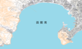
 Map of Takashima in Tokushima.png 422 × 336; 162 KB
-
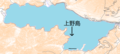 中禅寺湖上野島位置図.png 1,045 × 468; 538 KB
-
 徳島県三好市池田町サラダ位置.png 692 × 494; 602 KB


