Category:NASA MODIS images of South America
Subcategories
This category has the following 2 subcategories, out of 2 total.
Media in category "NASA MODIS images of South America"
The following 78 files are in this category, out of 78 total.
-
 Amazon fire satellite image.png 6,969 × 5,846; 28.28 MB
-
 Amazon MODIS.jpg 1,002 × 960; 149 KB
-
 Amazon.A2002182.1405.1km.jpg 1,800 × 1,400; 1.78 MB
-
 Argentina BA.jpg 536 × 401; 46 KB
-
 Ash on snow from the Cerro Hudson Volcano, Chile.jpg 1,200 × 800; 237 KB
-
 Ash plume from eruption of Chaiten volcano2.jpg 3,600 × 2,600; 1.57 MB
-
 Aster patagonia glacier lrg.jpg 2,412 × 1,925; 848 KB
-
 Big Blue Marble.jpg 4,096 × 4,096; 546 KB
-
 Blooming Waters off Argentina - NASA Earth Observatory.jpg 720 × 720; 158 KB
-
 Buenos Aires at night-satellite.jpg 540 × 423; 113 KB
-

-

-
 Cerro Huemul, Paso Huemul, Paso del Viento y Laguna Toro.jpg 1,241 × 1,241; 1.12 MB
-
 Chili satelliet.jpg 1,800 × 2,400; 777 KB
-
 Circo de los Altares, Monte Fitz Roy, Cerro Torre y Cordón Adela.jpg 738 × 738; 378 KB
-
 Cordón Dos Codos, Campo de Hielo Patagónico Sur.jpg 1,504 × 1,001; 739 KB
-
 Cordón Piedrabuena, límite entre Argentina y Chile, Campo de Hielo Patagónico Sur.jpg 1,461 × 1,461; 555 KB
-
 Cordón Pietrobelli, límite entre Argentina y Chile, Campo de Hielo Patagónico Sur.jpg 1,871 × 1,871; 714 KB
-
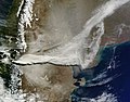
 Dust Storm over Bolivia.jpg 3,400 × 4,000; 1.98 MB
-
 Falkland islands 250m.jpg 1,400 × 1,000; 122 KB
-
 Falkland TMO 2008013 lrg.jpg 2,000 × 1,600; 241 KB
-
 Fires along Parana River, Argentina.jpg 2,800 × 2,200; 1.33 MB
-
 Fires and Deforestation on the Amazon Frontier, Rondonia, Brazil - August 12, 2007.jpg 3,836 × 3,000; 2.88 MB
-
 Fires and smoke in Argentina.jpg 4,400 × 3,400; 2.29 MB
-
 Fires near Porto Velho, Brazil.jpg 5,600 × 7,200; 8.1 MB
-
 Firstmodisimage.jpg 1,800 × 967; 382 KB
-
 Flooding in Brazil and Uruguay 2009.gif 3,800 × 4,600; 19.55 MB
-
 Glaciar Perito Moreno, Bismarck o Francisco Gormaz.jpg 2,276 × 2,184; 3.03 MB
-
 Guajirapeninsula1.png 1,149 × 945; 4.62 MB
-
 Haze Over Santiago Following 8,8 Earthquake.jpg 3,640 × 4,552; 2.14 MB
-
 Haze Over Santiago Following 8.8 Earthquake.gif 3,640 × 4,552; 20.27 MB
-
 ISS030-E-091253 lrg.jpg 1,440 × 960; 429 KB
-
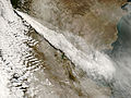
 July 08 2011 Puyehue-Cordón Caulle.jpg 2,400 × 1,800; 841 KB
-
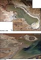
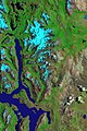
 Lago Titicaca y Salar de Uyuni (Perú-Bolivia) (NASA Terra-Modis) (4996896566).jpg 1,400 × 1,800; 988 KB
-
 Lagoa dos Patos.jpg 1,300 × 1,733; 301 KB
-
 Lagoa Mangueira (1992-07-23).jpg 753 × 464; 34 KB
-
 Laguna del Viedma, Campo de Hielo Patagónico Sur, Argentina-Chile.jpg 1,402 × 1,411; 1.35 MB
-
 Laguna del Viedma.jpg 95 × 90; 3 KB
-
 Laguna Escondida y el océano Pacífico.jpg 1,387 × 957; 994 KB
-
 Laguna Escondida, Argentina-Chile, Campo de Hielo Patagónico Sur.jpg 700 × 700; 311 KB
-
 Lake Merin.jpg 613 × 768; 58 KB
-
 LakePoopo WaterLevels.jpg 540 × 784; 91 KB
-
 NASA ISS006-E-24987.jpg 416 × 540; 180 KB
-
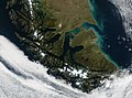 NASA Tierra del Fuego image.jpg 2,784 × 2,057; 1.68 MB
-
 Northern patagonian icefield sanquintin sanrafael sanvalentin.png 711 × 468; 807 KB
-
 Npatagonia oli 2017106 lrg.jpg 7,200 × 9,600; 15.61 MB
-
 Ongoing Eruption of Tungurahua, Ecuador 2010023 lrg.jpg 1,364 × 1,364; 354 KB
-
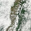
 Patagonia Snow.jpg 850 × 1,100; 903 KB
-
 Patagonia tmo 2011050 lrg.jpg 4,200 × 5,200; 3.05 MB
-
 Phytoplankton Blooms off the Falkland Islands 01.jpg 720 × 480; 114 KB
-
 Phytoplankton Blooms off the Falkland Islands 02.jpg 2,871 × 1,914; 590 KB
-
 Plume from eruption of Chaiten volcano, Chile.jpg 3,200 × 2,400; 1.07 MB
-
 Puyehue-Cordón Caulle - NASA Earth Observatory (1).jpg 720 × 480; 131 KB
-
 Puyehue-Cordón Caulle - NASA Earth Observatory (2).jpg 720 × 480; 151 KB
-
 Puyehue-Cordón Caulle.jpg 5,600 × 4,400; 2.97 MB
-
 Rio de la Plata BA 2.JPG 3,032 × 2,008; 1.75 MB
-
 Rio de la Plata Cuenca.png 600 × 780; 1.09 MB
-
 River Plate.jpg 900 × 700; 134 KB
-
 Salar de Uyuni 2006-10-19 satellite 250m.jpg 1,576 × 1,520; 416 KB
-
 San Jorge.jpg 784 × 477; 426 KB
-
 Sargentina amo 2008058 lrg.jpg 4,000 × 4,000; 3.14 MB
-
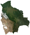
 Satellite image of Bolivia in June 2002.jpg 5,279 × 6,079; 4.02 MB
-
 Satellite image of Bolivia.png 5,279 × 6,079; 19.93 MB
-
 Satellite image of Paraguay in January 2003.jpg 3,543 × 3,786; 1.98 MB
-
 Sección del límite entre Argentina y Chile en el Campo de Hielo Patagónico Sur.jpg 1,715 × 1,715; 1.18 MB
-
 Sediment in the Río de La Plata - NASA Earth Observatory.jpg 720 × 480; 89 KB
-
 Sierradesangra tm5 1986014 lrg.jpg 2,000 × 3,000; 4.06 MB
-
 Sothernpatagonia oli 2016120 2016145 2016122 lrg.jpg 12,000 × 30,000; 49.53 MB
-
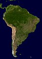 South America - Blue Marble orthographic.jpg 7,200 × 10,000; 13.01 MB
-
 South Georgia and South Sandwich Islands (32750840135) (cropped).jpg 1,454 × 1,037; 699 KB
-
 South Georgia and South Sandwich Islands (32750840135).jpg 2,800 × 2,000; 2.34 MB
-
 South Georgia NASA.jpg 896 × 676; 154 KB
-
 South Georgia NASA.map.png 896 × 676; 1.24 MB
-
 Southern South America - November 13, 2013.jpg 7,200 × 9,400; 13.42 MB
-
 SouthGeorgia TMO2002220 lrg.jpg 2,400 × 1,800; 1.3 MB
-
 StraitOfMagellan.jpg 2,000 × 2,600; 1.81 MB
-
 Uruguay (4690803887).jpg 3,600 × 4,600; 2.44 MB
-
 Uruguay T2.png 691 × 786; 1.18 MB


_(NASA_Terra-Modis)_(4996896566).jpg)

.jpg)


.jpg)
.jpg)


_(cropped).jpg)
.jpg)


.jpg)
