Category:NASA MODIS images of islands
Media in category "NASA MODIS images of islands"
The following 119 files are in this category, out of 119 total.
-
 A68A nears South Georgia.jpg 1,658 × 1,658; 505 KB
-
 Akan volcano meakan-dake hokkaido japan space shot.jpg 928 × 780; 209 KB
-
 Aleutian wave clouds 29 September 2016.png 8,081 × 4,753; 11.71 MB
-
 Alex 2016-01-14 1530Z.jpg 2,224 × 1,696; 752 KB
-
 Amami Islands NASA.jpg 850 × 802; 48 KB
-
 Azores satellite photo-NASA.jpg 1,600 × 1,200; 99 KB
-
 Baffin MODIS 2016187.jpg 5,500 × 5,500; 8.17 MB
-
 Bahamabank-1.jpg 564 × 642; 253 KB
-
 Bahamabank-2.jpg 564 × 642; 295 KB
-
 Bahamabank.jpg 564 × 642; 125 KB
-
 Bahamas.A2004024.1600.250m Grand Bahama crop.jpg 541 × 190; 15 KB
-
 Banc du Geyser Panorama MODIS.jpg 1,200 × 763; 170 KB
-
 Bermuda.jpg 220 × 180; 4 KB
-
 Canarias NASA2.jpg 1,024 × 714; 100 KB
-
 Canary A2002186 1155 250m.jpg 3,400 × 4,400; 1.89 MB
-
 Cape Verde islands 250m.jpg 4,000 × 3,000; 207 KB
-
 Cape Verde islands resized.jpg 2,168 × 1,626; 579 KB
-
 Cape Verde, Kármán vortex street.jpg 2,428 × 1,619; 3.46 MB
-
 CapeVerde.A2002360.1210.250m.jpg 2,800 × 3,600; 485 KB
-
 Chaunskaya Bay (MODIS on June 5 2001).jpg 900 × 900; 123 KB
-
 Chubu Region Japan 2003.png 1,480 × 1,923; 4.03 MB
-
 Chugoku Region Japan 2018.png 1,440 × 1,147; 1.89 MB
-
 Cloud Patterns Over the Prince Edward Islands.jpg 2,400 × 3,200; 954 KB
-
 Cloud streets Around Southern Greenland (6965046589).jpg 8,000 × 6,200; 8.19 MB
-
 Cuyo Islands - Satellite image of Philippines in March 2002.jpg 4,600 × 6,000; 2.87 MB
-
 Disko Island MODIS.jpg 1,150 × 726; 165 KB
-
 Dust Plumes off Western Africa.jpg 5,600 × 7,200; 3.24 MB
-
 Eastern Lesser Antilles (Barbuda to Grenada) satellite image.jpg 2,400 × 3,200; 1.1 MB
-
 El Hierro eruption MODIS 20111013.jpg 434 × 278; 67 KB
-
 El Hierro eruption MODIS 20111023.jpg 872 × 764; 231 KB
-
 El Hierro Submarine Eruption - NASA Earth Observatory.jpg 720 × 480; 141 KB
-
 Ellesmere MODIS 2016169.jpg 2,880 × 4,000; 3 MB
-
 Eruption of Kuchinoerabu-jima 2015.jpg 600 × 400; 29 KB
-
 Eruption on Isla Fernandina.jpg 2,600 × 2,000; 667 KB
-
 Ev11558 Reunion.A2002016.0635.721.250m.jpg 2,000 × 1,500; 288 KB
-
 Ev11558 Reunion.A2002018.0620.721.250m.jpg 2,000 × 1,500; 550 KB
-
 Fires Sweep Through Madeira - 2013-08-19.jpg 1,156 × 772; 38 KB
-
 Fogo eruption 2014.jpg 720 × 540; 105 KB
-
 Galapagos-satellite-2002.jpg 1,600 × 1,200; 387 KB
-
 Galapagos-Sierra Negra 2005 October 22.jpg 1,776 × 1,776; 1.47 MB
-
 Greenland.A2003233.1340.250m.jpg 2,400 × 3,200; 1.85 MB
-
 Gunung Merapi 2006-05-14, MODIS.jpg 4,448 × 3,336; 3.01 MB
-
 Hawaje-NoRedLine.jpg 3,600 × 2,800; 2.81 MB
-
 Heard Island 2005-08.jpg 2,000 × 1,600; 850 KB
-

-
 Ito Ignimbrite Aira Caldera Kyushu Japan.jpg 1,630 × 1,446; 444 KB
-
 JanMayen angepasst.jpg 440 × 340; 9 KB
-
 JanMayen.jpg 440 × 340; 5 KB
-
 Kansai Region Japan 2003.png 1,028 × 1,113; 1.6 MB
-
 Kanto Region Japan 2003.png 1,134 × 1,232; 1.81 MB
-
 Karthala MODIS 20051125.jpg 1,600 × 1,200; 298 KB
-
 Kazan-retto.jpg 1,000 × 657; 69 KB
-
 Kerguelen.jpg 721 × 741; 260 KB
-
 Kolguyev MODIS 2016233.jpg 1,024 × 1,024; 99 KB
-
 Kyushu-Japan Terra2002145.jpg 2,000 × 2,500; 368 KB
-
 Lakshadweep Islands - NASA Earth Observatory.jpg 720 × 720; 17 KB
-
 Lakshadweep.jpg 498 × 630; 41 KB
-
 Lesser Antilles 250m (cropped to Dominica Passage).jpg 600 × 600; 165 KB
-
 Lesser Antilles 250m (cropped to Martinique Passage).jpg 600 × 600; 168 KB
-
 Lesser Antilles 250m.jpg 838 × 1,120; 424 KB
-
 Lesser Sunda Islands, Indonesia (4632905990).jpg 4,400 × 3,400; 1.64 MB
-
 LesserSundaIslands A2003077 0210 250m.jpg 4,800 × 3,600; 2.12 MB
-
 Madeira AMO 2010225 lrg.jpg 1,000 × 1,200; 442 KB
-
 Madeira amo 2012201 lrg.jpg 912 × 684; 61 KB
-
 MadeiraIslands.A2003210.1205.250m.jpg 800 × 600; 29 KB
-
 Maldives.A2004005.0545.1km.jpg 700 × 900; 153 KB
-
 Nagano, Japan 1998 (12350251945).jpg 4,800 × 6,000; 3.75 MB
-
 Nansei Island Bathymetry MODIS 2004.jpg 5,000 × 4,000; 708 KB
-
 Nansei Island MODIS 2004.jpg 5,000 × 4,000; 729 KB
-
 Nansei-Islands-Japan-23-May-2019-NASA.png 6,115 × 3,881; 20.02 MB
-
 Nettilling Lake (December 10, 2013).jpg 1,133 × 691; 251 KB
-
 Nevis Satellite.jpg 576 × 580; 154 KB
-
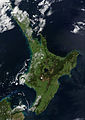 NewZealand.A2002296.2220.250m North Island crop.jpg 2,380 × 3,368; 1,008 KB
-
 Noord-Madagascar.jpg 2,500 × 3,129; 1.13 MB
-
 Ogasawara Gunto MODIS.jpg 1,000 × 634; 200 KB
-
 Okinawa Islands NASA.jpg 800 × 600; 39 KB
-
 Osumi Islands.jpg 500 × 350; 12 KB
-
 Paracel Islands Panorama labelled.jpg 1,028 × 728; 217 KB
-
 Phytoplankton Bloom off Greenland.jpg 2,400 × 3,200; 627 KB
-
 Ryukyu Islands on February 19, 2017.jpg 2,400 × 3,200; 637 KB
-
 Saharan dust - Jun 18, 2020.jpg 4,532 × 3,233; 1.66 MB
-
 Sakishima Islands.jpg 1,500 × 1,000; 142 KB
-
 Satellite image of Antigua And Barbuda in September 2002.jpg 311 × 372; 16 KB
-
 Satellite image of Barbados September 2002.jpg 128 × 144; 4 KB
-
 Satellite image of Cape Verde in December 2002.jpg 1,189 × 1,111; 485 KB
-
 Satellite image of Dominica in September 2002.jpg 118 × 210; 6 KB
-
 Satellite image of Grenada in September 2002.jpg 202 × 268; 13 KB
-
 Satellite image of Hokkaido, Japan in January 2003.jpg 2,200 × 2,800; 1.74 MB
-
 Satellite image of Hokkaido, Japan in May 2001.jpg 2,400 × 3,200; 466 KB
-
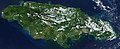 Satellite image of Jamaica in November 2001.jpg 949 × 387; 65 KB
-
 Satellite image of Japan in April 2018.png 6,000 × 6,600; 19.44 MB
-
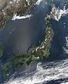 Satellite image of Japan in May 2003.jpg 5,800 × 7,200; 3.69 MB
-
 Satellite image of Maldives in December 2002.jpg 597 × 2,255; 196 KB
-
 Satellite image of Philippines in March 2002.jpg 4,600 × 6,000; 3.58 MB
-
 Satellite image of The Azores in May 2003.jpg 1,374 × 996; 46 KB
-
 Satellite view of Japan in April 2018.jpg 6,000 × 6,600; 1.65 MB
-
 Scoresby Sund 2003-08-21 Terra MODIS.jpg 1,832 × 1,640; 1.38 MB
-
 Scoresby Sund image satellite.jpg 2,545 × 1,969; 950 KB
-
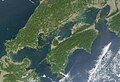 Seto Inland Sea satellite.jpg 1,024 × 696; 242 KB
-
 Southern Greenland (8341574635).jpg 2,600 × 1,800; 947 KB
-
 Spring Bloom Colors the Pacific Near Hokkaido.jpg 7,555 × 9,212; 10.23 MB
-
 Sumatra fires Oct 2006.jpg 4,000 × 4,000; 1.98 MB
-
 Summer thunderstorm clouds over Japan.jpg 3,600 × 1,450; 751 KB
-
 SundaIslands.A2003242.0225.500m.jpg 2,200 × 1,700; 600 KB
-
 Taiwan NASA Terra MODIS 23791.jpg 1,200 × 1,600; 314 KB
-
 Terceira Azores MODIS Pict.gif 758 × 582; 199 KB
-
 Terra Kyushu 20091028.jpg 1,619 × 1,748; 1.47 MB
-
 Tohoku Region Japan 2003.png 1,668 × 2,193; 2.74 MB
-
 TristanDaCunha.jpg 440 × 340; 3 KB
-
 Varied Ice Shapes along the Greenland Coast 2010-03-27 lrg.jpg 5,200 × 6,800; 3.6 MB
-
 Varied Ice Shapes along the Greenland Coast 2010-03-27.jpg 720 × 480; 99 KB
-
 Vaygach MODIS 2016225.jpg 1,000 × 1,200; 143 KB
-

-
 Vortex street near Madeira Island, Dec 1, 2002.jpg 2,800 × 2,200; 1.35 MB
-
 Wave cloud.jpg 1,919 × 1,215; 544 KB
-
 Wave Clouds from South Sandwich Islands.jpg 2,000 × 2,600; 563 KB
-
 Wrangel-island-sat.jpg 929 × 563; 370 KB
-
 Wrangelisland (cropped).jpg 2,710 × 2,035; 820 KB
-
 Wrangelisland.jpg 4,000 × 3,000; 1.55 MB


.jpg)


.jpg)


_satellite_image.jpg)


.jpg)


.jpg)
.jpg)

.jpg)


.jpg)


.jpg)


.jpg)


.jpg)
