Category:NYPL by E. & H. T. Anthony & Co
This temporary category contains images from the New York Public Library Digital Collection whose Original Source field includes the text "by E. & H. T. Anthony & Co.".
Media in category "NYPL by E. & H. T. Anthony & Co"
The following 200 files are in this category, out of 293 total.
(previous page) (next page)-
 A Mountaneous view - Yosemite Valley, by E. & H.T. Anthony (Firm).jpg 2,737 × 1,395; 1.43 MB
-
 A Mountaneous view - Yosemite Valley, by E. & H.T. Anthony (Firm).png 2,737 × 1,395; 4.77 MB
-
 Ah-wah-ne-chee. Indian Profile, Indian Canyon, by E. & H.T. Anthony (Firm).jpg 2,737 × 1,586; 1.57 MB
-
 Ah-wah-ne-chee. Indian Profile, Indian Canyon, by E. & H.T. Anthony (Firm).png 2,737 × 1,586; 5.29 MB
-

-

-

-

-
 Artistic studies, Yosemite Creek, by E. & H.T. Anthony (Firm) 2.jpg 2,737 × 1,598; 1.97 MB
-
 Artistic studies, Yosemite Creek, by E. & H.T. Anthony (Firm) 2.png 2,737 × 1,598; 6.27 MB
-
 Artistic studies, Yosemite Creek, by E. & H.T. Anthony (Firm).jpg 2,737 × 1,585; 2.04 MB
-
 Artistic studies, Yosemite Creek, by E. & H.T. Anthony (Firm).png 2,737 × 1,585; 6.5 MB
-
 Bridal Veil Falls and the Three Graces, by E. & H.T. Anthony (Firm) 2.jpg 2,737 × 1,586; 1.69 MB
-
 Bridal Veil Falls and the Three Graces, by E. & H.T. Anthony (Firm) 2.png 2,737 × 1,586; 5.58 MB
-
 Bridal Veil Falls and the Three Graces, by E. & H.T. Anthony (Firm).jpg 2,737 × 1,616; 1.58 MB
-
 Bridal Veil Falls and the Three Graces, by E. & H.T. Anthony (Firm).png 2,737 × 1,616; 5.2 MB
-
 Bridal Veil Falls, 940 ft. high, by E. & H.T. Anthony (Firm) 2.jpg 2,737 × 1,441; 1.81 MB
-
 Bridal Veil Falls, 940 ft. high, by E. & H.T. Anthony (Firm) 2.png 2,737 × 1,441; 5.71 MB
-
 Bridal Veil Falls, 940 ft. high, by E. & H.T. Anthony (Firm).jpg 2,737 × 1,574; 1.99 MB
-
 Bridal Veil Falls, 940 ft. high, by E. & H.T. Anthony (Firm).png 2,737 × 1,574; 6.26 MB
-
 Bridal Veil Falls, 950 ft. high, by E. & H.T. Anthony (Firm).jpg 2,737 × 1,577; 1.91 MB
-
 Bridal Veil Falls, 950 ft. high, by E. & H.T. Anthony (Firm).png 2,737 × 1,577; 6.1 MB
-
 Bridal Veil, near view, 937 feet high, by E. & H.T. Anthony (Firm).jpg 2,737 × 1,386; 1.36 MB
-
 Bridal Veil, near view, 937 feet high, by E. & H.T. Anthony (Firm).png 2,737 × 1,386; 4.64 MB
-
 Camping scene on the Merced River, by E. & H.T. Anthony (Firm).jpg 2,737 × 1,369; 1.56 MB
-
 Camping scene on the Merced River, by E. & H.T. Anthony (Firm).png 2,737 × 1,369; 5.15 MB
-
 Canyon of South Dome. Clouds' Rest in the distance, by E. & H.T. Anthony (Firm).jpg 2,737 × 1,437; 1.63 MB
-
 Canyon of South Dome. Clouds' Rest in the distance, by E. & H.T. Anthony (Firm).png 2,737 × 1,437; 5.41 MB
-
 Cap of Liberty, 4240 ft. high, by E. & H.T. Anthony (Firm).jpg 2,737 × 1,571; 1.49 MB
-
 Cap of Liberty, 4240 ft. high, by E. & H.T. Anthony (Firm).png 2,737 × 1,571; 5.01 MB
-
 Cashes, or Indian Acorn Storehouses, by E. & H.T. Anthony (Firm) 2 (cropped).png 1,139 × 1,316; 2.21 MB
-
 Cashes, or Indian Acorn Storehouses, by E. & H.T. Anthony (Firm) 2.jpg 2,737 × 1,590; 1.93 MB
-
 Cashes, or Indian Acorn Storehouses, by E. & H.T. Anthony (Firm) 2.png 2,737 × 1,590; 6.01 MB
-
 Cashes, or Indian Acorn Storehouses, by E. & H.T. Anthony (Firm).jpg 2,737 × 1,620; 1.94 MB
-
 Cashes, or Indian Acorn Storehouses, by E. & H.T. Anthony (Firm).png 2,737 × 1,620; 6.14 MB
-
 Cathedral Rock, 2670 ft. high, by E. & H.T. Anthony (Firm).jpg 2,737 × 1,433; 1.55 MB
-
 Cathedral Rock, 2670 ft. high, by E. & H.T. Anthony (Firm).png 2,737 × 1,433; 5.11 MB
-

-

-
 Cathedral Rocks and Spires, 2670 feet high. View at sunrise, by E. & H.T. Anthony (Firm).jpg 2,737 × 1,380; 1.55 MB
-
 Cathedral Rocks and Spires, 2670 feet high. View at sunrise, by E. & H.T. Anthony (Firm).png 2,737 × 1,380; 5.02 MB
-
 Cathedral Rocks, 2650 ft. high, by E. & H.T. Anthony (Firm).jpg 2,737 × 1,566; 1.75 MB
-
 Cathedral Rocks, 2650 ft. high, by E. & H.T. Anthony (Firm).png 2,737 × 1,566; 5.68 MB
-
 Cathedral Spires, 2400 feet high, by E. & H.T. Anthony (Firm).jpg 2,737 × 1,584; 1.83 MB
-
 Cathedral Spires, 2400 feet high, by E. & H.T. Anthony (Firm).png 2,737 × 1,584; 5.85 MB
-
 Chain Cascade, Little Yosemite Valley, by E. & H.T. Anthony (Firm).jpg 2,737 × 1,410; 1.49 MB
-
 Chain Cascade, Little Yosemite Valley, by E. & H.T. Anthony (Firm).png 2,737 × 1,410; 4.84 MB
-

-

-
 El Capitan, 3300 feet high. View from the west, by E. & H.T. Anthony (Firm).jpg 2,737 × 1,424; 1.56 MB
-
 El Capitan, 3300 feet high. View from the west, by E. & H.T. Anthony (Firm).png 2,737 × 1,424; 5.04 MB
-
 El Capitan, 3300 ft. high. From the Merced River, by E. & H.T. Anthony (Firm).jpg 2,737 × 1,583; 1.77 MB
-
 El Capitan, 3300 ft. high. From the Merced River, by E. & H.T. Anthony (Firm).png 2,737 × 1,583; 5.59 MB
-
 Fall on the South fork, 600 feet high, by E. & H.T. Anthony (Firm).jpg 2,737 × 1,362; 1.48 MB
-
 Fall on the South fork, 600 feet high, by E. & H.T. Anthony (Firm).png 2,737 × 1,362; 4.78 MB
-
 Feet of the (Yosemite) Valley, by E. & H.T. Anthony (Firm).jpg 2,737 × 1,583; 1.57 MB
-
 Feet of the (Yosemite) Valley, by E. & H.T. Anthony (Firm).png 2,737 × 1,583; 5.25 MB
-
 First log hut erected in the grove, Mariposa Grove, by E. & H.T. Anthony (Firm) 2.jpg 2,737 × 1,408; 1.65 MB
-
 First log hut erected in the grove, Mariposa Grove, by E. & H.T. Anthony (Firm) 2.png 2,737 × 1,408; 5.31 MB
-
 First log hut erected in the grove, Mariposa Grove, by E. & H.T. Anthony (Firm) 3.jpg 2,737 × 1,413; 1.5 MB
-
 First log hut erected in the grove, Mariposa Grove, by E. & H.T. Anthony (Firm) 3.png 2,737 × 1,413; 4.89 MB
-
 First log hut erected in the grove, Mariposa Grove, by E. & H.T. Anthony (Firm).jpg 2,737 × 1,400; 1.57 MB
-
 First log hut erected in the grove, Mariposa Grove, by E. & H.T. Anthony (Firm).png 2,737 × 1,400; 5.09 MB
-
 Flying squirrel, by E. & H.T. Anthony (Firm).jpg 2,737 × 1,419; 1.36 MB
-
 Flying squirrel, by E. & H.T. Anthony (Firm).png 2,737 × 1,419; 4.66 MB
-
 Foot of the Cap of Liberty. Snow's Alpine House, by E. & H.T. Anthony (Firm).jpg 2,737 × 1,591; 1.66 MB
-
 Foot of the Cap of Liberty. Snow's Alpine House, by E. & H.T. Anthony (Firm).png 2,737 × 1,591; 5.45 MB
-
 Foot of the Cap of Liberty. View from Snow's Alpine House, by E. & H.T. Anthony (Firm).jpg 2,737 × 1,577; 1.78 MB
-
 Foot of the Cap of Liberty. View from Snow's Alpine House, by E. & H.T. Anthony (Firm).png 2,737 × 1,577; 5.83 MB
-

-

-
 General view of the Valley, from Inspiration Point, by E. & H.T. Anthony (Firm).jpg 2,737 × 1,596; 1.72 MB
-
 General view of the Valley, from Inspiration Point, by E. & H.T. Anthony (Firm).png 2,737 × 1,596; 5.47 MB
-
 Hunter in the Yosemite Valley, by E. & H.T. Anthony (Firm).jpg 2,737 × 1,406; 1.67 MB
-
 Hunter in the Yosemite Valley, by E. & H.T. Anthony (Firm).png 2,737 × 1,406; 5.37 MB
-
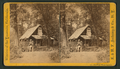
 Hutching's Cottage, by E. & H.T. Anthony (Firm) 2.jpg 2,737 × 1,586; 1.78 MB
-
 Hutching's Cottage, by E. & H.T. Anthony (Firm) 2.png 2,737 × 1,586; 5.76 MB
-
 Hutching's Cottage, by E. & H.T. Anthony (Firm).jpg 2,737 × 1,555; 1.78 MB
-
 Hutching's Cottage, by E. & H.T. Anthony (Firm).png 2,737 × 1,555; 5.85 MB
-
 Hutching's winter quarters, by E. & H.T. Anthony (Firm) 2.jpg 2,737 × 1,567; 1.96 MB
-
 Hutching's winter quarters, by E. & H.T. Anthony (Firm) 2.png 2,737 × 1,567; 6.28 MB
-
 Hutching's winter quarters, by E. & H.T. Anthony (Firm).jpg 2,737 × 1,611; 2.03 MB
-
 Hutching's winter quarters, by E. & H.T. Anthony (Firm).png 2,737 × 1,611; 6.49 MB
-
 Indian Canyon, from the Merced River, by E. & H.T. Anthony (Firm).jpg 2,737 × 1,607; 1.65 MB
-
 Indian Canyon, from the Merced River, by E. & H.T. Anthony (Firm).png 2,737 × 1,607; 5.32 MB
-
 Indian Tom, Guide and mail carrier, by E. & H.T. Anthony (Firm) 2.jpg 2,737 × 1,422; 1.72 MB
-
 Indian Tom, Guide and mail carrier, by E. & H.T. Anthony (Firm) 2.png 2,737 × 1,422; 5.44 MB
-
 Indian Tom, Guide and mail carrier, by E. & H.T. Anthony (Firm).jpg 2,737 × 1,427; 1.81 MB
-
 Indian Tom, Guide and mail carrier, by E. & H.T. Anthony (Firm).png 2,737 × 1,427; 5.74 MB
-
 Indian Tom, Yosemite Valley, by E. & H.T. Anthony (Firm).jpg 2,737 × 1,469; 1.67 MB
-
 Indian Tom, Yosemite Valley, by E. & H.T. Anthony (Firm).png 2,737 × 1,469; 5.47 MB
-
 Indian Tom. Yosemite Valley, by E. & H.T. Anthony (Firm).jpg 2,737 × 1,515; 1.63 MB
-
 Indian Tom. Yosemite Valley, by E. & H.T. Anthony (Firm).png 2,737 × 1,515; 5.44 MB
-
 Lake Tenaya. Clouds' Rest Mountain in the distance, by E. & H.T. Anthony (Firm).jpg 2,737 × 1,405; 1.47 MB
-
 Lake Tenaya. Clouds' Rest Mountain in the distance, by E. & H.T. Anthony (Firm).png 2,737 × 1,405; 4.73 MB
-
 Lamon's Log Cabin, the first erected in the Valley,, by E. & H.T. Anthony (Firm) 2.jpg 2,737 × 1,405; 1.55 MB
-
 Lamon's Log Cabin, the first erected in the Valley,, by E. & H.T. Anthony (Firm) 2.png 2,737 × 1,405; 5.02 MB
-
 Lamon's Log Cabin, the first erected in the Valley,, by E. & H.T. Anthony (Firm).jpg 2,737 × 1,434; 1.51 MB
-
 Lamon's Log Cabin, the first erected in the Valley,, by E. & H.T. Anthony (Firm).png 2,737 × 1,434; 4.94 MB
-
 Leydig's Hotel, by E. & H.T. Anthony (Firm) 2.jpg 2,737 × 1,635; 1.8 MB
-
 Leydig's Hotel, by E. & H.T. Anthony (Firm) 2.png 2,737 × 1,635; 5.83 MB
-
 Leydig's Hotel, by E. & H.T. Anthony (Firm).jpg 2,737 × 1,582; 1.72 MB
-
 Leydig's Hotel, by E. & H.T. Anthony (Firm).png 2,737 × 1,582; 5.55 MB
-

-

-
-

-

-
-
-
-
 Mt. Hoffman, 10,872 feet above the sea, by E. & H.T. Anthony (Firm) 2.jpg 2,737 × 1,604; 1.87 MB
-
 Mt. Hoffman, 10,872 feet above the sea, by E. & H.T. Anthony (Firm) 2.png 2,737 × 1,604; 5.93 MB
-
 Mt. Hoffman, 10,872 feet above the sea, by E. & H.T. Anthony (Firm).jpg 2,737 × 1,615; 1.8 MB
-
 Mt. Hoffman, 10,872 feet above the sea, by E. & H.T. Anthony (Firm).png 2,737 × 1,615; 5.78 MB
-

-

-
 Nevada Fall, 600 feet high, by E. & H.T. Anthony (Firm) 2.jpg 2,737 × 1,337; 1.49 MB
-
 Nevada Fall, 600 feet high, by E. & H.T. Anthony (Firm) 2.png 2,737 × 1,337; 4.76 MB
-
 Nevada Fall, 600 feet high, by E. & H.T. Anthony (Firm) 3.jpg 2,737 × 1,408; 1.4 MB
-
 Nevada Fall, 600 feet high, by E. & H.T. Anthony (Firm) 3.png 2,737 × 1,408; 4.69 MB
-
 Nevada Fall, 600 feet high, by E. & H.T. Anthony (Firm).jpg 2,737 × 1,352; 1.45 MB
-
 Nevada Fall, 600 feet high, by E. & H.T. Anthony (Firm).png 2,737 × 1,352; 4.77 MB
-
 Nevada Fall, with South Dome and Valley, by E. & H.T. Anthony (Firm).jpg 2,737 × 1,390; 1.39 MB
-
 Nevada Fall, with South Dome and Valley, by E. & H.T. Anthony (Firm).png 2,737 × 1,390; 4.69 MB
-
 Nevada Falls, 700 ft. high, by E. & H.T. Anthony (Firm) 2.jpg 2,737 × 1,423; 1.46 MB
-
 Nevada Falls, 700 ft. high, by E. & H.T. Anthony (Firm) 2.png 2,737 × 1,423; 4.83 MB
-
 Nevada Falls, 700 ft. high, by E. & H.T. Anthony (Firm) 3.jpg 2,737 × 1,393; 1.39 MB
-
 Nevada Falls, 700 ft. high, by E. & H.T. Anthony (Firm) 3.png 2,737 × 1,393; 4.64 MB
-
 Nevada Falls, 700 ft. high, by E. & H.T. Anthony (Firm) 4.jpg 2,737 × 1,587; 1.7 MB
-
 Nevada Falls, 700 ft. high, by E. & H.T. Anthony (Firm) 4.png 2,737 × 1,587; 5.49 MB
-
 Nevada Falls, 700 ft. high, by E. & H.T. Anthony (Firm) 5.jpg 2,737 × 1,575; 1.74 MB
-
 Nevada Falls, 700 ft. high, by E. & H.T. Anthony (Firm) 5.png 2,737 × 1,575; 5.7 MB
-
 Nevada Falls, 700 ft. high, by E. & H.T. Anthony (Firm).jpg 2,737 × 1,597; 1.74 MB
-
 Nevada Falls, 700 ft. high, by E. & H.T. Anthony (Firm).png 2,737 × 1,597; 5.64 MB
-
 North Dome, 3720 feet high, by E. & H.T. Anthony (Firm).jpg 2,737 × 1,406; 1.23 MB
-
 North Dome, 3720 feet high, by E. & H.T. Anthony (Firm).png 2,737 × 1,406; 4.34 MB
-
 North Dome, 3729 feet high, by E. & H.T. Anthony (Firm).jpg 2,737 × 1,344; 1.21 MB
-
 North Dome, 3729 feet high, by E. & H.T. Anthony (Firm).png 2,737 × 1,344; 4.25 MB
-
 On the Merced River, Cathedral Rocks in the distance, by E. & H.T. Anthony (Firm) 2.jpg 2,737 × 1,619; 1.75 MB
-
 On the Merced River, Cathedral Rocks in the distance, by E. & H.T. Anthony (Firm) 2.png 2,737 × 1,619; 5.84 MB
-
 On the Merced River, Cathedral Rocks in the distance, by E. & H.T. Anthony (Firm) 3.jpg 2,737 × 1,588; 1.8 MB
-
 On the Merced River, Cathedral Rocks in the distance, by E. & H.T. Anthony (Firm) 3.png 2,737 × 1,588; 5.86 MB
-
 On the Merced River, Cathedral Rocks in the distance, by E. & H.T. Anthony (Firm).jpg 2,737 × 1,586; 1.83 MB
-
 On the Merced River, Cathedral Rocks in the distance, by E. & H.T. Anthony (Firm).png 2,737 × 1,586; 5.96 MB
-
 On the Merced River, Sentinel Rocks in the distance, by E. & H.T. Anthony (Firm).jpg 2,737 × 1,430; 1.64 MB
-
 On the Merced River, Sentinel Rocks in the distance, by E. & H.T. Anthony (Firm).png 2,737 × 1,430; 5.36 MB
-
 Piute Indian Captain, by E. & H.T. Anthony (Firm) 2.jpg 2,737 × 1,573; 1.36 MB
-
 Piute Indian Captain, by E. & H.T. Anthony (Firm) 2.png 2,737 × 1,573; 4.65 MB
-
 Piute Indian Captain, by E. & H.T. Anthony (Firm).jpg 2,737 × 1,561; 1.53 MB
-
 Piute Indian Captain, by E. & H.T. Anthony (Firm).png 2,737 × 1,561; 5.03 MB
-
 Point Louise, Summit of Glacier Rock, 3705 ft. high, by E. & H.T. Anthony (Firm).jpg 2,737 × 1,588; 1.78 MB
-
 Point Louise, Summit of Glacier Rock, 3705 ft. high, by E. & H.T. Anthony (Firm).png 2,737 × 1,588; 5.7 MB
-
 Reflection of El Capitain in the Merced River, by E. & H.T. Anthony (Firm).jpg 2,737 × 1,632; 1.82 MB
-
 Reflection of El Capitain in the Merced River, by E. & H.T. Anthony (Firm).png 2,737 × 1,632; 5.9 MB
-

-

-

-

-

-

-
 Sentinel Rock, 3270 ft. high. From Merced River, by E. & H.T. Anthony (Firm).jpg 2,737 × 1,574; 1.74 MB
-
 Sentinel Rock, 3270 ft. high. From Merced River, by E. & H.T. Anthony (Firm).png 2,737 × 1,574; 5.74 MB
-
 Sentinel rock, by E. & H.T. Anthony (Firm).jpg 2,737 × 1,343; 1.34 MB
-
 Sentinel rock, by E. & H.T. Anthony (Firm).png 2,737 × 1,343; 4.52 MB
-
 Smith's Cosmopolitan Hotel, by E. & H.T. Anthony (Firm) 2.jpg 2,737 × 1,577; 1.8 MB
-
 Smith's Cosmopolitan Hotel, by E. & H.T. Anthony (Firm) 2.png 2,737 × 1,577; 5.77 MB
-
 Smith's Cosmopolitan Hotel, by E. & H.T. Anthony (Firm).jpg 2,737 × 1,610; 1.83 MB
-
 Smith's Cosmopolitan Hotel, by E. & H.T. Anthony (Firm).png 2,737 × 1,610; 5.92 MB
-
 South Dome from South Fork, by E. & H.T. Anthony (Firm).jpg 2,737 × 1,358; 1.52 MB
-
 South Dome from South Fork, by E. & H.T. Anthony (Firm).png 2,737 × 1,358; 4.9 MB
-
 South Dome, 6000 feet high, by E. & H.T. Anthony (Firm).jpg 2,737 × 1,586; 1.76 MB
-
 South Dome, 6000 feet high, by E. & H.T. Anthony (Firm).png 2,737 × 1,586; 5.63 MB
-
 South Dome, 6000 ft. high, by E. & H.T. Anthony (Firm).jpg 2,737 × 1,569; 1.64 MB
-
 South Dome, 6000 ft. high, by E. & H.T. Anthony (Firm).png 2,737 × 1,569; 5.32 MB
-
 Sugar Loaf Mountain. Little Yosemite Valley, by E. & H.T. Anthony (Firm).jpg 2,737 × 1,568; 1.72 MB
-
 Sugar Loaf Mountain. Little Yosemite Valley, by E. & H.T. Anthony (Firm).png 2,737 × 1,568; 5.53 MB
-

-

-

-

-

-

-

-

-
 The Merced Cascades, by E. & H.T. Anthony (Firm).jpg 2,737 × 1,419; 1.44 MB
-
 The Merced Cascades, by E. & H.T. Anthony (Firm).png 2,737 × 1,419; 4.78 MB
-
 The Merced River, looking east, by E. & H.T. Anthony (Firm) 2.jpg 2,737 × 1,417; 1.35 MB
-
 The Merced River, looking east, by E. & H.T. Anthony (Firm) 2.png 2,737 × 1,417; 4.66 MB
-
 The Merced River, looking east, by E. & H.T. Anthony (Firm).jpg 2,737 × 1,402; 1.32 MB
-
 The Merced River, looking east, by E. & H.T. Anthony (Firm).png 2,737 × 1,402; 4.64 MB
-
 The North and South Domes, by E. & H.T. Anthony (Firm) 2.jpg 2,737 × 1,398; 1.48 MB
-
 The North and South Domes, by E. & H.T. Anthony (Firm) 2.png 2,737 × 1,398; 4.83 MB
-
 The North and South Domes, by E. & H.T. Anthony (Firm).jpg 2,737 × 1,582; 1.58 MB
-
 The North and South Domes, by E. & H.T. Anthony (Firm).png 2,737 × 1,582; 5.2 MB
-
 The North Dome and Washington Tower, by E. & H.T. Anthony (Firm) 2.jpg 2,737 × 1,580; 1.69 MB
-
 The North Dome and Washington Tower, by E. & H.T. Anthony (Firm) 2.png 2,737 × 1,580; 5.38 MB
-
 The North Dome and Washington Tower, by E. & H.T. Anthony (Firm).jpg 2,737 × 1,578; 1.83 MB
-
 The North Dome and Washington Tower, by E. & H.T. Anthony (Firm).png 2,737 × 1,578; 5.89 MB
-

.jpg)
.png)
.jpg)
.png)
.jpg)
.png)
.jpg)
.png)
_2.jpg)
_2.png)
.jpg)
.png)
_2.jpg)
_2.png)
.jpg)
.png)
_2.jpg)
_2.png)
.jpg)
.png)
.jpg)
.png)
.jpg)
.png)
.jpg)
.png)
.jpg)
.png)
.jpg)
.png)
_2_(cropped).png)
_2.jpg)
_2.png)
.jpg)
.png)
.jpg)
.png)
_2.jpg)
_2.png)
.jpg)
.png)
.jpg)
.png)
.jpg)
.png)
.jpg)
.png)
.jpg)
.png)
.jpg)
.png)
.jpg)
.png)
.jpg)
.png)
_Valley,_by_E._%26_H.T._Anthony_(Firm).jpg)
_Valley,_by_E._%26_H.T._Anthony_(Firm).png)
_2.jpg)
_2.png)
_3.jpg)
_3.png)
.jpg)
.png)
.jpg)
.png)
.jpg)
.png)
.jpg)
.png)
.jpg)
.png)
.jpg)
.png)
.jpg)
.png)
_2.jpg)
_2.png)
.jpg)
.png)
_2.jpg)
_2.png)
.jpg)
.png)
.jpg)
.png)
_2.jpg)
_2.png)
.jpg)
.png)
.jpg)
.png)
.jpg)
.png)
.jpg)
.png)
_2.jpg)
_2.png)
.jpg)
.png)
_2.jpg)
_2.png)
.jpg)
.png)
_2.jpg)
_2.png)
_3.jpg)
_3.png)
.jpg)
.jpg)
.png)
.png)
_2.jpg)
_2.png)
.jpg)
.png)
.jpg)
.png)
_2.jpg)
_2.png)
_3.jpg)
_3.png)
.jpg)
.png)
.jpg)
.png)
_2.jpg)
_2.png)
_3.jpg)
_3.png)
_4.jpg)
_4.png)
_5.jpg)
_5.png)
.jpg)
.png)
.jpg)
.png)
.jpg)
.png)
_2.jpg)
_2.png)
_3.jpg)
_3.png)
.jpg)
.png)
.jpg)
.png)
_2.jpg)
_2.png)
.jpg)
.png)
.jpg)
.png)
.jpg)
.png)
_2.jpg)
_2.png)
_3.jpg)
_3.png)
.jpg)
.png)
.jpg)
.png)
.jpg)
.png)
_2.jpg)
_2.png)
.jpg)
.png)
.jpg)
.png)
.jpg)
.png)
.jpg)
.png)
.jpg)
.png)
.jpg)
.png)
.jpg)
.png)
.jpg)
.png)
.jpg)
.png)
.jpg)
.png)
_2.jpg)
_2.png)
.jpg)
.png)
_2.jpg)
_2.png)
.jpg)
.png)
_2.jpg)
_2.png)
.jpg)
.png)
.jpg)