Category:Na Strážné (Dobroslavice)
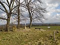
Čeština: Vrchol Na Strážné severně od obce Dobroslavice. Křížek a trigonometrický bod č. 19 (TL 2720).
| Object location | | View all coordinates using: OpenStreetMap |
|---|
hill in Czech Republic .jpg) | |||||
| Upload media | |||||
| Instance of | |||||
|---|---|---|---|---|---|
| Location | Dobroslavice, Opava District, Moravian-Silesian Region, Czechia | ||||
 | |||||
Subcategories
This category has the following 2 subcategories, out of 2 total.
A
- Alej k lipám (2 F)
C
Media in category "Na Strážné (Dobroslavice)"
The following 6 files are in this category, out of 6 total.
-
 Alej k lipám, Dobroslavice 2.jpg 8,000 × 6,000; 10.65 MB
-
 Na Strážné (0655).jpg 3,600 × 2,420; 2.19 MB
-
 Na Strážné (0662).jpg 2,462 × 3,600; 4.03 MB
-
 Na Strážné (0668).jpg 3,600 × 2,370; 4.02 MB
-
 Na Strážné (0670).jpg 3,600 × 2,422; 4.83 MB
-
 Na Strážné (0674).jpg 3,600 × 2,398; 3.74 MB

.jpg)
.jpg)
.jpg)
.jpg)