Category:Naauw 13, Leeuwarden
| Object location | | View all coordinates using: OpenStreetMap |
|---|
 | |||||
| Upload media | |||||
| Instance of |
| ||||
|---|---|---|---|---|---|
| Location | Leeuwarden, Friesland, Netherlands | ||||
| Located on street | |||||
| Heritage designation |
| ||||
 | |||||
|
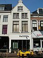
This is a category about rijksmonument number 24259
|
| Address |
|
Media in category "Naauw 13, Leeuwarden"
The following 3 files are in this category, out of 3 total.
-
 Naauw 13 Leeuwarden puntgevels.jpg 4,288 × 3,216; 2.9 MB
-
 Naauw 13 Leeuwarden.jpg 3,216 × 4,288; 2.96 MB
-
 Overzicht Naauw - Leeuwarden - 20130556 - RCE.jpg 1,192 × 1,200; 285 KB

