Category:Nachkriegsstollen (Muttental)
| Object location | | View all coordinates using: OpenStreetMap |
|---|
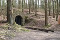
This is the category for an archaeological site.
It is on the list of cultural monuments of Witten, no. 16.
It is on the list of cultural monuments of Witten, no. 16.
Media in category "Nachkriegsstollen (Muttental)"
The following 5 files are in this category, out of 5 total.
-
 Hardenstein 2014 - Guarding the Tunnel.jpg 3,750 × 2,500; 4.22 MB
-
 Hardenstein 2014 - Into the Tunnel.jpg 4,368 × 2,457; 5.05 MB
-
 Nachkriegsstollen Muttental.jpg 3,872 × 2,592; 4.57 MB
-
 Nachkriegsstollen.jpg 2,152 × 2,864; 1.31 MB
-
 Witten Infotafel Nachkriegsstollen.jpg 3,000 × 4,000; 3.72 MB


